|
|
|
|
 french page
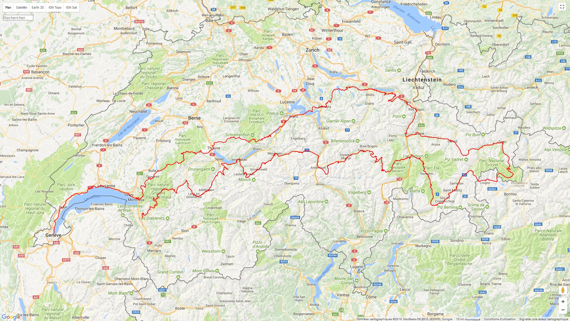
maps, elevation gain and GPX roads
Crossing of Switzerland by
mountain bike
Alpine Bike : Aigle / Scuol (10 days) -
585 km 17936 md+
Panorama Bike : Rorschach / Montreux (back 10 days) - 522 km
12315 md+
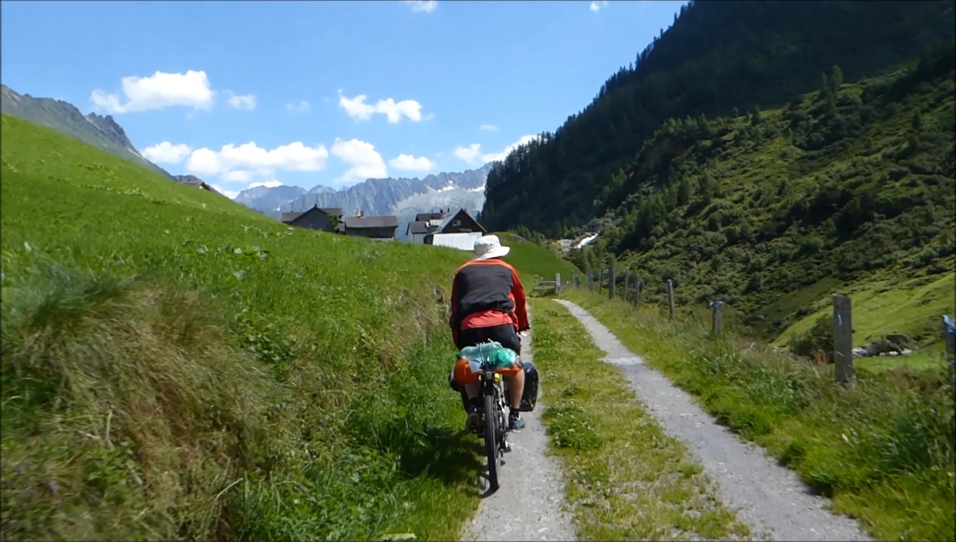
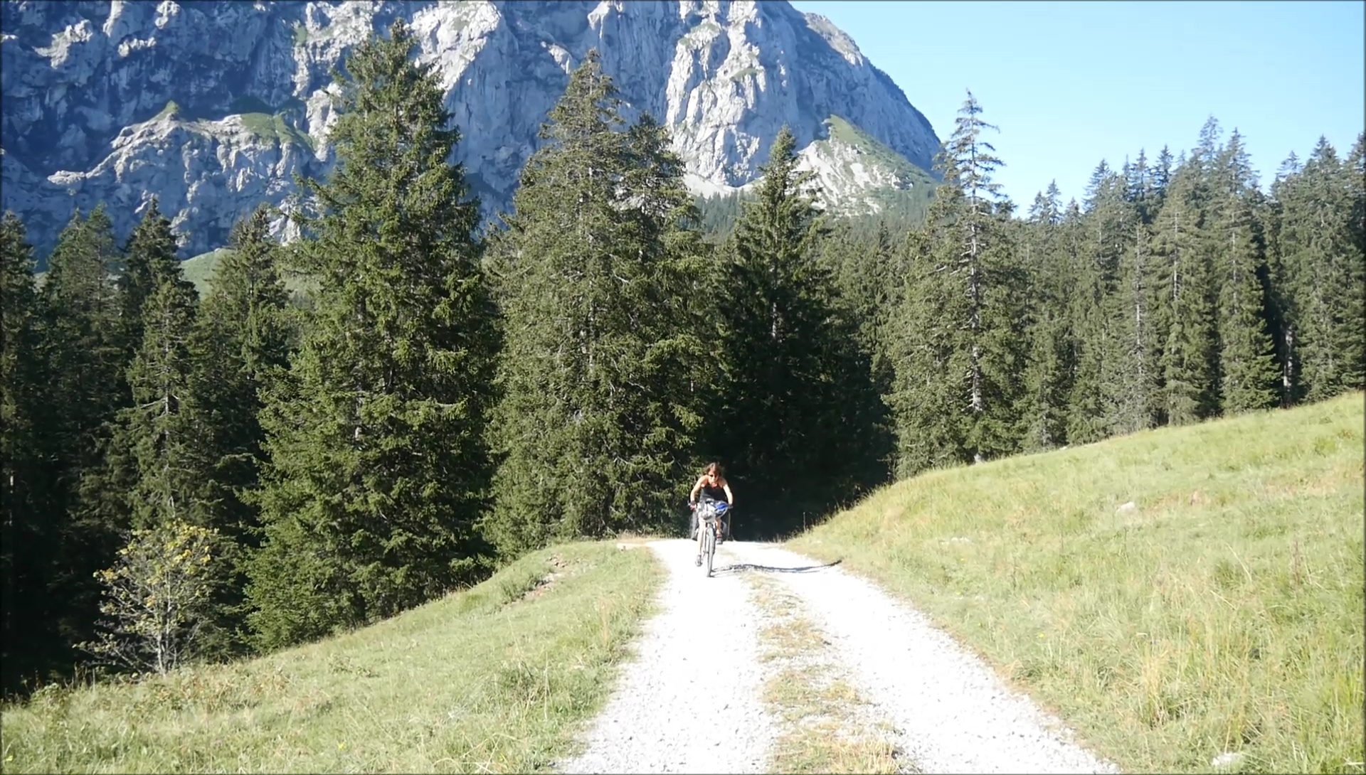
Switzerland is a paradise for cycling ... and
mountain biking in particular. I travel that I propose you through
these pages is an immersion in the Swiss Alps: a sweet mixture
of dreams and reality, and extends the first part between Geneva
and Nice, Rolling in the Alps. The route is ultra demanding
and quite technical, but especially difficult in the long term
(3 weeks with the bags, it starts to do ...) but the rewards
are at all crossroads. The valleys are sublime, the mythical
passes, the "cheese" breaks at the edge of the path
memorable. Bivouacking at the foot of the Eiger or watching
the sunset against Lake Geneva is priceless luxury ... The discovery
of the East / West / East Switzerland makes it possible to cross
the cantons in a few pedal strokes, Vaud, Bern, Schwyz , Graubünden,
etc. but the course is neither direct nor flat. The mountains
follow each other daily with intense effort ... you have to
rely on his legs, his machine ... and his mind. Ready for 30250
vertical meters and 1100 kils? Here we go...
|
|
|
|
|

cartes
& topo
|
|
|
|
|
|
|
|
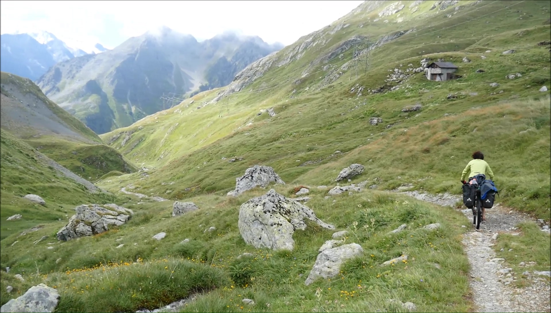
After crossing the Alps from Lake
Geneva to the Mediterranean, here is the great mountain tour of
Switzerland by mountain trails from Lake Geneva to Graubünden
... to Léman, a return trip of 1100 kils and a deluxe elevation
of 30,000 meters in altitude. 21 days. Is this a world first:
the Alpine Bike with saddlebags? After careful consideration:
it's really nothing! Finally, there are some who have not tried,
there have not been any problems! The others did not succeed ...
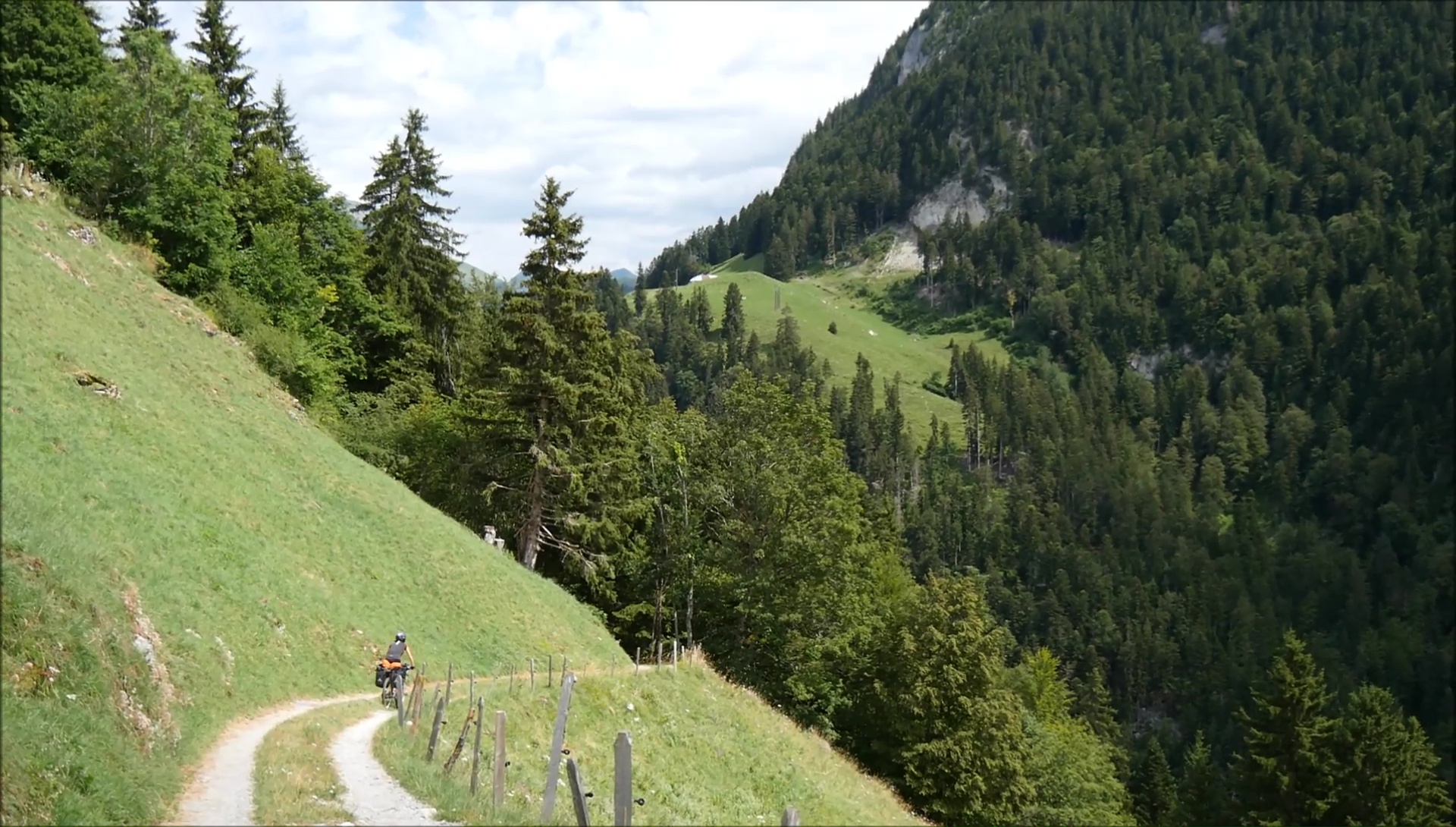
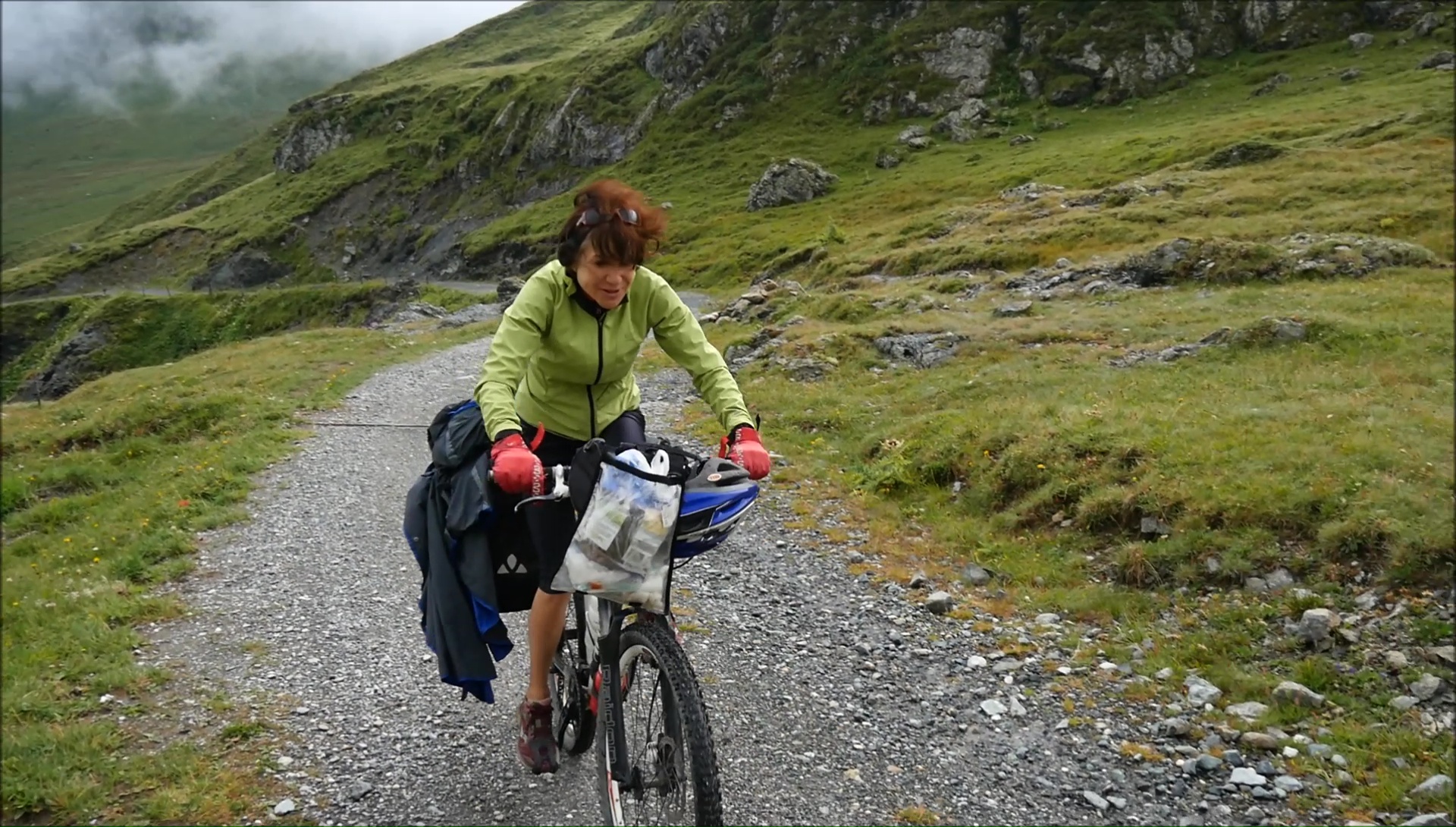
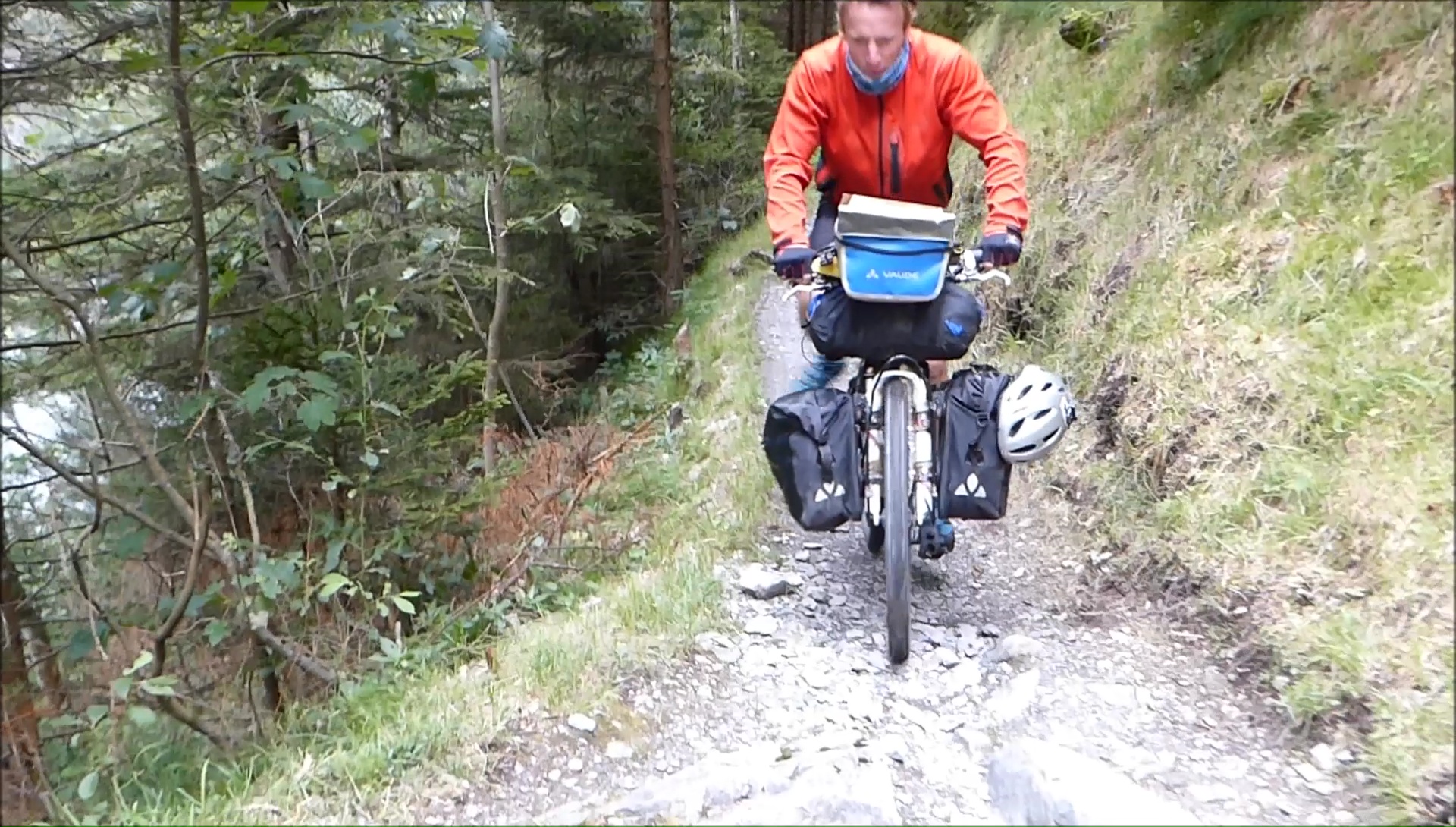
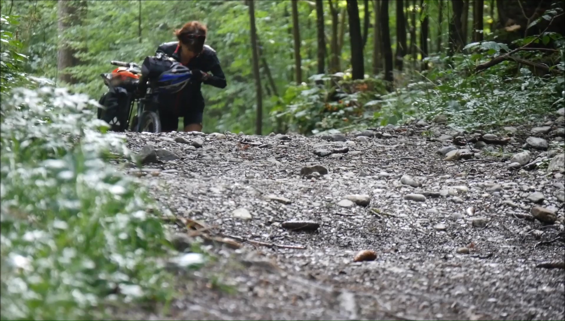
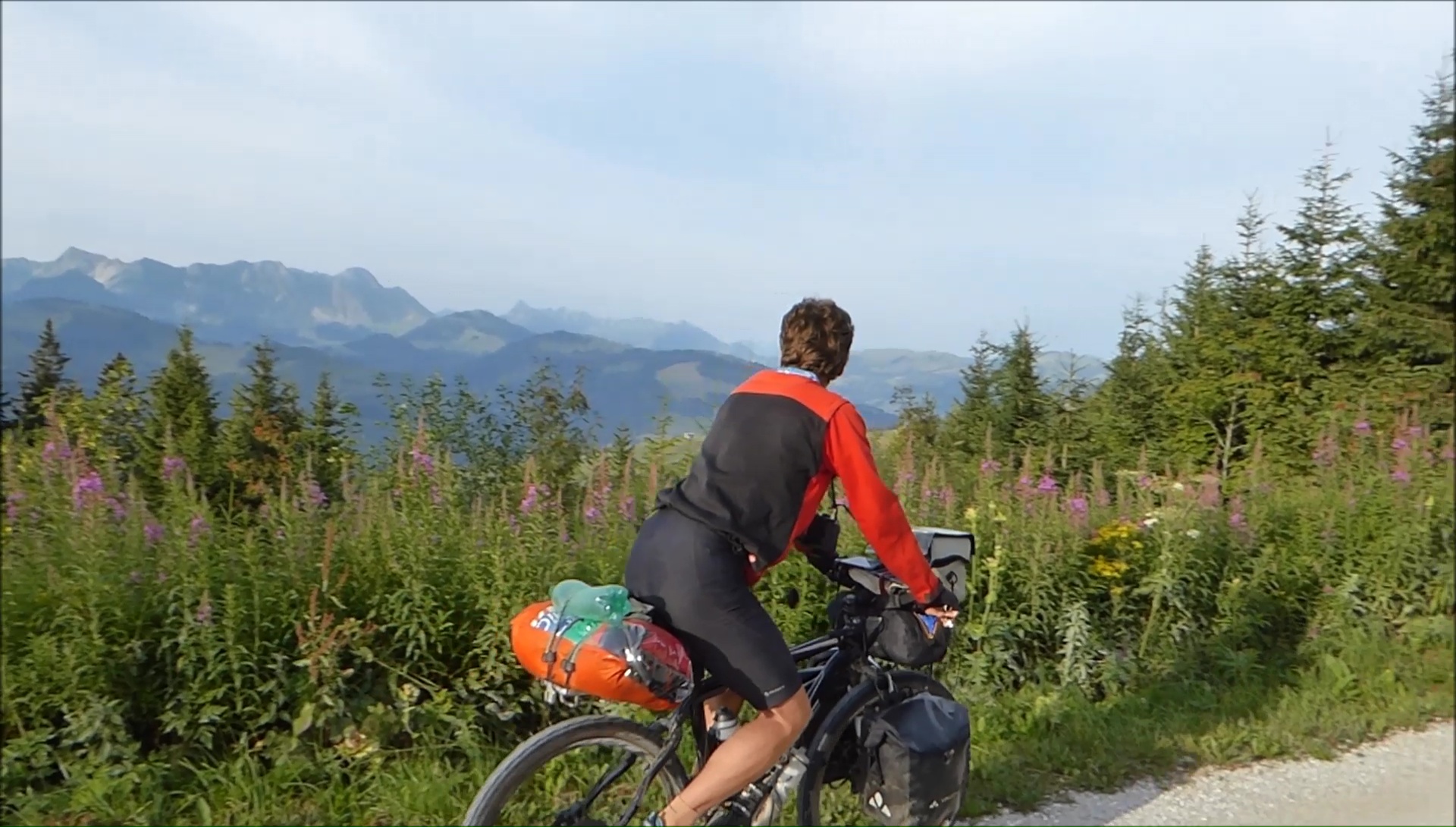
The first pedal strokes of Evian
are tedious but the real difficulties arrive quickly. The climb
after Aigle is very steep, then impracticable on the Corbeyrier
trail. The terrain is unstable and slippery ... at the edge of
the cliff. All that we like. You have to catch your breath and
push the bike. In Leysin, the road becomes rolling again and the
view of the mountains of Diablerets / Grimsel gives a boost of
energy (even if one is never safe from a climb) to reach the heights
of Col des Mosses. The bivouac is done in the mountain pastures
after a chase with our supporters who moo at our passage. COW-ment
nice Swiss (and too beautiful)!
|
|
|
|

|
 |
|
|
Cleaned by the night rain, the bikes are covered
in mud in less than 2 minutes because of the wet soils. The day
begins with climbs without any real interest, chopped by the turnstiles
for cattle and ... UFOs with mountain bike bags. The calvary !
But the descent on a track dug in the rock for Château d'Oex
is extra, 400 md- in the woods without forcing, the foot! Especially
since the break is never very far: nothing more wonderful than
to stall against a stone near a river, here the Sarine, from Gstaad.
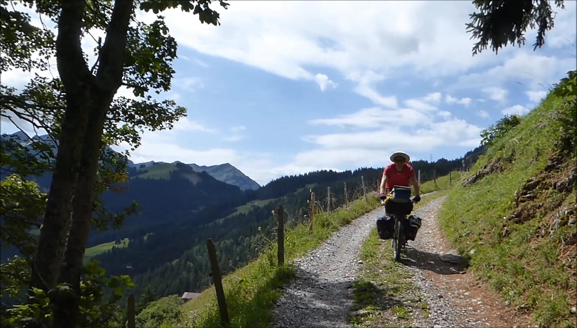
The forest path on the banks of the Sarine is very
rolling, ideal when the legs are a bit heavy! The region of Gstaad
is ultra beautiful and ... ultra rich: the density of big cars
is hallucinating. It stinks of pollution and money! The rest of
the program is refreshing with a climb under a light rain at the
Saanen Pass, when comes the flood at 1269 meters! The path that
leads to Lenk along the Simme is almost flat. The place is magical,
the valley sinks into dark mountains towards distant glaciers.
The Vaud Alps are moving away.
|
|
|
|
|
|
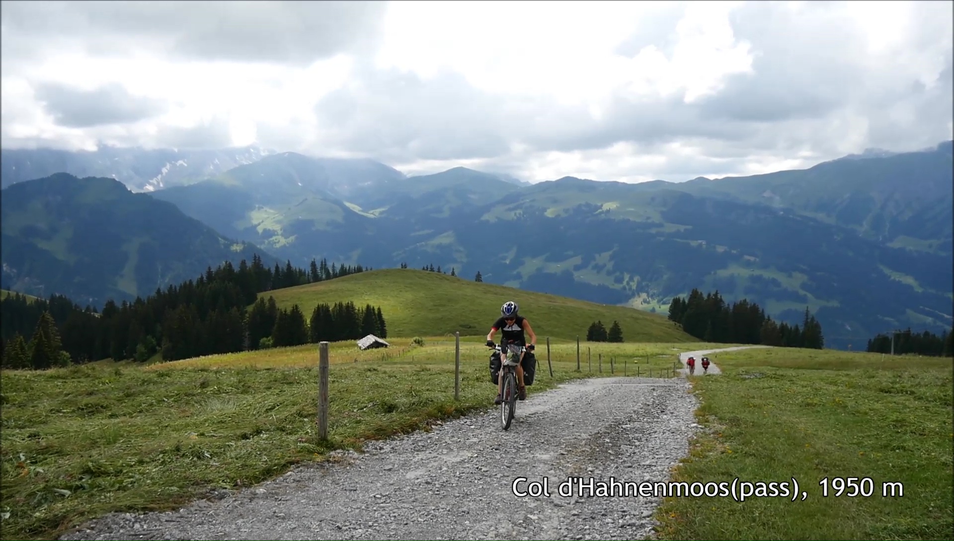
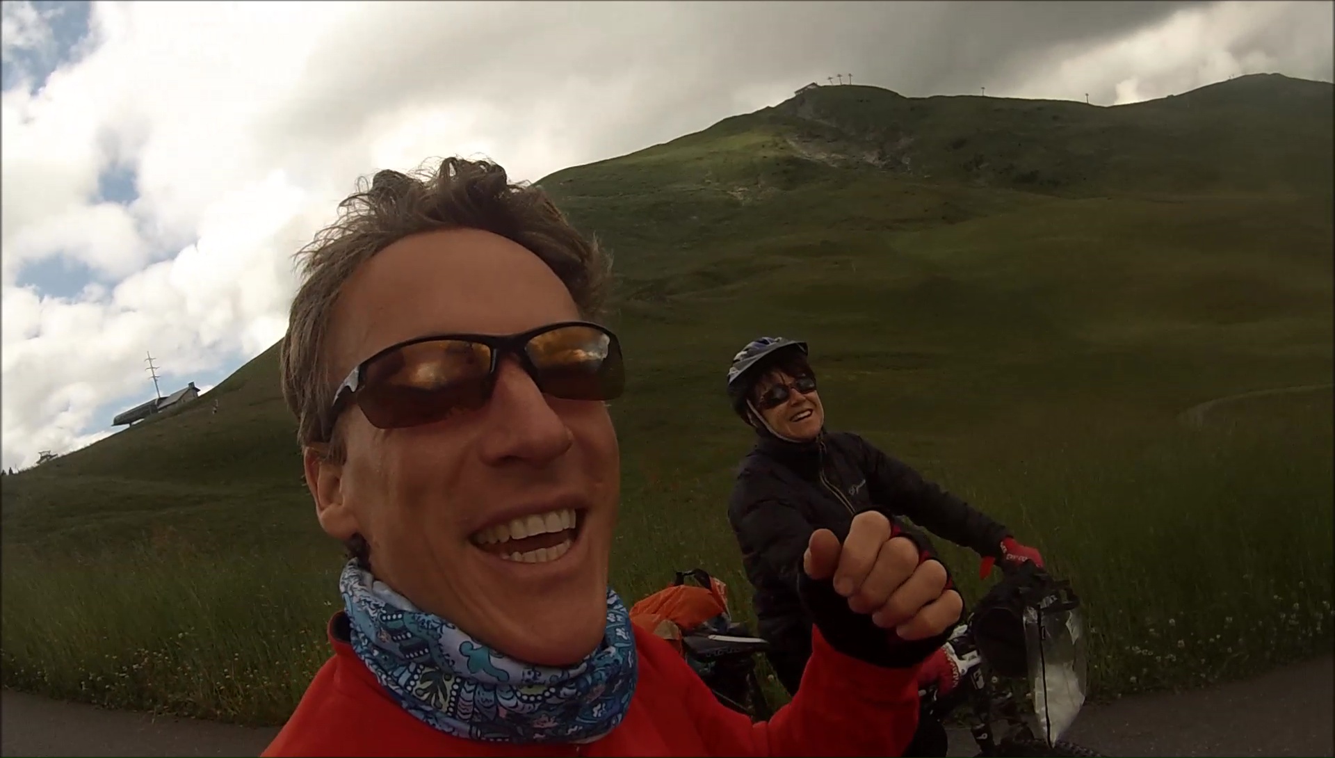
After the expensive repair of my
derailleur, the climb to the Hahnenmoos pass is under a blazing
sun on the asphalt, then under the clouds on a steep track to
reach the top of the lifts. The route is quite hard, but we stay
in the saddle to the top. Encouragements are always good to take,
but taken in the effort, it is difficult to stop to discuss. The
hikers that we meet are admiring or ... dismayed by us or cycling,
to choose. I really like this contrast: riding a bike in unlikely
places!
The descent to Adelboden is done
on a very nice track, easy to pick up speed without breaking the
back! In the distance, the Wildstrubel peaks at 3240 meters and
spits water in fury: the Entschigefäll waterfall is visible
several miles away, extra. The rest of the route is equally pleasant
between country roads and small roads. Little climb, until Frutigen,
then comes the time to plant the tent ... crucial moment of the
day not to neglect. The bivouac is placed under a tree, with a
table and a bench. Ideal to rest the back.
|
|
|
|
|
|

|
|
|
After a night illuminated by the fireworks and
the sounds of firecrackers due to national holiday, we leave the
castle of Frutigen to take full north the Entschlige valley then
the direction of Aeschi and Interlaken: first passage obliged
along a national, horrible! After a short drive in the city, we
reach Luterbrunnen following the Jungfrau which stands at 4158
meters. First shampoo along the way: the hair will dry in the
wind. Ideal time to ride, some clouds and a little wind. Almost
easy!
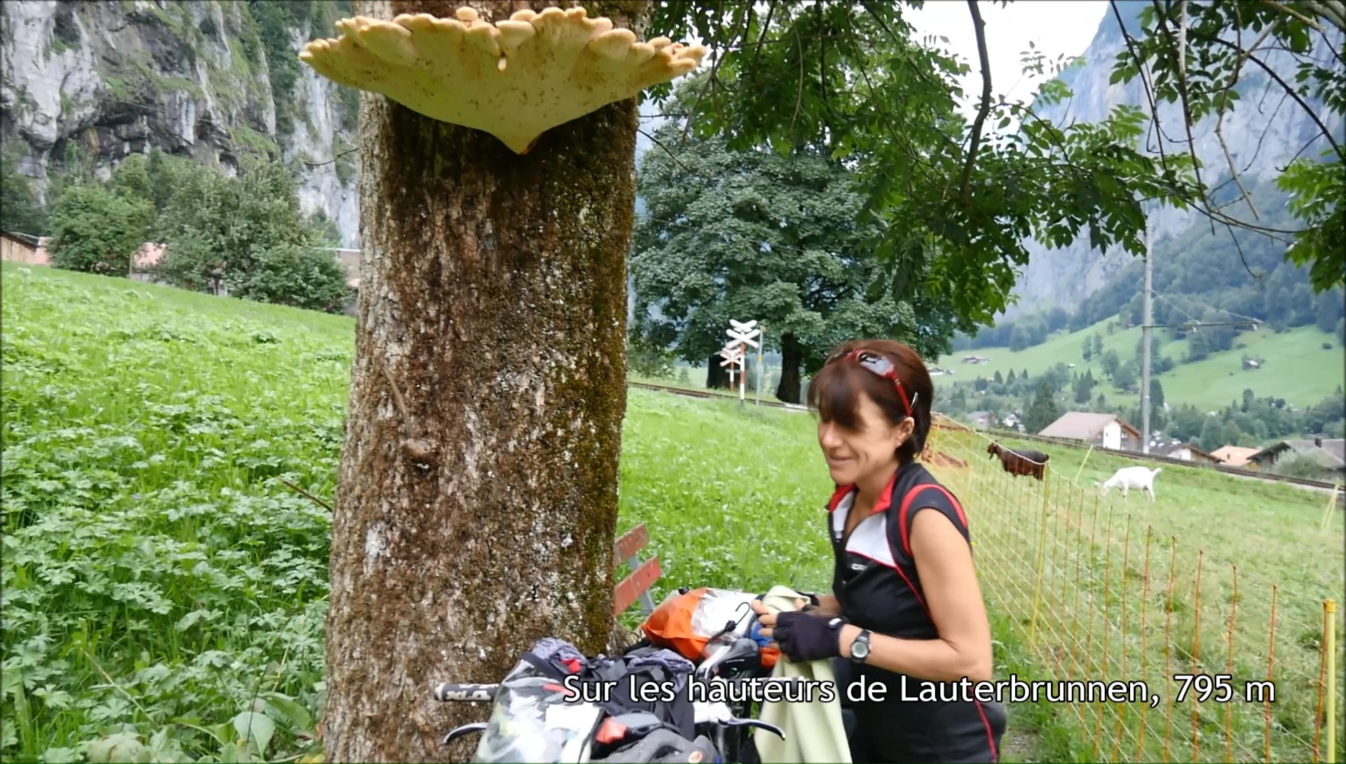
Lauterbrunnen, 3 pm. For some it's the end of the
day, for us the hard part begins! Looking at the map, we see that
it will be hard: 650 md + over 1.5 kil. In short, we start fully
from the first pedal strokes: 20 laces on a track oscillating
between 12 and 15% ... I put the foot at each turn, breathless.
In total sweat! ... but I will ride everything on the saddle:
the most difficult part of the trip! In Wengen, the rain cools
bikes and legs, the road becomes more rolling and majestic in
front of the circus of Eiger, Mönch and Jungfrau. Bivouac
sublime.
|
|
|
|
|
|
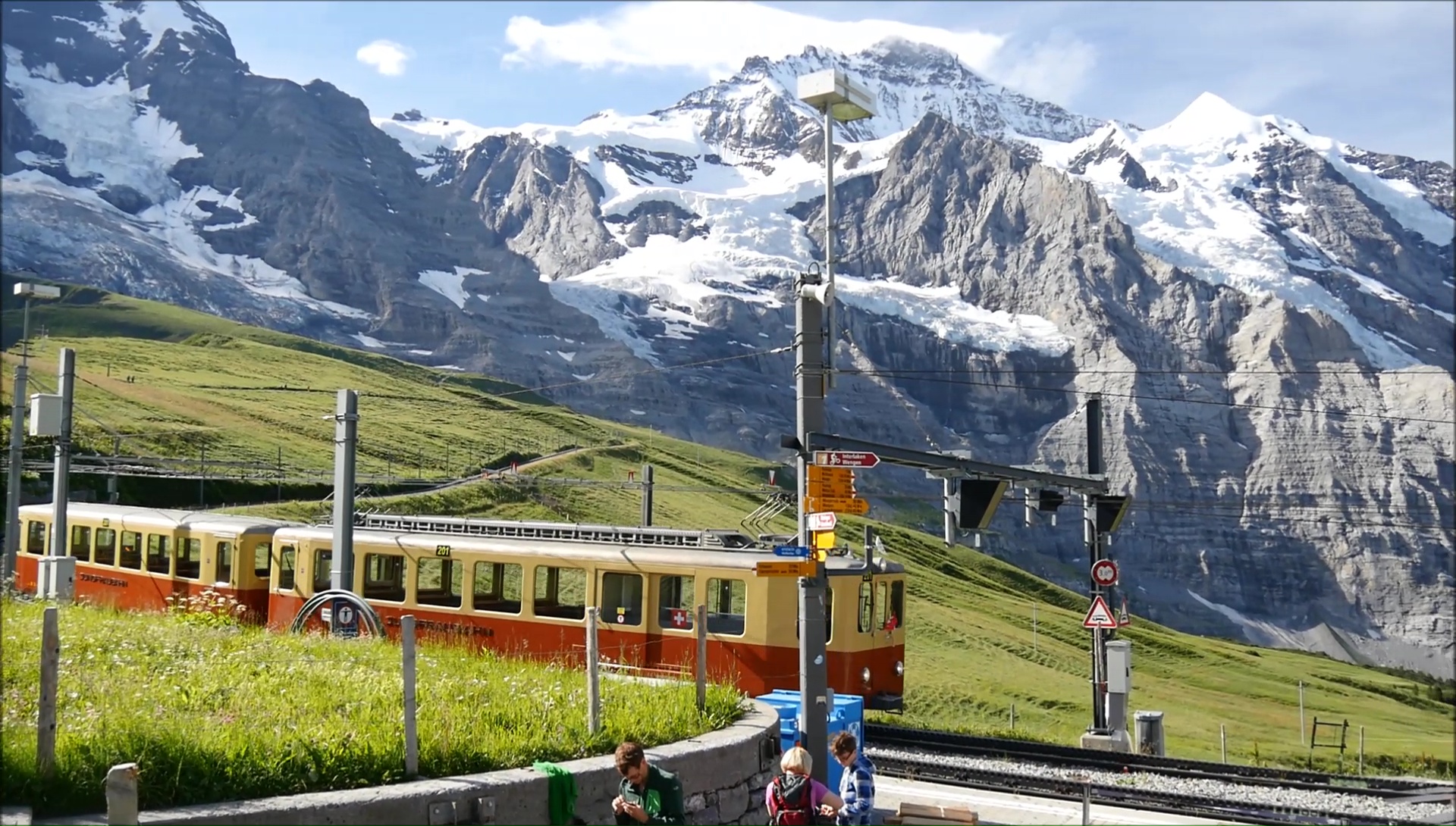
Fantastic breakfast: 1500 meters
of vertical wall in front of our eyes. We take to the cool the
kleine Scheidegg pass at 2061 m: it's the madness of mass tourism.
The mountain trains pour hordes of tourists more preocupés
to take a picture of themselves than to watch this natural spectacle.
Sad. Fortunately, the descent to Grindelwald is quieter with a
beautiful part in the woods. We meet other crazy pedal who make
the Transcontinentale ... a journey combining itinerancy, orientation
and choice of course to reach Istanbul. Causette with the champions.
After having filled the saddlebags,
the following of the aprèm is quite simple: another climb
under the sun for the Grosse Scheidegg (after the Petit ... le
Grand) at 1962 meters ... 900 m + to add! In Meiringen, we push
the bike on a hill (as steep as useless): going up to go down
... it's a little bit the purpose of the trip but there is no
point in reaching Innertkirchen! If in addition, the horseflies
attack, it does not sting that the legs! After an integral toilet
at the edge of the road, the tent is calmly placed far from the
road. A little rest before the sequel!
|
|
|
|

|
|
|
|
|
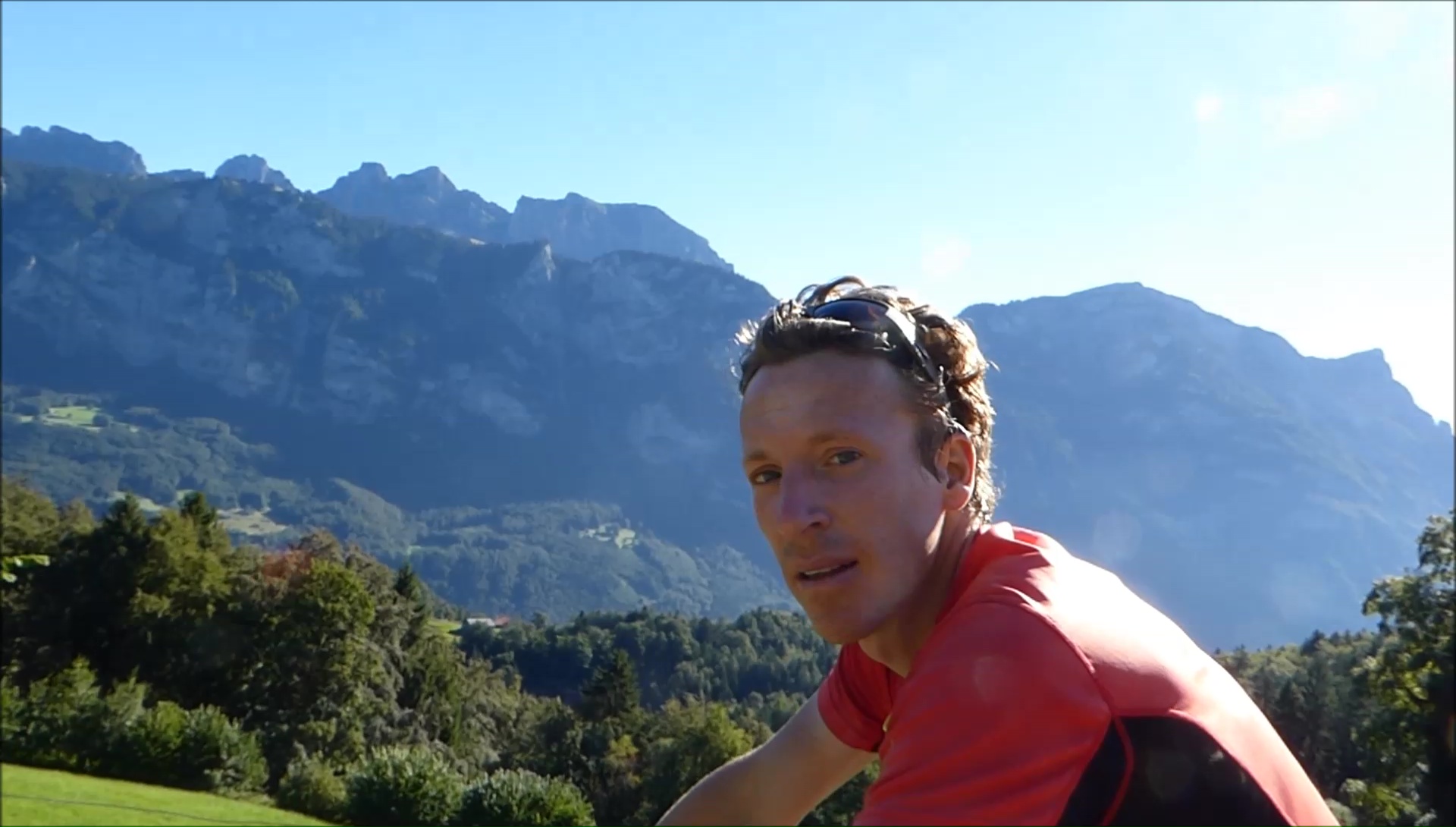
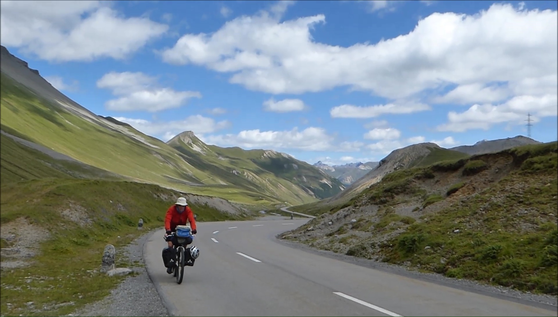
On this anniversary day, Val releases the nice
gifts: a handle of popote and 2 freeze-dried sachets ... rabbit
and beef (a real treat, nooon it's delicious!). We quickly leave
the path for the Susten Pass road at 2300 m: a real alpine pass,
as we like them. Sun, laces, sight, and especially legs that turn
alone. I even have the time to do laundry during the ascent: the
drying clothes is almost immediate! Val lands 20 minutes after
me ... ideal for a well-deserved break in a field of small flowers,
facing the glaciers.
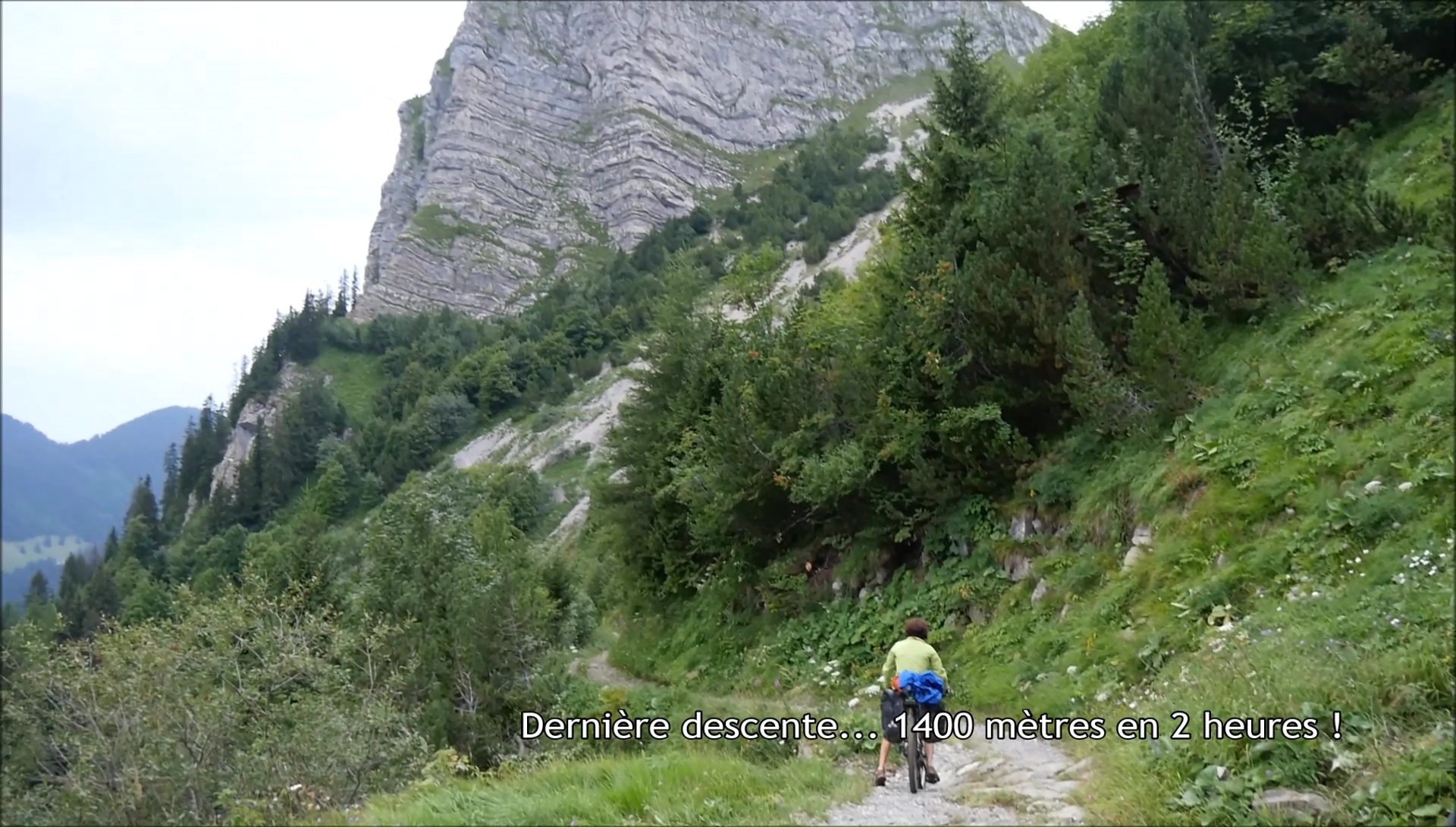
And it is left for a descent of madness with a
vertical drop of 1400 meters without forcing first on the road
and then on a track ... and there you say to yourself "saw
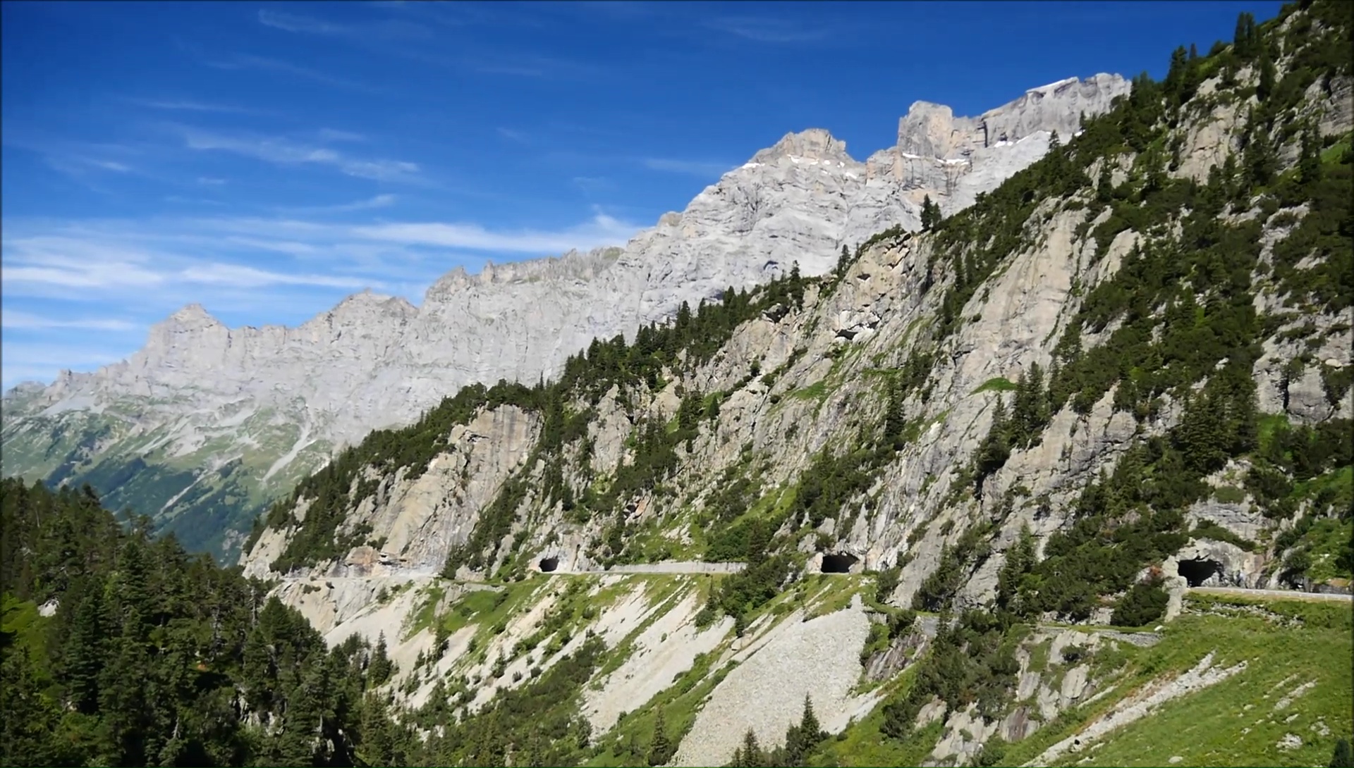
the slope, I prefer to be in this direction!" Easy to Wassen.
We leave for 10 km and 400 md +: with experience, it's 2 hours
... except that we do not advance between the portage on the stairs
and the passage of the tracks! We are a little cooked in Göschenen
when a miracle occurs: the Andermatt road is closed to bicycles.
The last part is all comfort in a train, first class. Bivouac
on the heights: the bad weather is preparing!
|
|
|
|
|
|
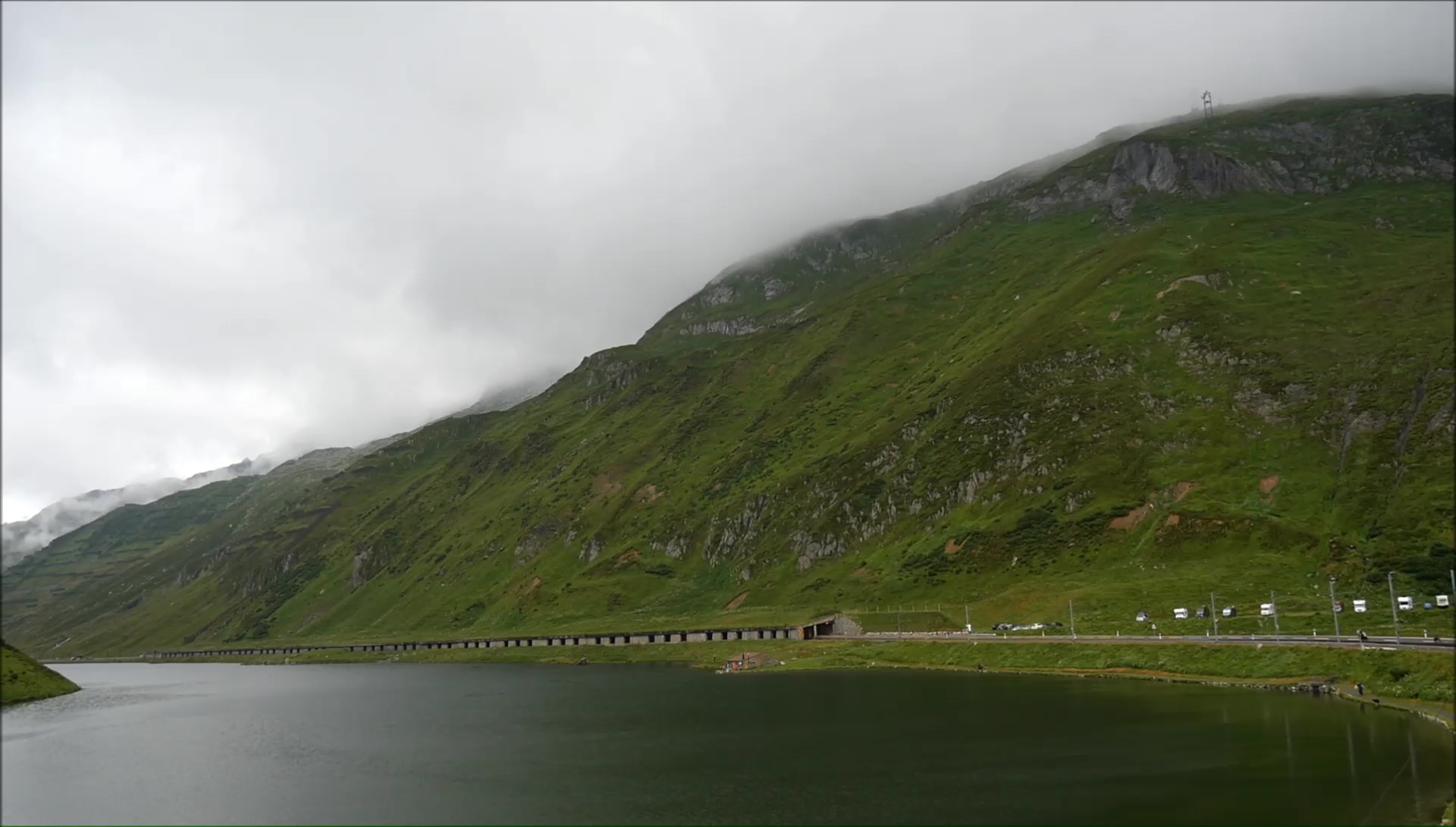
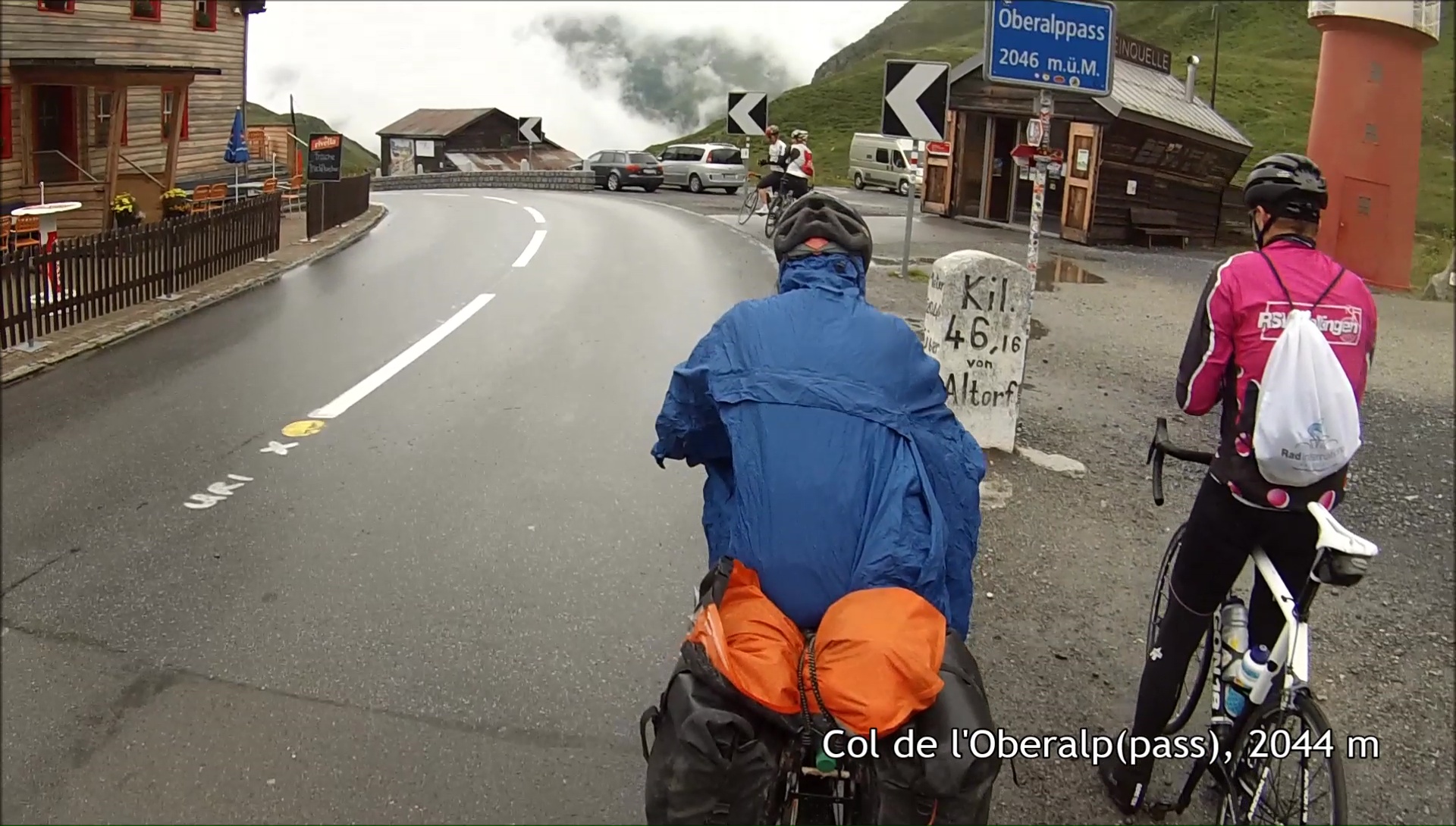
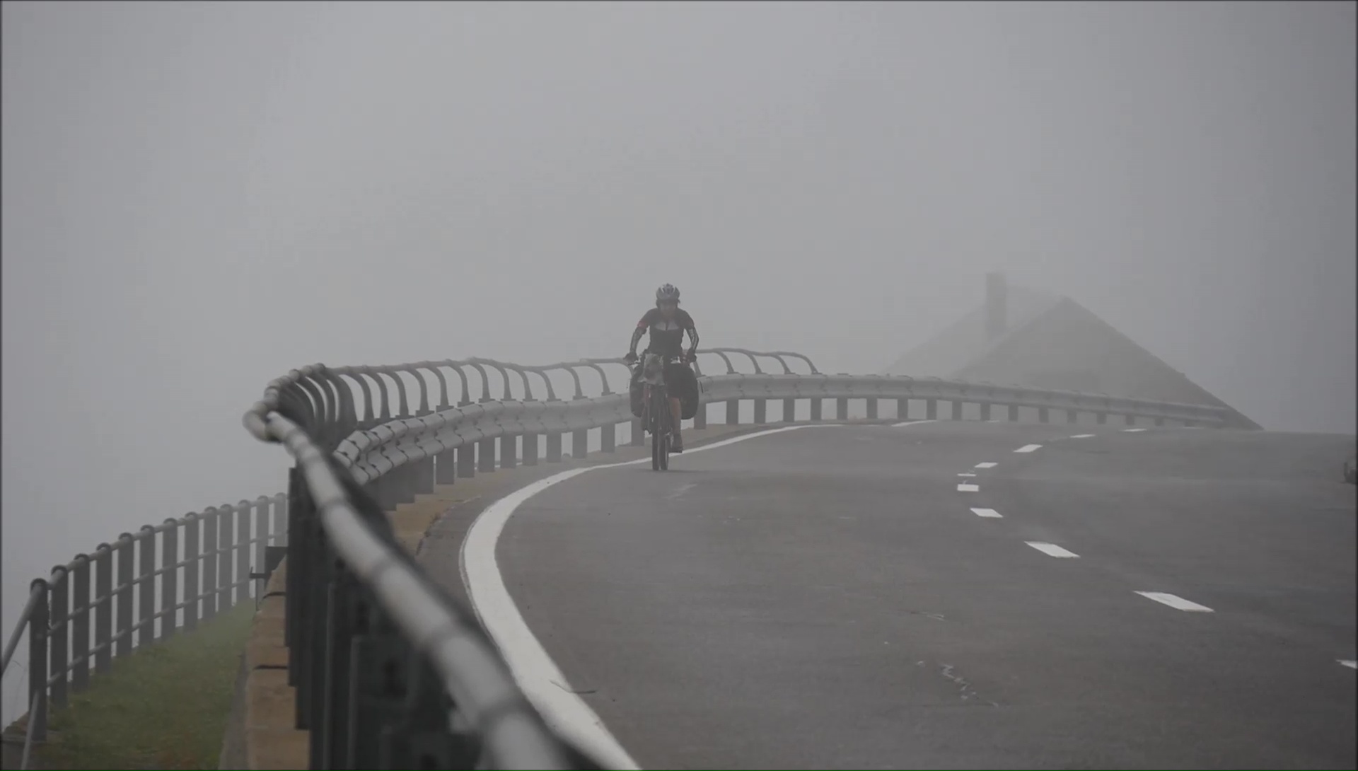
The breakfast is plentiful and the
Olympic form came back to climb the laces of the Oberalp pass.
Fortunately it is summer because the weather is really rotten:
discontinuous drizzle, fog and wind at over 2000 m. Panchos give
a little color to those dull days. The weather improves with the
descent, we pass Disentis Munstér without stopping ...
except when there are raspberries that call us at the edge of
the road. A little dart makes us go down a little too low. Do
not panic, the legs are sharp and ready to go back!
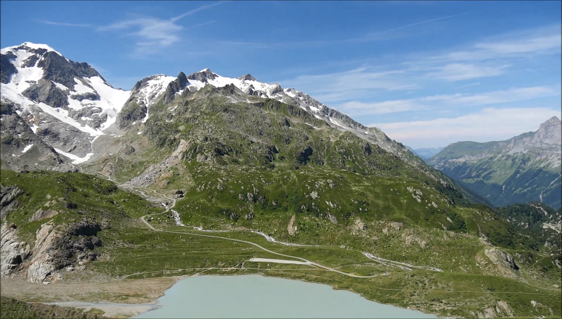
We go back through Obersaxen and
the lunch break is needed on a bench ... and say that a few years
ago I took this route in the other direction to join the Rhine
to the Rhone! The climb for the Sezner is grueling and the stops
are multiplying. Once on the heights, the trail is rolling ...
before of course to cross a field broken by the cows. Inroulable!
The tent is planted facing the mountains to climb the next day:
oh, oh, it's going strong! It is 18 hours and we finally enjoy
a real quiet evening! Serenity !
|
|
|
|
|
 |
|
|
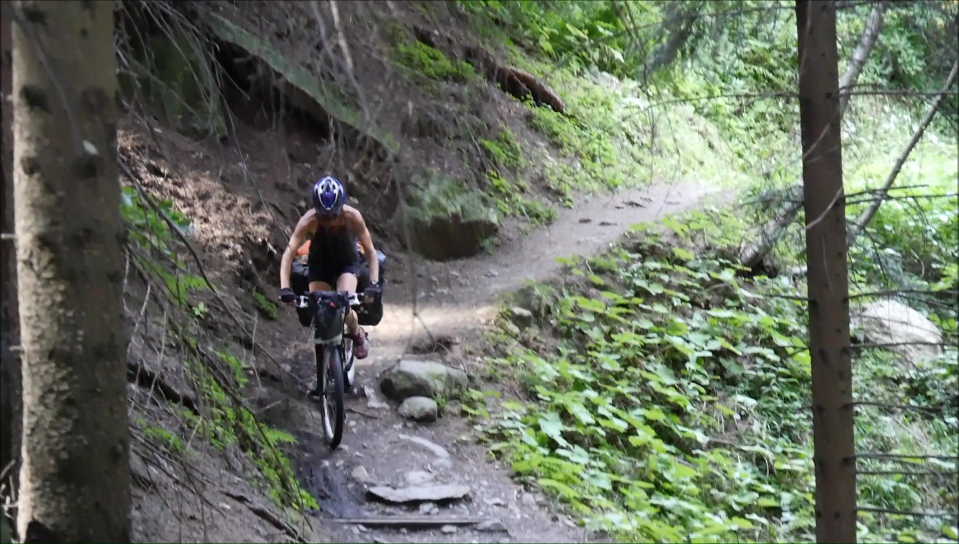
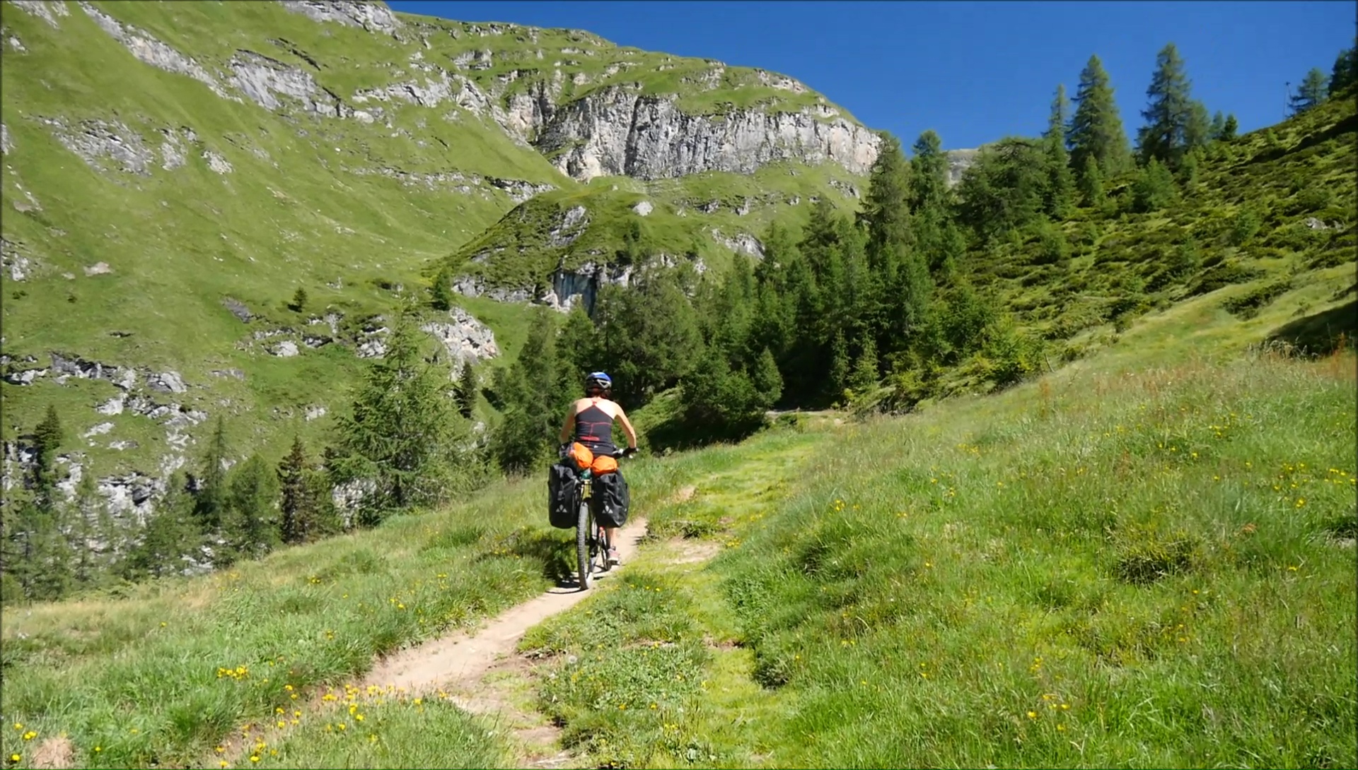
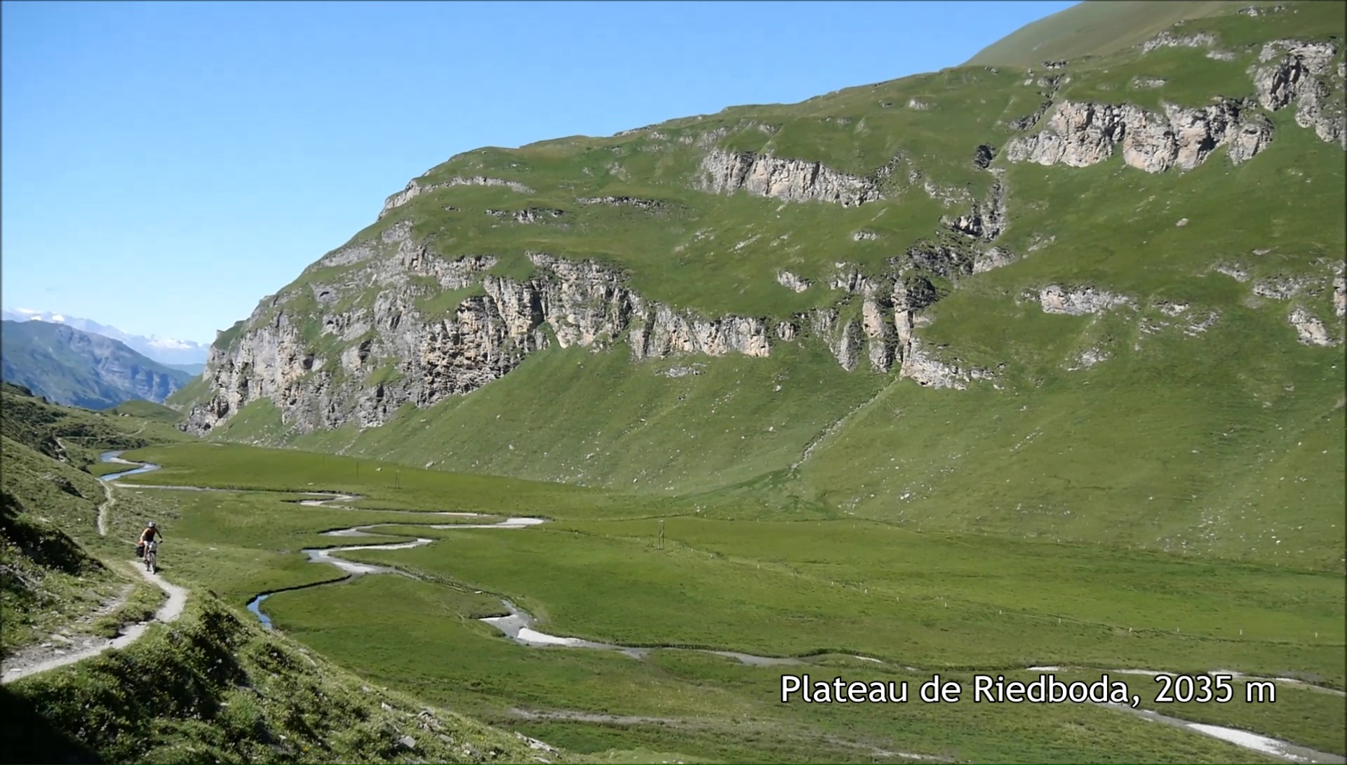
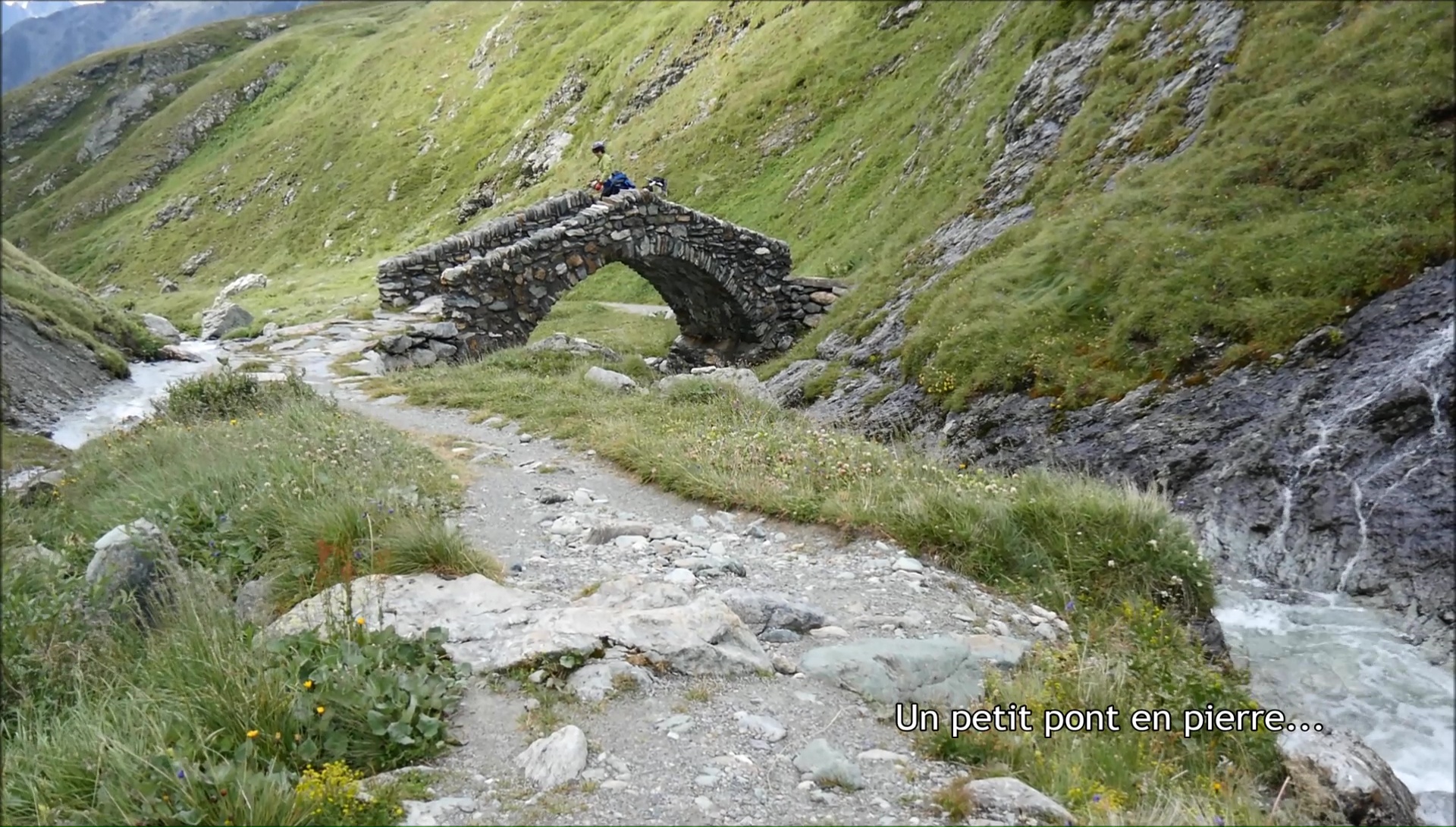
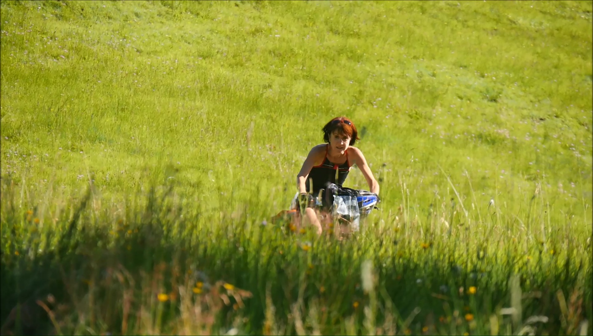
The descent of the Sezner starts with a single
in the tall grass, it rolls without problem with the saddlebags
to the bottom of the valley of Lumbrein, Vrin and Surin to recover
a track in the forest. To reach the spa town of Vals, we take
the road ... without forcing too much! But the concern of the
day is to find something to eat because it's Sunday and the grocery
stores are closed and our bags are almost empty. We find our happiness
in a snack bar that offers huge home-made country breads ... we
will take 2 kilos, just to keep up the hill.
After a quick break, the serious things begin with
a climb on a track overlooking Vals ... then a path ... and of
course, we push! Lucky v'tistes who come down take us for crazy,
when they learn that we go to S.Moritz is the total joke! We ride
on the saddle a few hundred meters, and rebelote, big portage
to a sheepfold where 4 yahourts are engulfed in 4 minutes! After
a last effort, we reach the Tomül pass to put the tent a
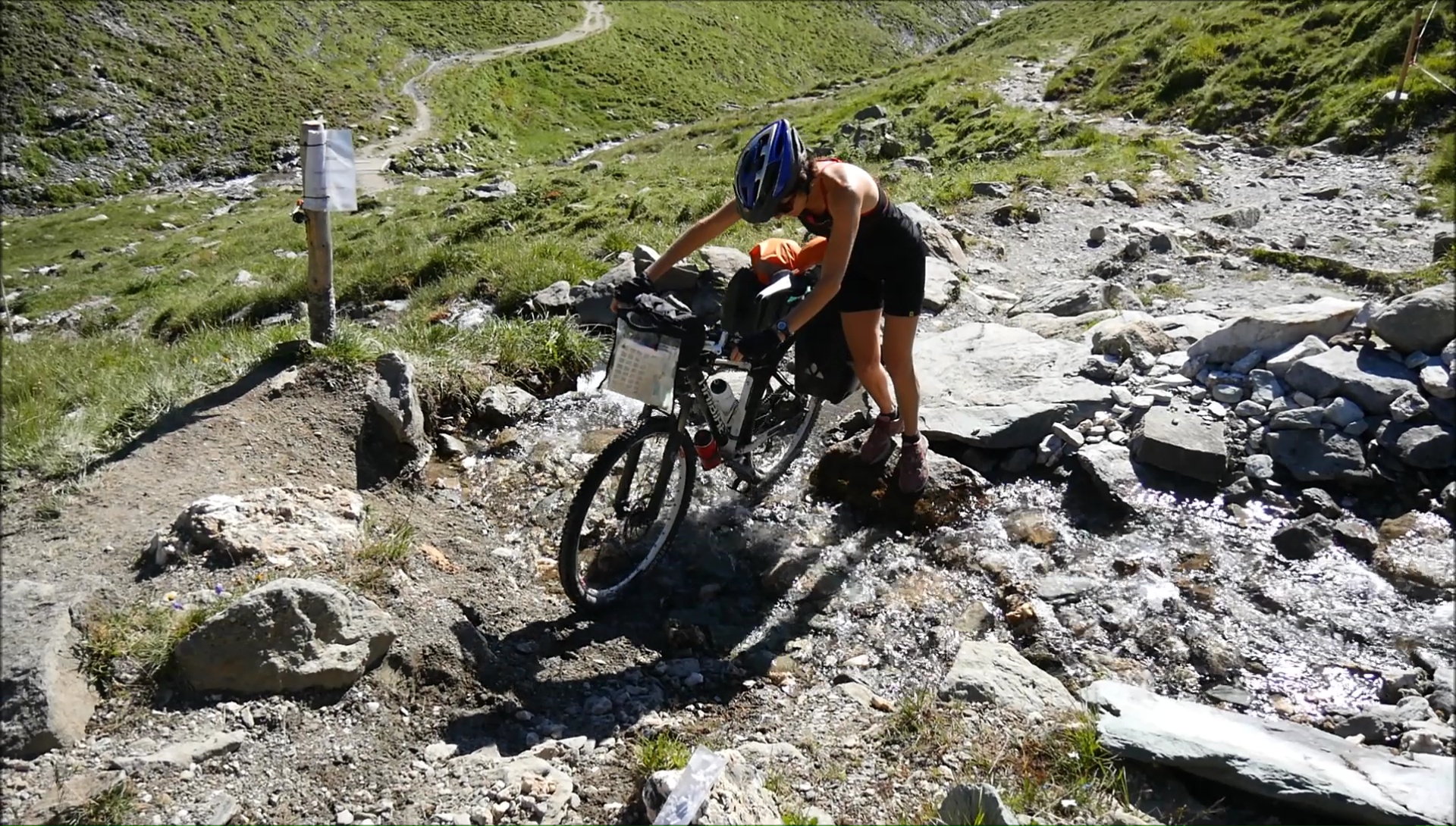
little lower, the place is perfect. A trickle of water allows
us to do a bit of toilet.
|
|
|
|
|
|
The morning is sunny, almost too
hot. The stony path becomes a wide stony path that descends into
the valley: hard to pick up speed without breaking your back!
Down below, the sun has not arrived yet: the icy air, forced to
take out the jackets. To see the trail (vertical) and contours
of the map, we will make a more rolling loop by bike to avoid
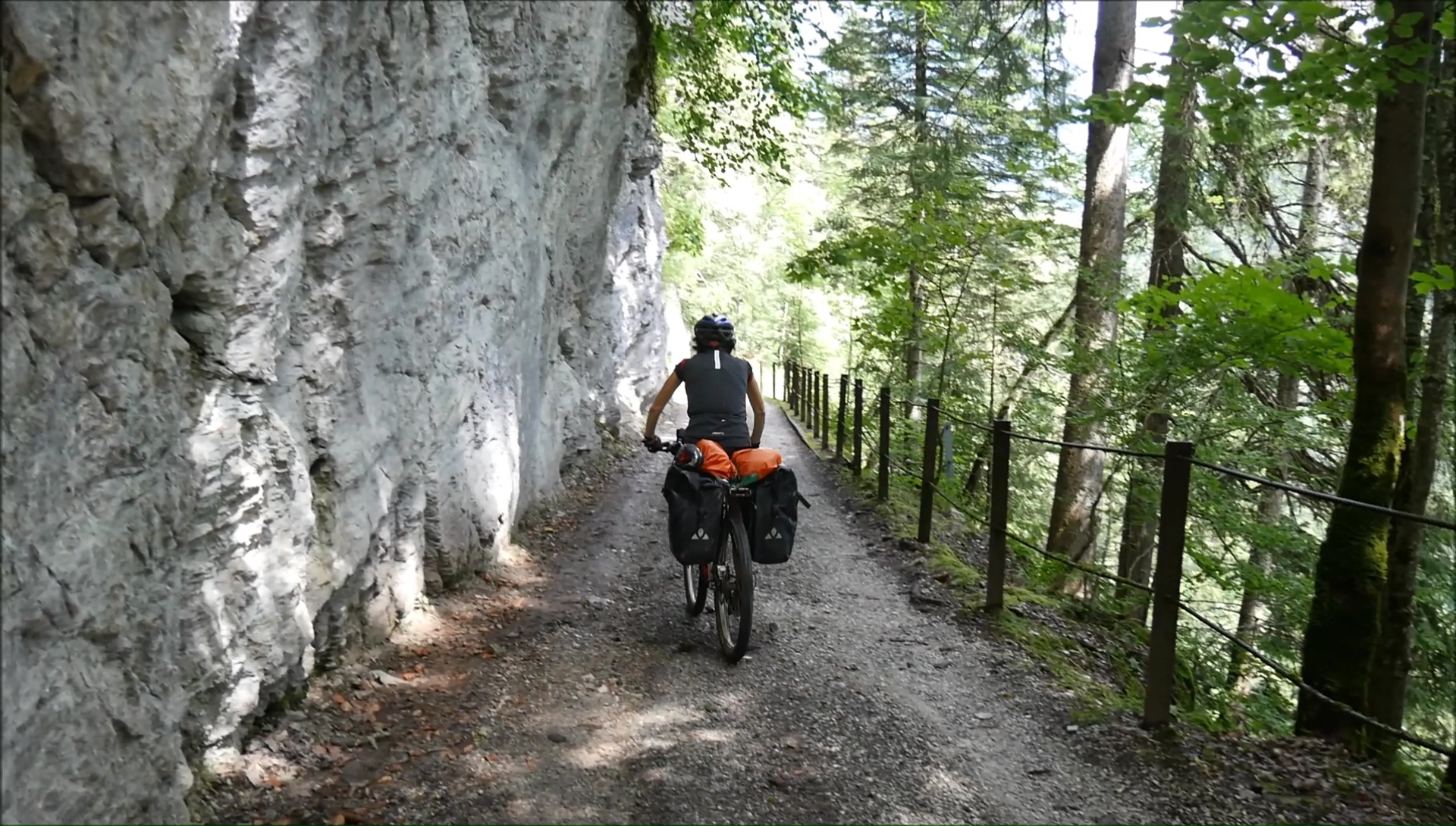
a pass at 1850 meters! We go on a track dug in the rock with very
picturesque tunnels: the detour is worth it and we keep some strength
for the next to come.
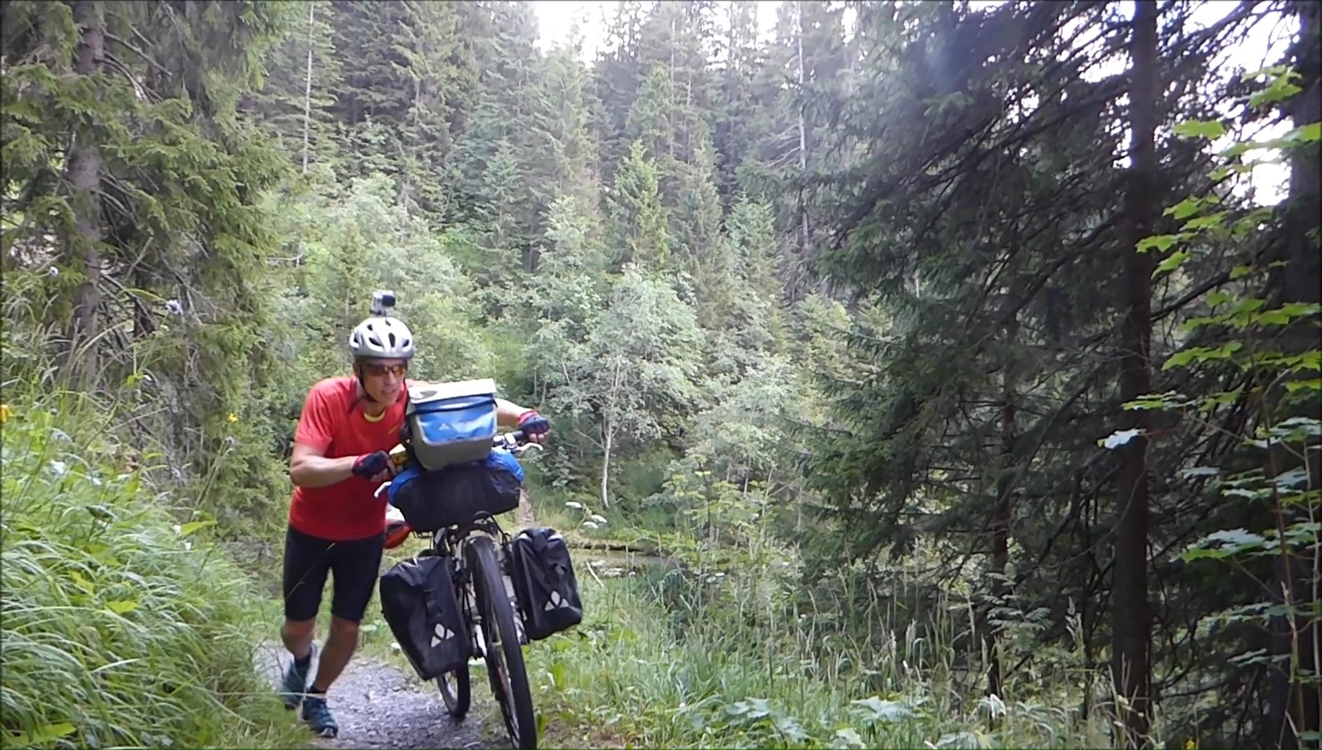
Although I miss a section of road
on my GPS, everything makes me think that we can connect a forest
track leading directly to the valley of Cazis / Thusis. We discover
a path of 20 cm necessarily impractical bike ... Joy of adventure!
To know how to force a little and save for the rest of the day:
this is what drives us to pass these mountains inaccessible but
so beautiful! After a pass at 1700 m, the valleys of Cazis and
Albula are splendid. We leave the Alpine bike for a trail almost
as hard technically, we put the mountain bikes at night. Exhausted!
|
|
|
|

|
|

|
|
|
This morning, the sky goes
through 50 shades of gray, nothing good that is worth! But we
go between the big drops, which allows at least refresh the calves!
We alternate between road and road depending on the profile of
the mountain: a little tired of getting burned for nothing! And
then the weather threatens, it is easier to take shelter along
a RN in the middle of the forest: it is the deluge at Mulegns.
A good hour break under the roof terrace of a hotel with Romanian
bikers: we are in the open but at least the rest dry. We start
on a soggy road to Marmomera.
After the dam of Marmorera, it is the last straight
before Bivio. The sky always threatens a little more then the
visit of the center is ultra fast ... Nobody in the streets, everything
is gray, wet and cold. We decide to continue in the pastures in
search of a flat ground to put the tent. First drop: cottages
are placed every hundred meters, we are "too" visible.
Second drop: we are always higher. The storm: I tent the emergency
in a relative flat, between pebbles and ... water holes. The place
is marshy: it will wet!
|
|
|
|
|
|
Despite the rain, the 16 hours spent
in the tent were good and ... miracle, the wind has (almost) dried
the canvas! Crossed the day before, hikers greet us "So,
you slept well?" ... :) Yep! The temperature is icy, I am
obliged to put a pair of socks as gloves! Access to the Septimer
Pass is easy, but the South Trail that runs south into the Orlegna
Valley alternates between holes and rocks. Breaking ground, backache!
We come across mountain bikers: for once, we are in the right
direction, but we had to climb to get here!
And still a real mountain itinerary
as we like them: the 14 laces of Maloja spice up the end of the
morning and allow access to the top of the valley of St Moritz
and its many lakes with turquoise colors. The time of a break,
the business dries in the wind and one rolls without forcing on
small roads and singles very accessible. Flash passage in St Moritz.
The path that runs right North is ultra rolling with the beautiful
colors of a summer evening. It's the foot. The tent is set off
the path on the heights of the Flax River ... with a sweet smell
of larches!
|
|
|
|

|
|
|
|
|
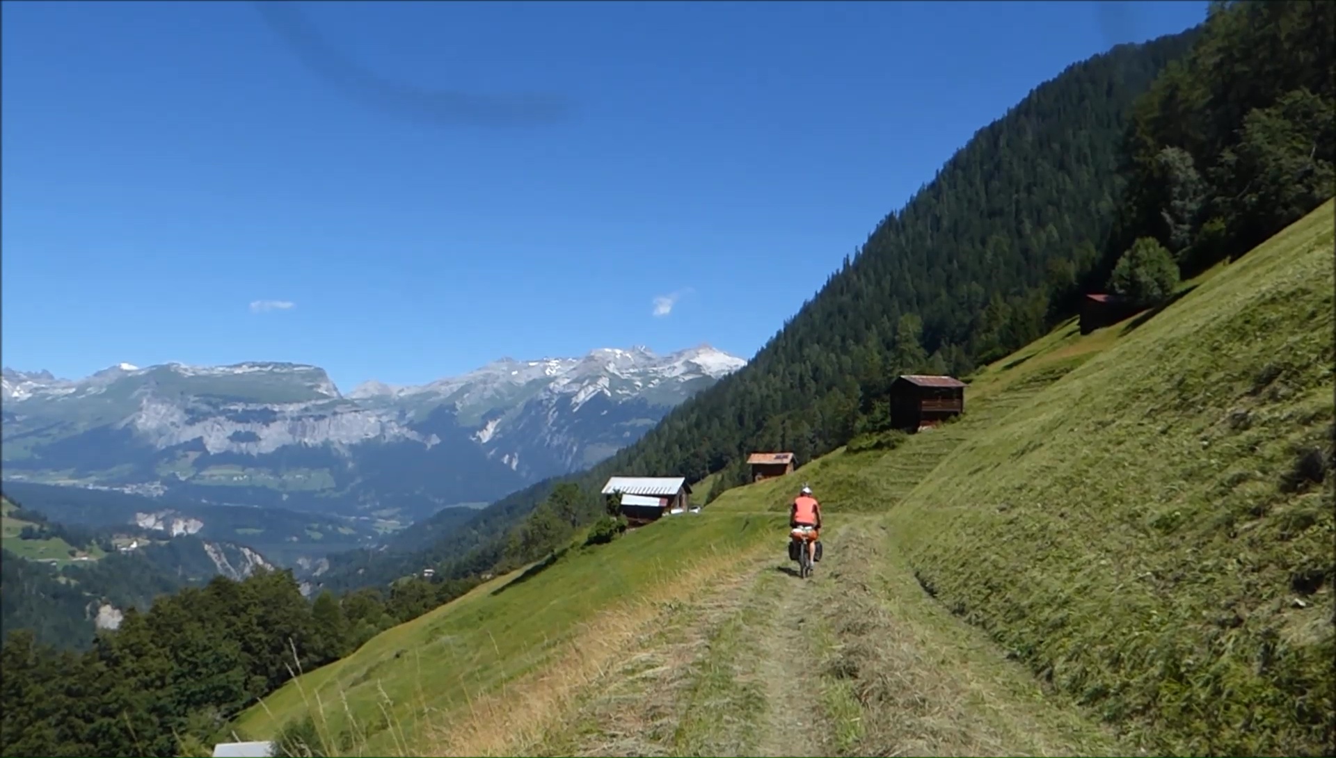
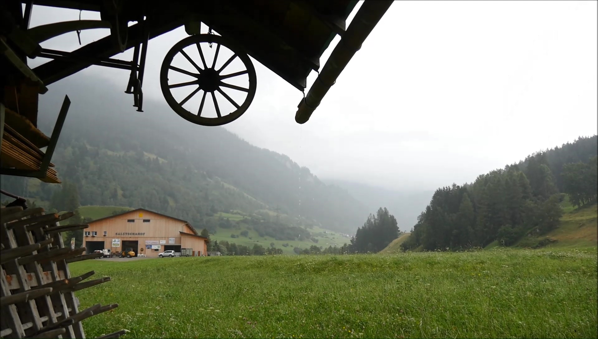
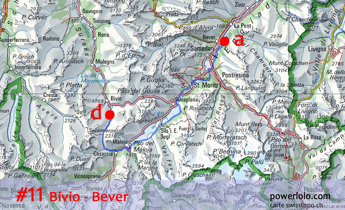
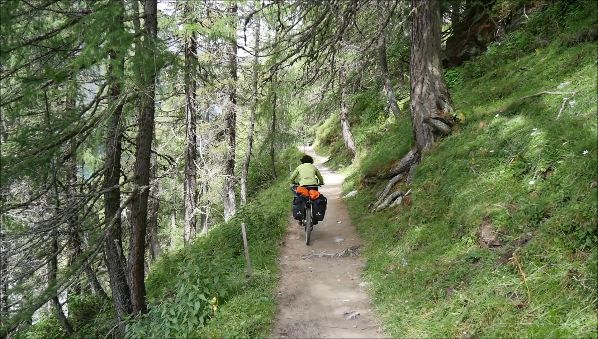
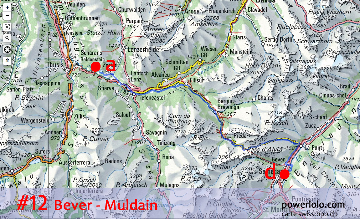
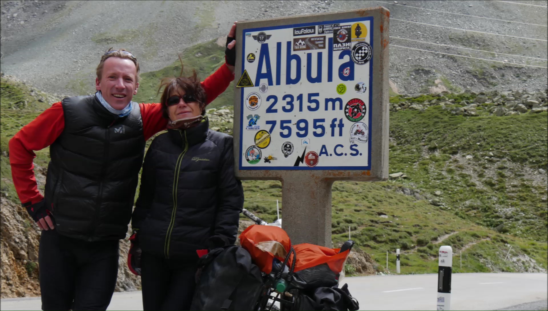
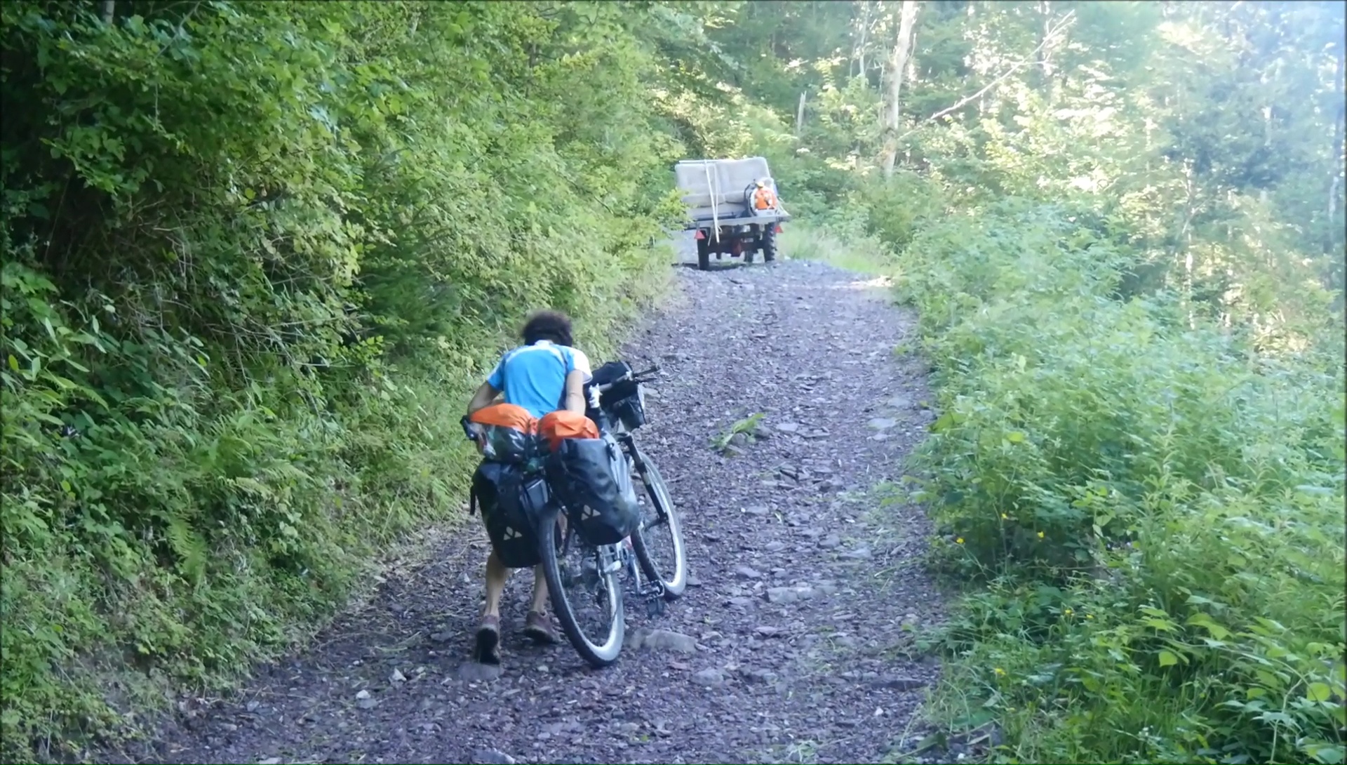
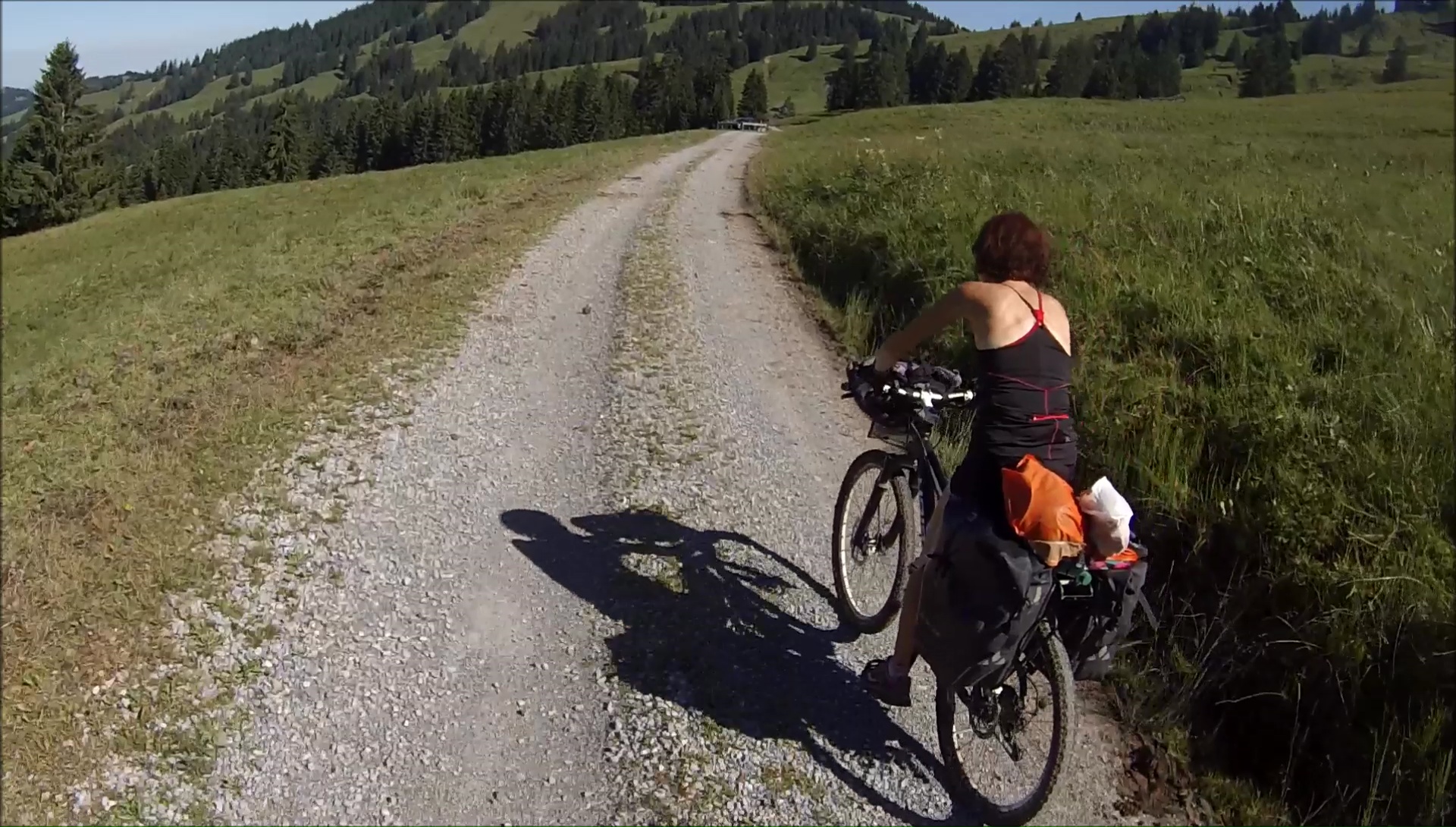
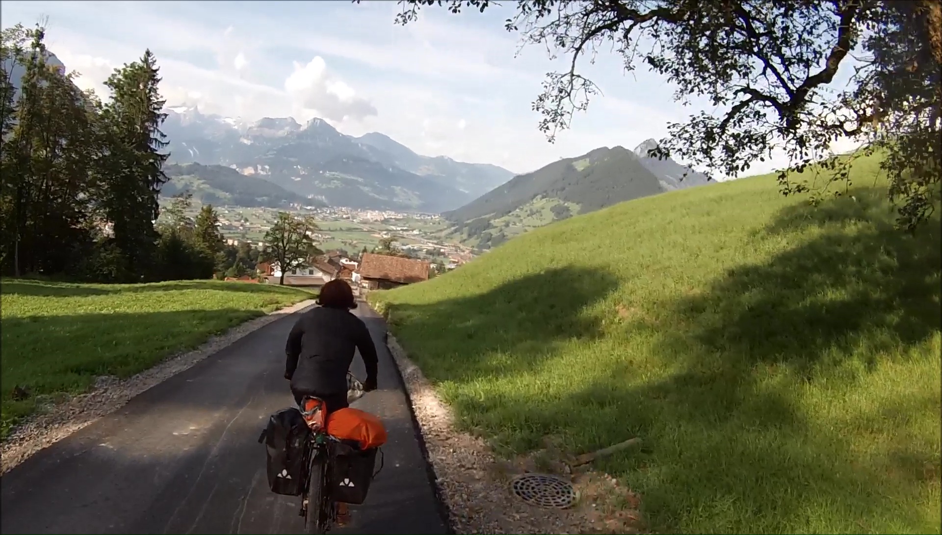
We discover the charming villages of the valley,
like Bever where the walls of the houses are painted and richly
decorated. Always wanting to privilege paths, I spot on the map
a path that joins the road to the Albula ... but very quickly,
you have to push the bike up and down ... down! A small kilometer
is transformed into 1 hour portage painful and without interest!
Hard! The climb to the pass is much more interesting with a succession
of alpine landscapes. We finish at the collar in down jacket:
the icy wind blows from the front; it is so strong that one is
braked on the plane.
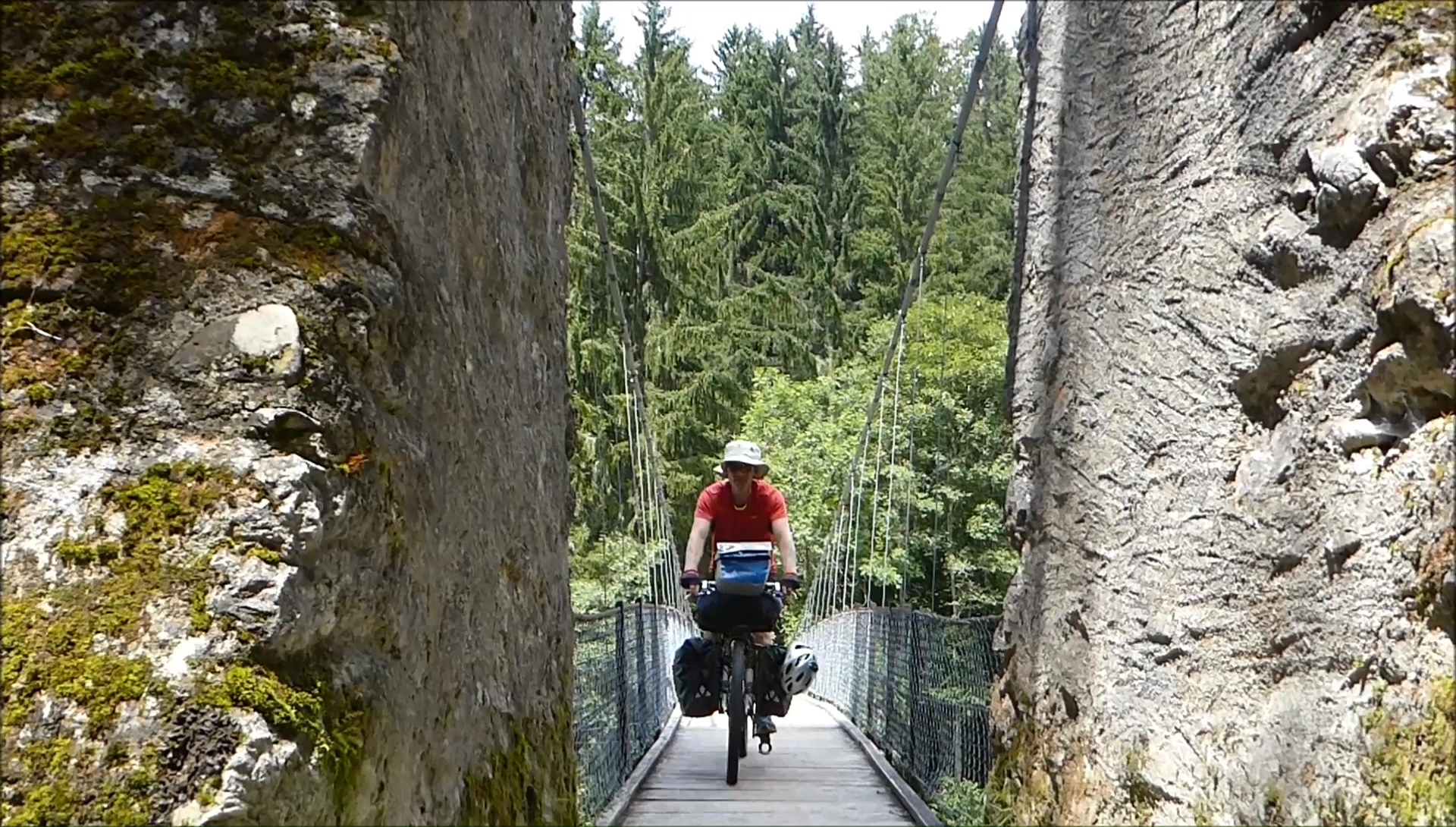
The descent of the Albula is genialissime,
few cars; we even race with the Alpine classic Pullman Express,
a mountain train that winds between bridges and tunnels. We find
the route 6 mountain bike tour of the Oberalp, single very nice
even with our heavy bags that takes us back to Tiefencastle. Great
moment on mountain bike! The climb for Muldain is exhausting but
all the ingredients are together for a fantastic evening: sun
facing, filled cans, pedaling in t-shirt, raspberry along the
way, bivouac with table, bench, grill, 180 degree panorama. Great
luxury.
|
|
|
|
|
|
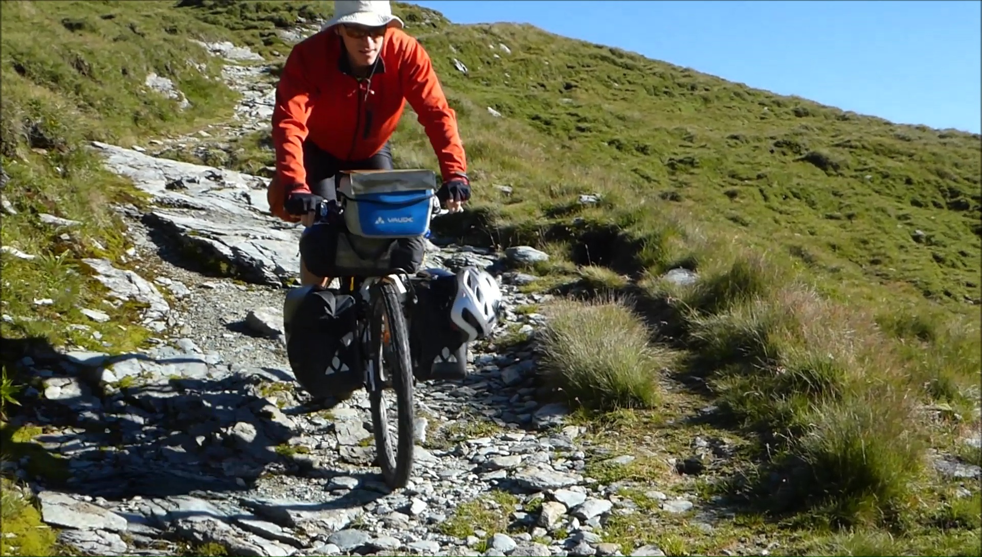
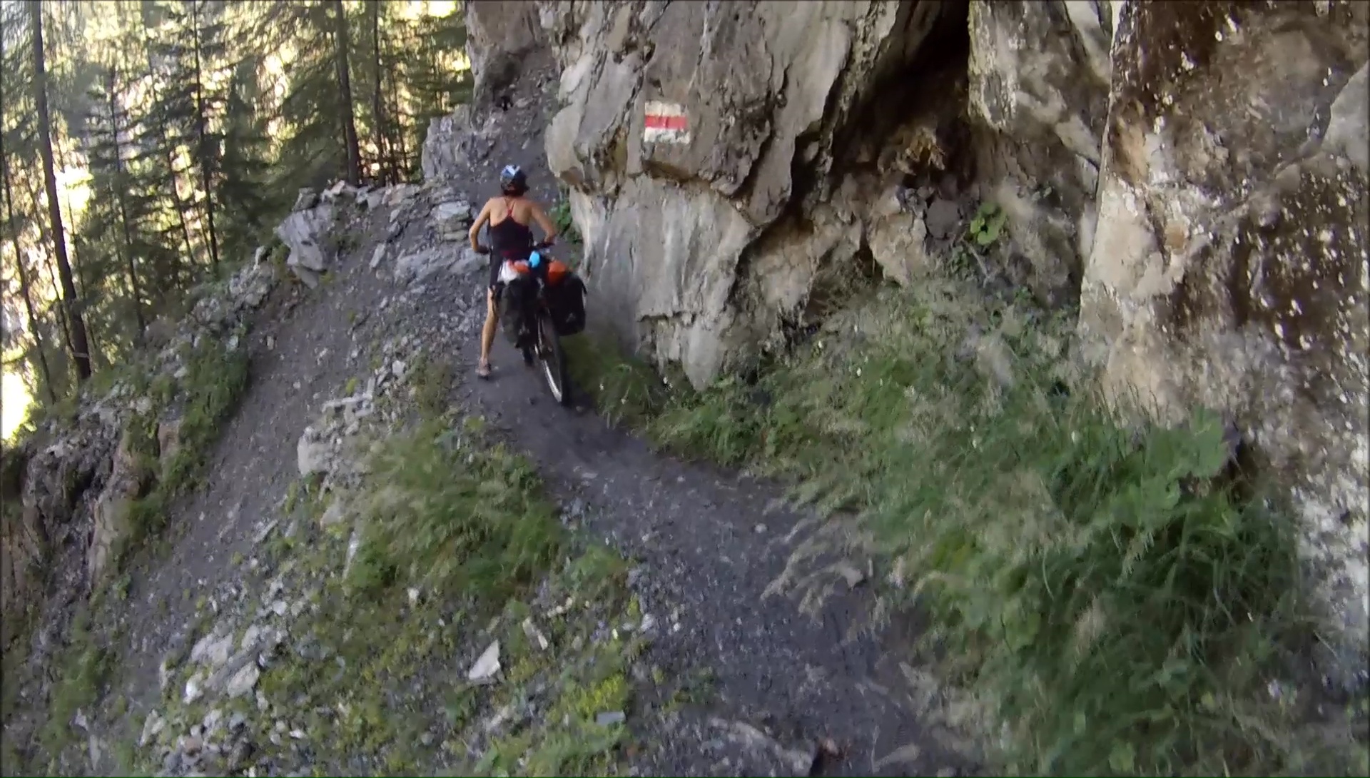
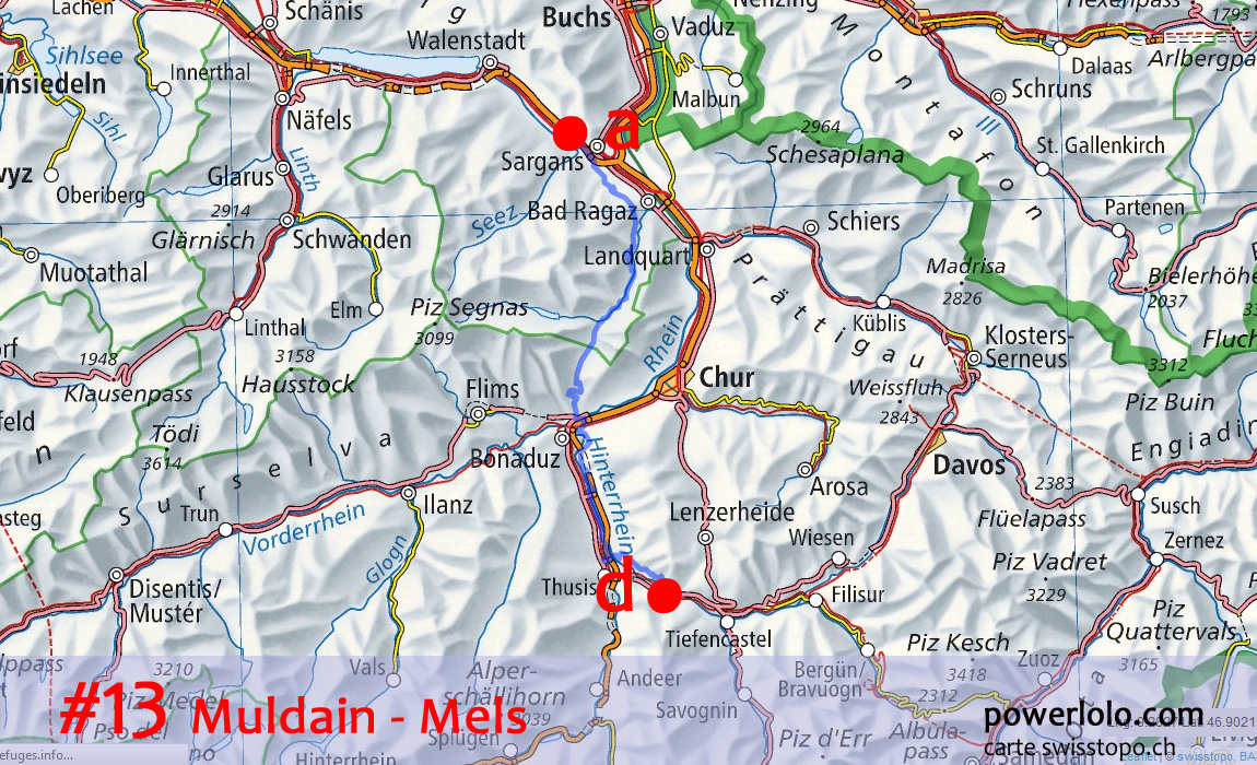
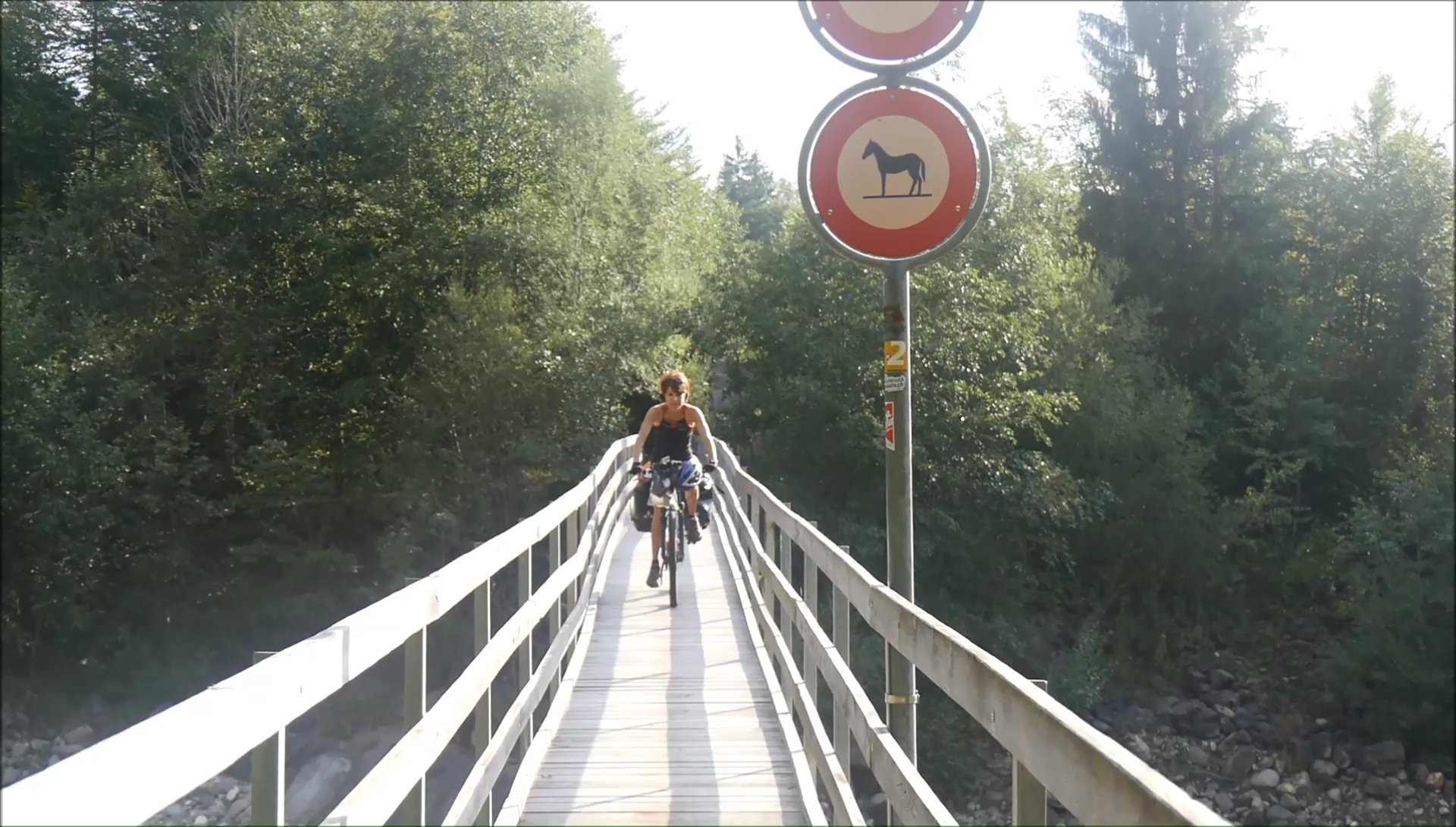
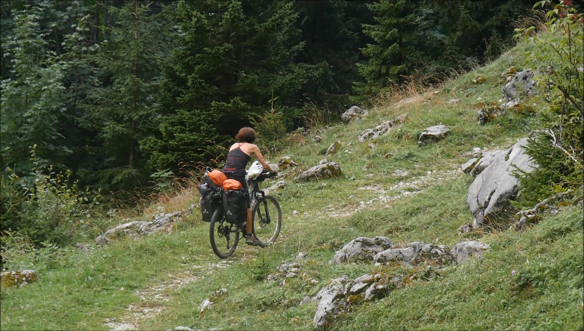
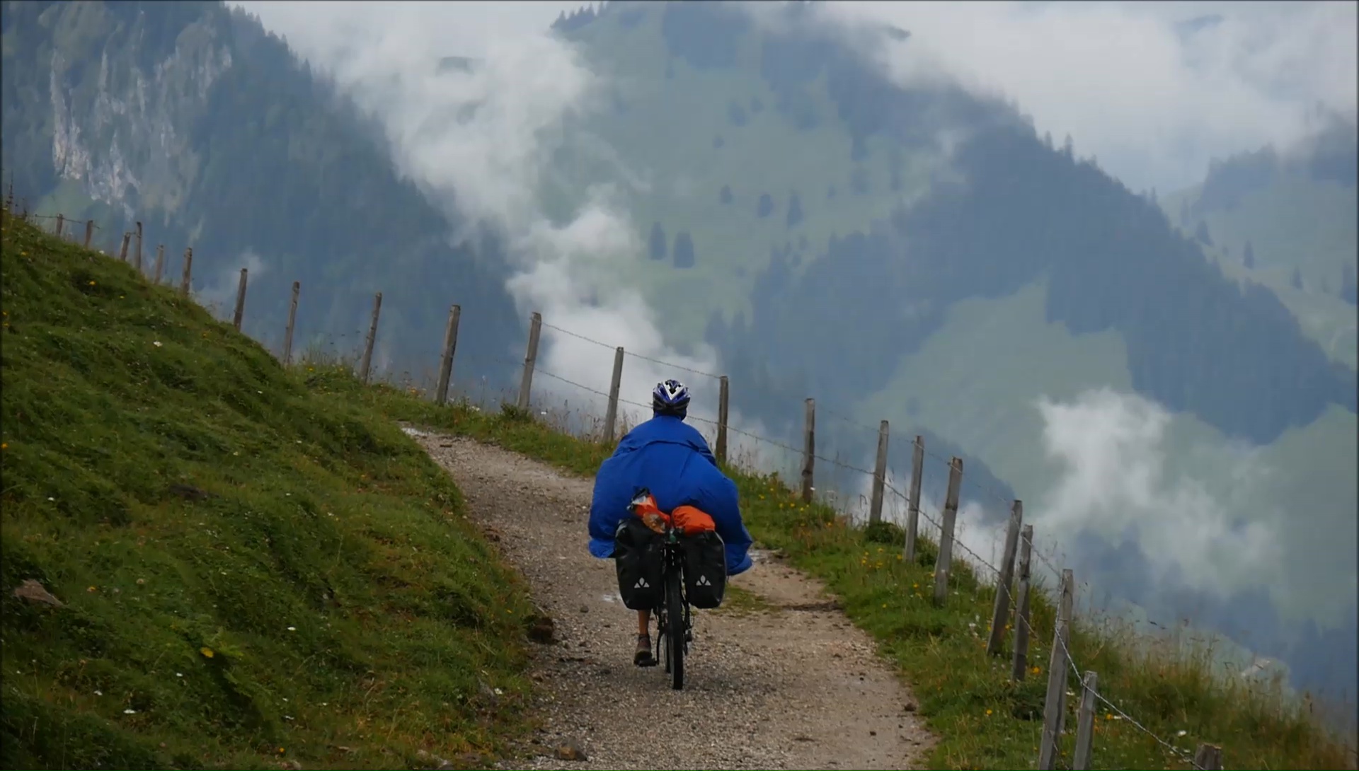
Mountain paths in Switzerland are
out of the ordinary: in the middle of nowhere, the tunnels are
lit automatically at the entrance ... and powered by solar panels!
The trail crosses impassable cliffs where each passage of torrent
is arranged for our greatest happiness. We return to the Aldi
Cazis to refuel bags at a mini price, with the bonus of wifi.
Satisfaction guarantee! We descend the lower Rhine as far as the
Chur valley with a forbidden bicycles passage ... by a quarry,
oh yeah! Break already on the place of Tamins.
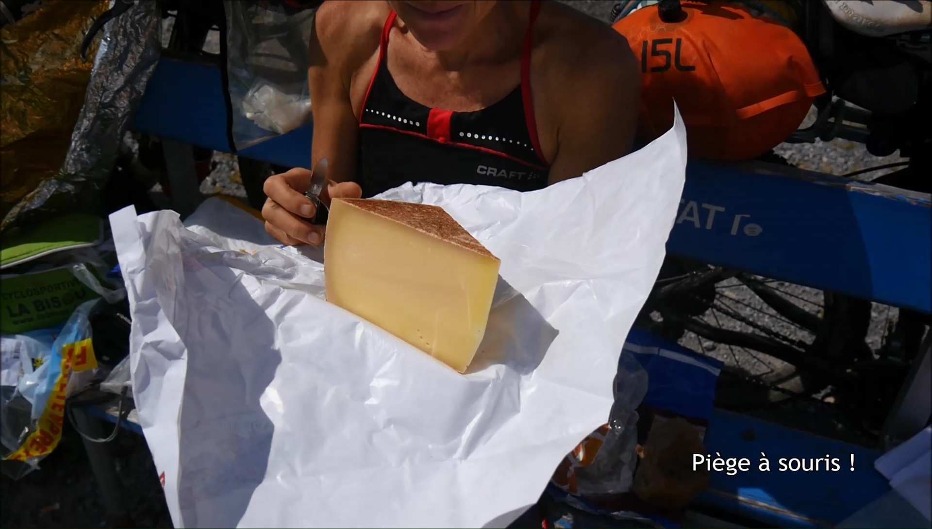
To join the Kunkel pass, it is 700
md + which must be assured without flinching. The slope is very
steep but softens at the top: the landscapes go from mineral to
plant with green valleys covered with fir trees. Once again, we
love 550 grams of cow's cheese: a true delight. As often, we take
out the jackets. But the sports trail after Lake Mapragg above
Bad-Ragaz gives color again because we favor a few steep climbs
to enjoy the views. In Mels, the evening is serene and beautiful
with the pink colors of the sunset. Top !
|
|
|
|

|
|
|
|
|
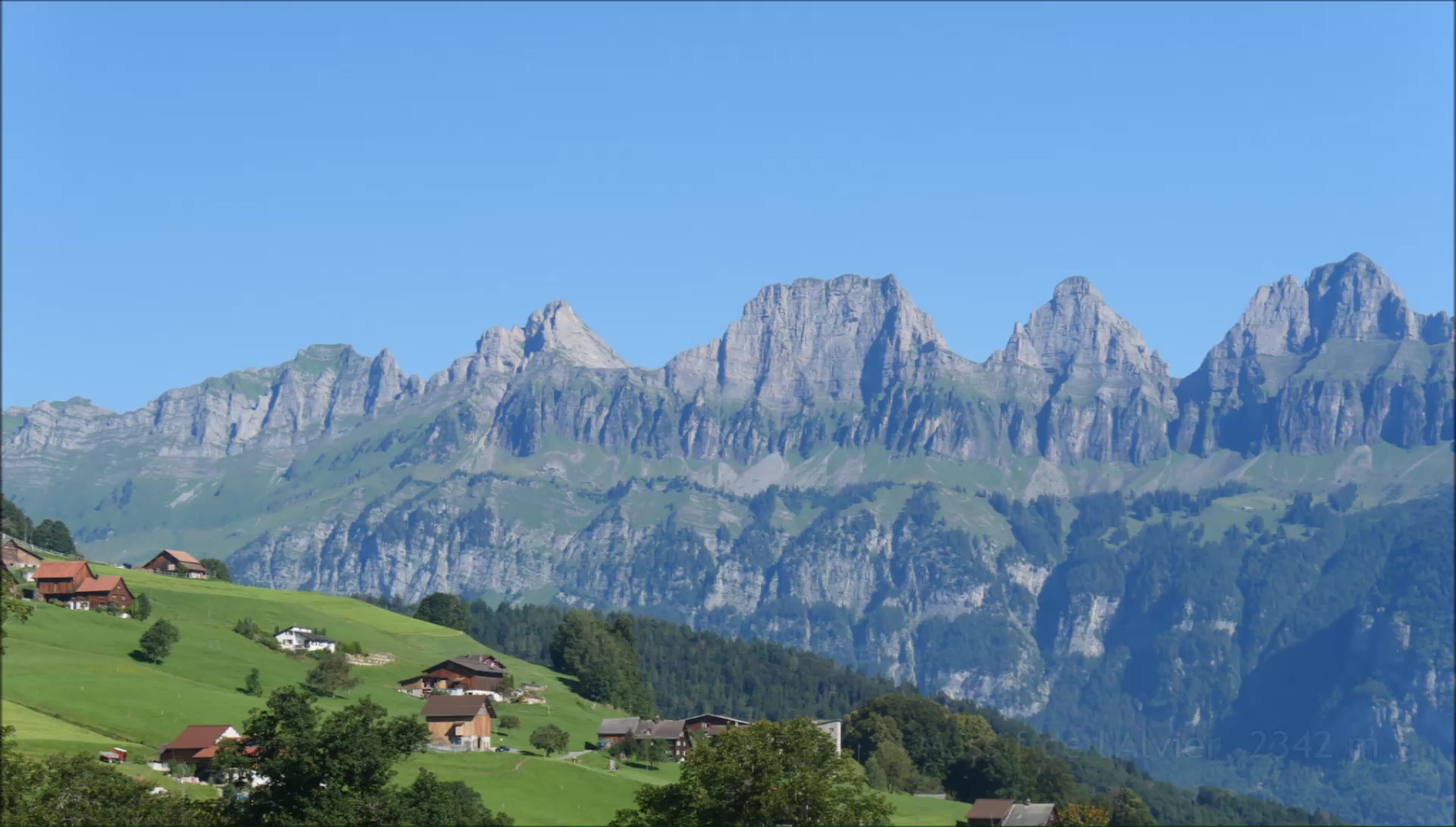
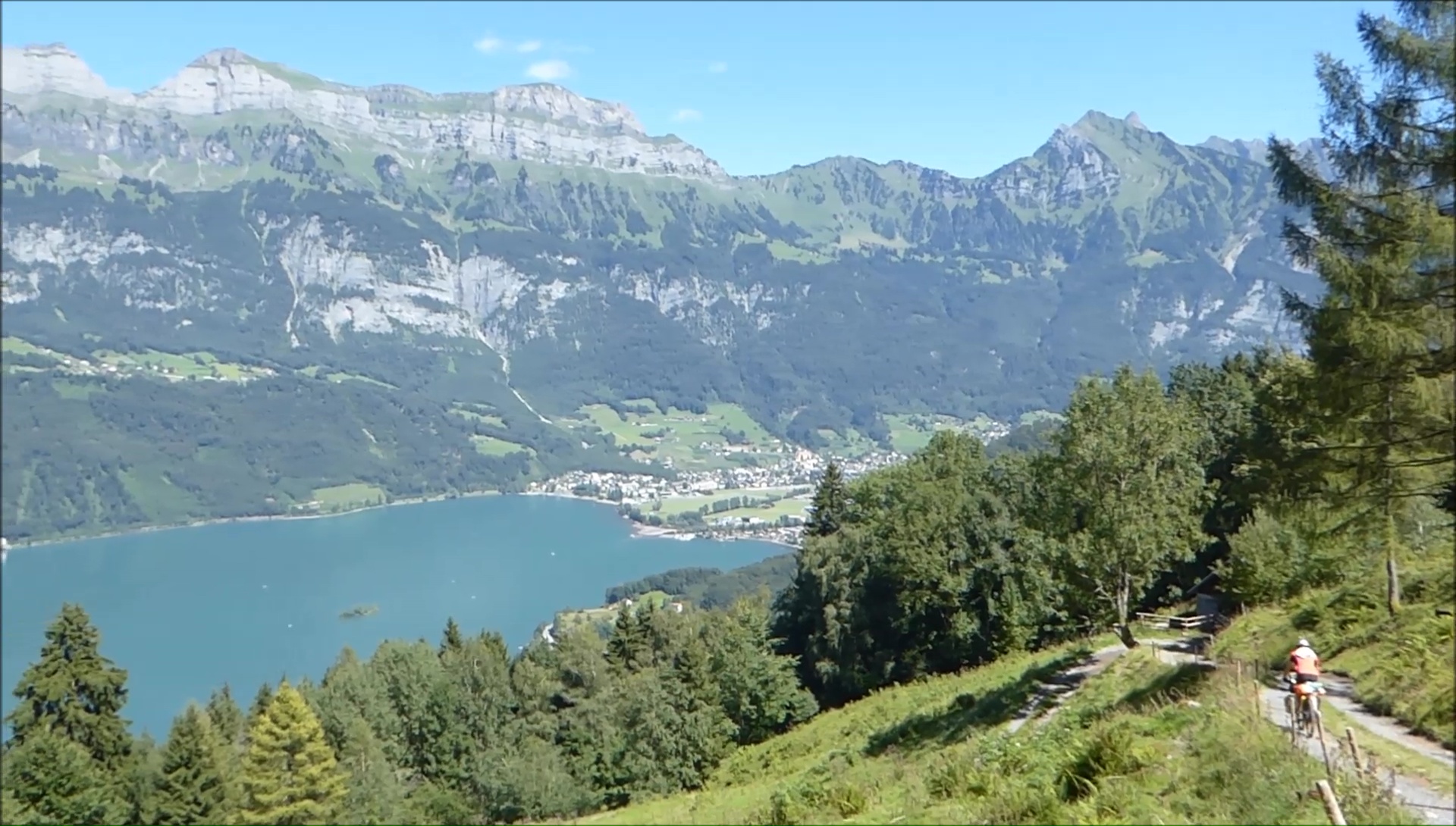
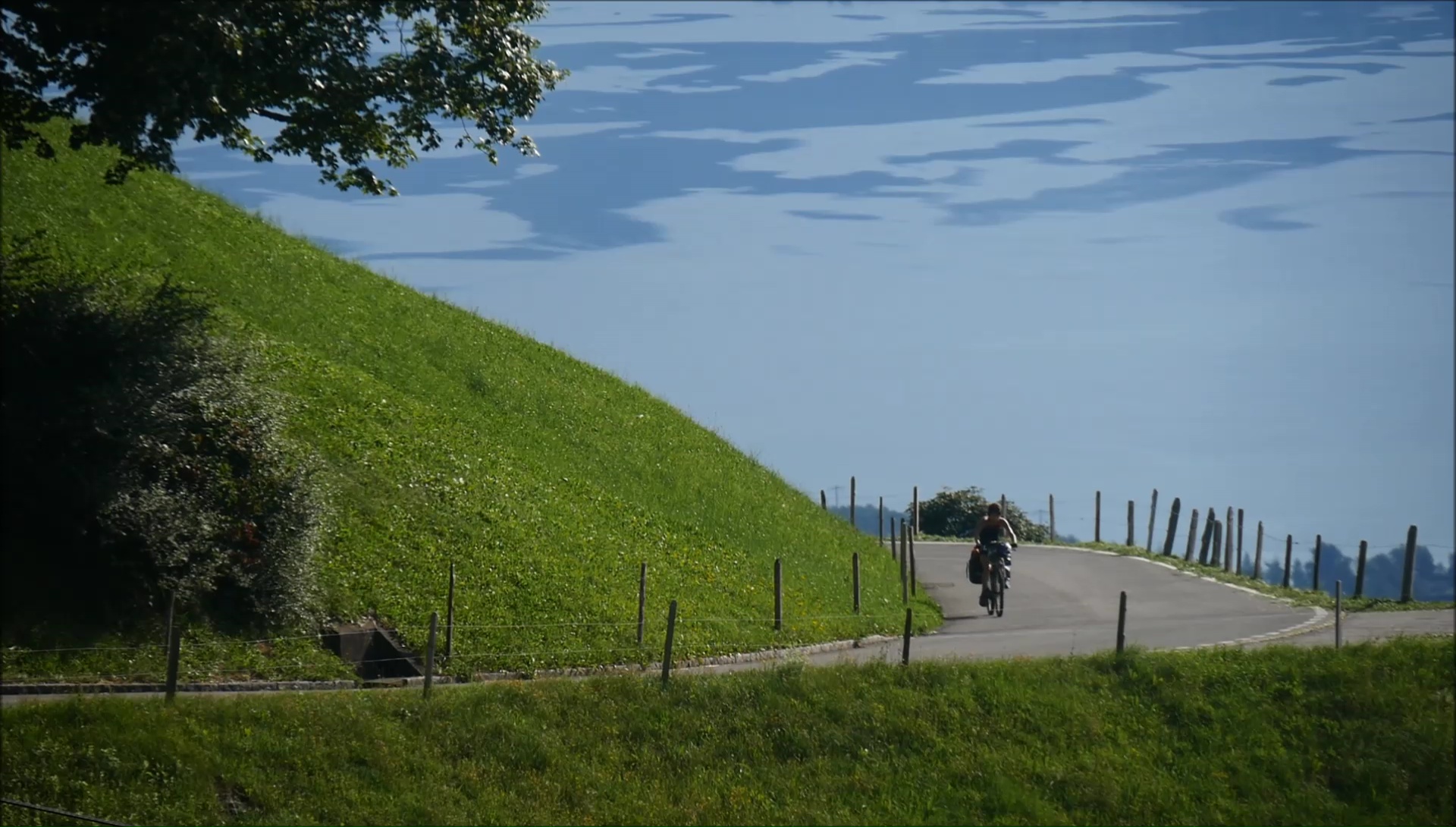
The mountain range of Churfirsten shows us the
right direction: full West. The day begins with a big difficulty,
I cut (slightly) the ordeal because to go up to 1800 m of altitude
will blow us up in flight! Basta the slopes at 20% where we skid
with trail shoes ... The bike (too) heavy brakes us in our progress.
Not simple every day! We find a small road to 1000 m: we literally
revive, especially that an integral cleaning with icy water invigorates
the body and mind! We take the opportunity to wash our frigues.
All fresh, all beautiful, all clean.
The single of the aprèm was too much (I
confess) ... impossible to roll! But the approach to Lake Walen
is splendid with this intense turquoise in an alpine universe.
At the same time, we recover a bike path without (too much) difficulty
on the shores of the lake! Heaven on earth. After a break "ice"
(because it's summer, if, if ...) in Weesen, we leave for the
valley Niederurner. Once again, we go from 400 to 1200 m alt.
in a few minutes of sweat under a scorching heat and under a small
cable car of 4 places. It could give us ideas for next time ...
|
|
|
|
|
|
The ascent to the Flüewald Pass
is peaceful, but the descent is much more dangerous, it will take
us 30 minutes to a few hundred meters and cross a wet area on
wooden pontoons. We do not risk it with our panniers ... Not crazy!
The path continues in yoyo always under the sun. Big sweats. All
means are good to stop: religious service in the open air, crossing
a refreshment bar installed on the way, photos and videos, filling
cans at the inhabitant. We take advantage of all these moments,
savoring the idea of ??being there only by the strength of our
calves.
We pass the Sattelegg pass and its
Harley's cloud, Willerzell, its lake and Einsiedeln and its abbey.
Stroll along the Alp River to Alpthal where you tackle the last
difficulty of the day: 500 md + which leads us to the Haggenegg
Pass, at 1414 m. Easy ! Hikers advise us on a bivouac on the heights
and a breathtaking view of Lake Schwyz, but the portage is uninviting
at the end of the day. After a technical descent, even acrobatic
with saddlebags, we sleep lower in a field of raspberries. Yum,
yum!
|
|
|
|
|
 |
|
|
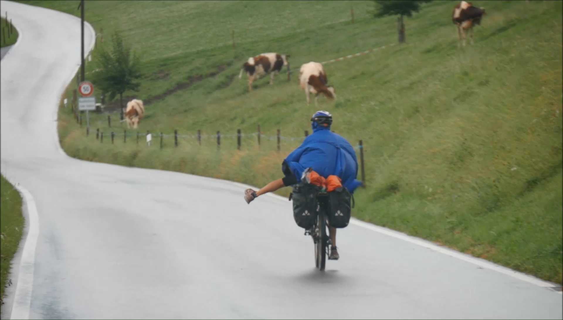
Like every Sunday, it's a struggle to find an open
shop; like every day, we are constantly hungry. It is haphazardly
the chance that a grocery store or a sheepfold cross our path,
which makes all the charm of bike roaming. After Brunnen and Gersau,
we cross the Lake Lucerne by ferry ... me who thought that Autofähre
was a highway, good surprise! Lunch at the lake side Buochs ??among
a swarm of tourists in shorts and effervescence: profusion of
grilled sausages and beer cans! We had forgotten mass tourism
...
|
|
|
|
|
|
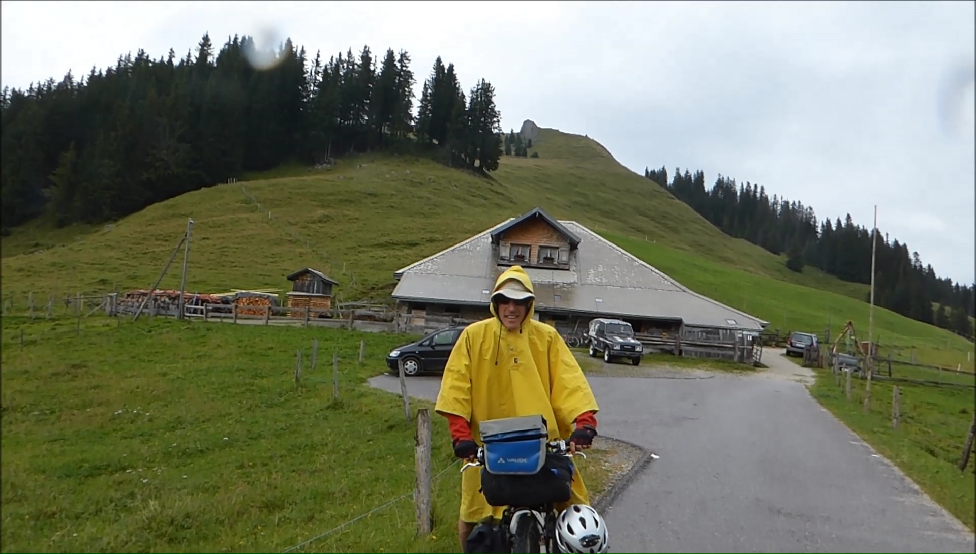
Just awake, we attack in the hard:
2:30 for 1100 m + climb on a panoramic RN with asphalt smooth
(that happiness) to the Glaubenbielen pass. Why take the path?
While the clouds disappear, the last kil of the pass is a billiard
almost flat where a cheese seller is waiting for us: 750 gr more
in the saddlebags! A delight ! The landscapes become more alpine
until Sörenberg: the orange juice replaces the EPO, it bombards
in the rise. Then, the path plunges into a mysterious and radiant
valley ... the sun comes back!
Behind us, the sky is completely
black and seems to catch us despite our frantic pedaling. The
course is on the paper "down" but there are always qq
rises well used for legs and morals! Difficult to constantly restart
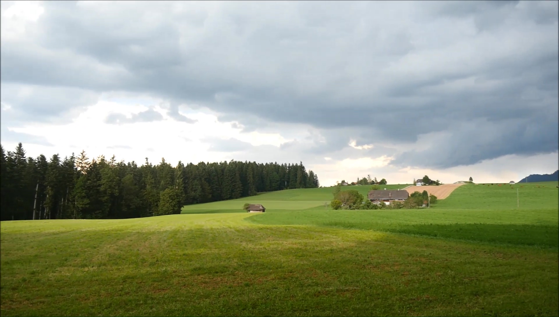
the machine after 17 days. From the Schallenberg Pass, let yourself
be carried to our bivouac on the heights of Thun. The end of the
day is peaceful despite the lightning that is never far away.
We will finish our pasta "3 minutes" in the shelter
in the tent, the wind rises and the rain gets closer. Patience.
|
|
|
|
|
|
|
|
|
To see the gloomy weather, we hesitate to leave
as soon as possible or hang out in the tent. But the space is
so small that I have to fold in 4, which does not help to relax
my back. We leave to better stop a few minutes further ... in
a local trash. The place is ideal because spacious and equipped
with electrical outlets to charge the phone. Block batteries!
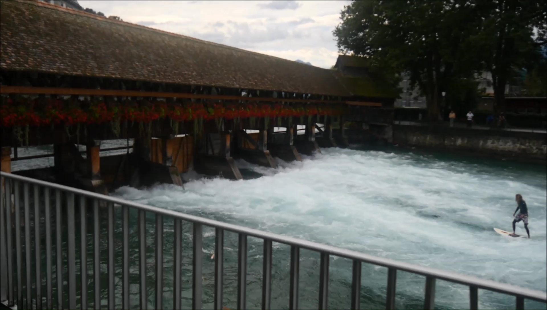
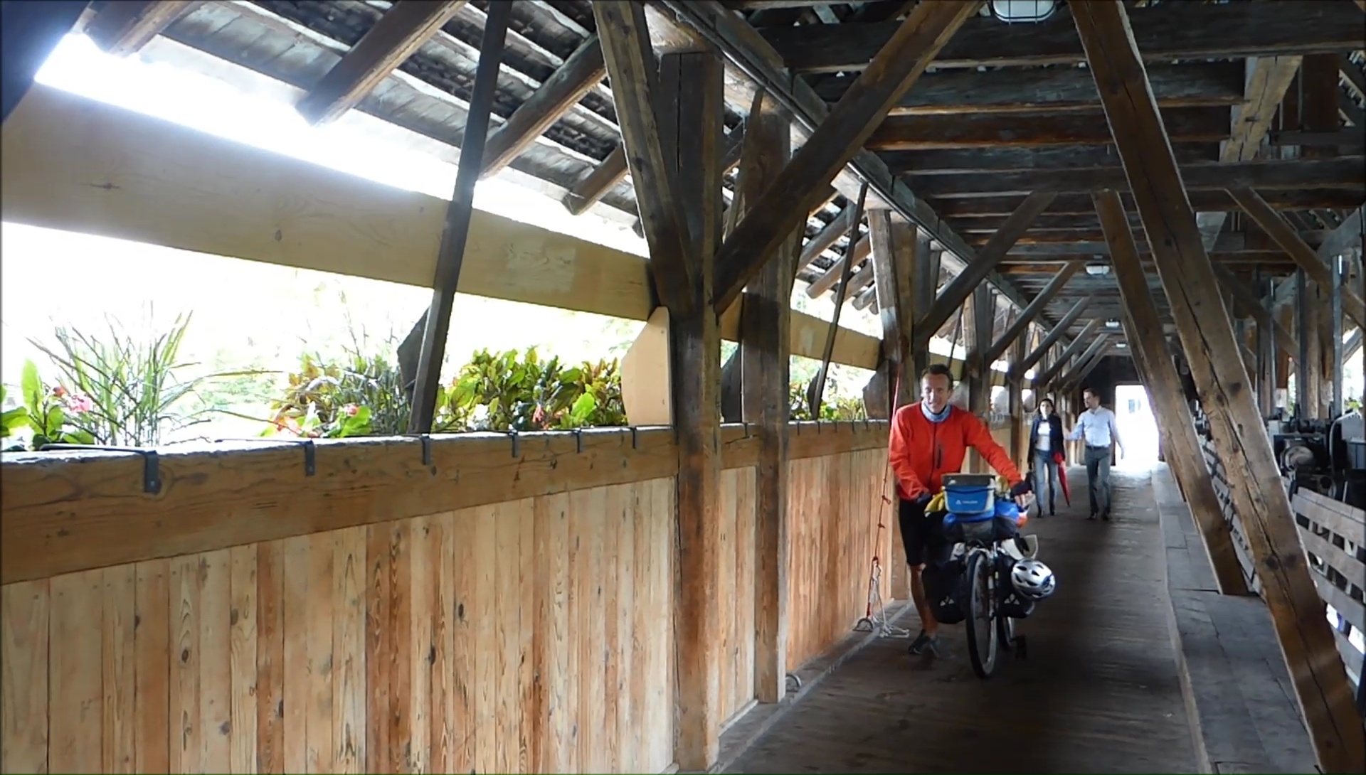
In Thun, we take the time to visit because the legs are heavy,
difficult to find the setting while the ground is generally flat.
There are days like this but the day is far from over!
Barely stopped for lunch at noon that mosquitoes
attack ... surely awake by the smell of the charcutter! We opt
for the mountain bike path and find the Gurnigel pass at more
than 1600m. After a few painful minutes, we find our legs gradually,
first in the forest and then in the pastures. The cans are filled
at the altitude restaurant. Extra! Blueberries punctuate the evening,
hard to get back in the saddle! We land next to a mini home cross-country
skiing: WC, table and bench with a hard roof in case of storm.
We wait patiently for the storm in the shelter ...
|
|
|
|
|
|
The storms slammed and shot all night
within 3 km ... what luck, we missed! The daylight is beautiful,
the contrasts of nature and sky are incredible. Photo stops! We
descend on a perfect track without hole or bump until Sangernboden
to continue on a deserted road. I eat frenzy (and with Val too)
raspberries like a drug addict missing! The weather is spoiling
fast and we escape the storm comfortably seated near the stove
of the Salzmatt refuge. At noon, we let go: beer and menu of the
day. We leave the Swiss Francs! It hurts...
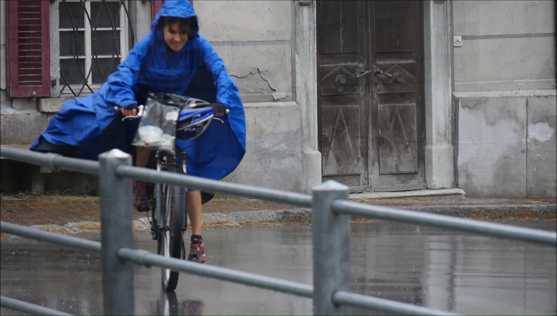
The mist is thick but the rain stops
going down to the lake Noir ... what a pleasure to find names
in French! A huge climb awaits us before the pass of Baliza: portions
to 20% sting our legs ... we push at arm's length the bike. We
stop every 10 meters, the breath is cut, the shoes skid, the sweat
bead drops. Very difficult ! We find the joys of bitumen and automotive
madness around Broc. The wind pushes us to our bivouac location
5 stars: breathtaking views of the castle Gruyères. This
luxury is priceless.
|
|
|
|
|
|

|
|
|
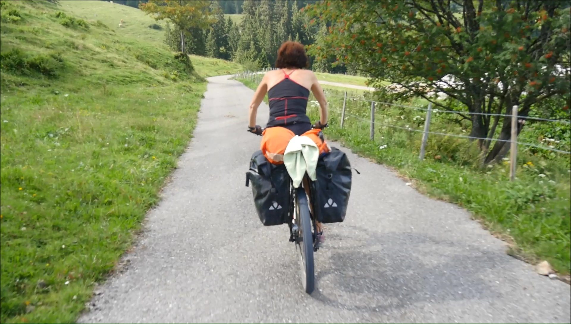
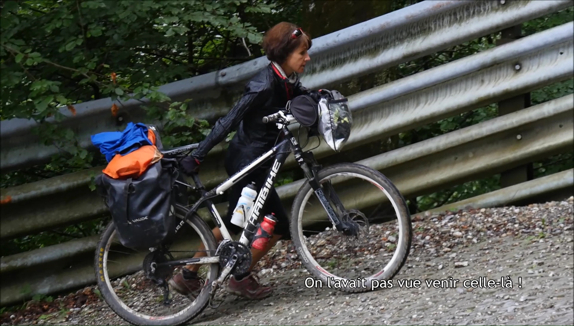
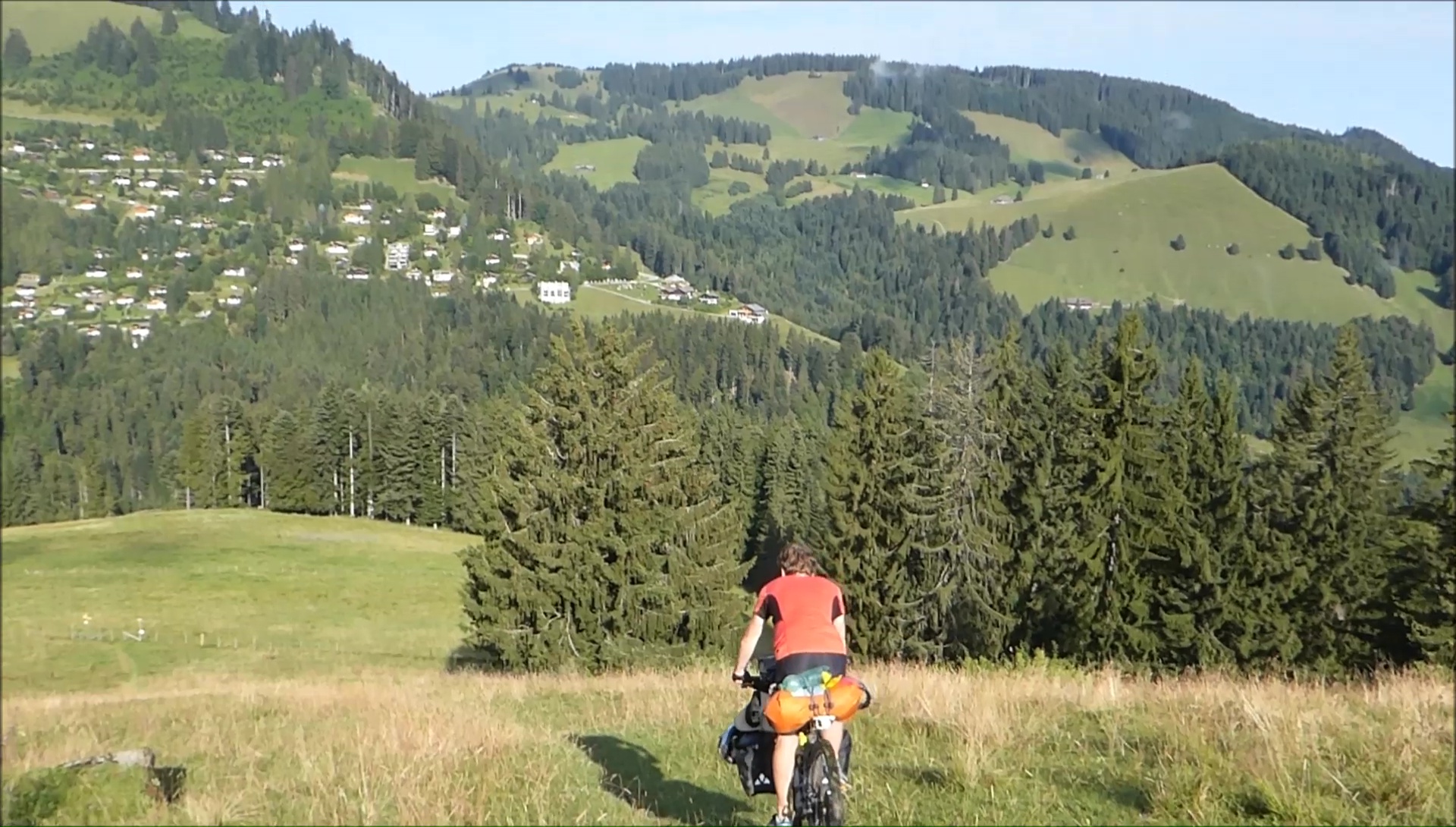
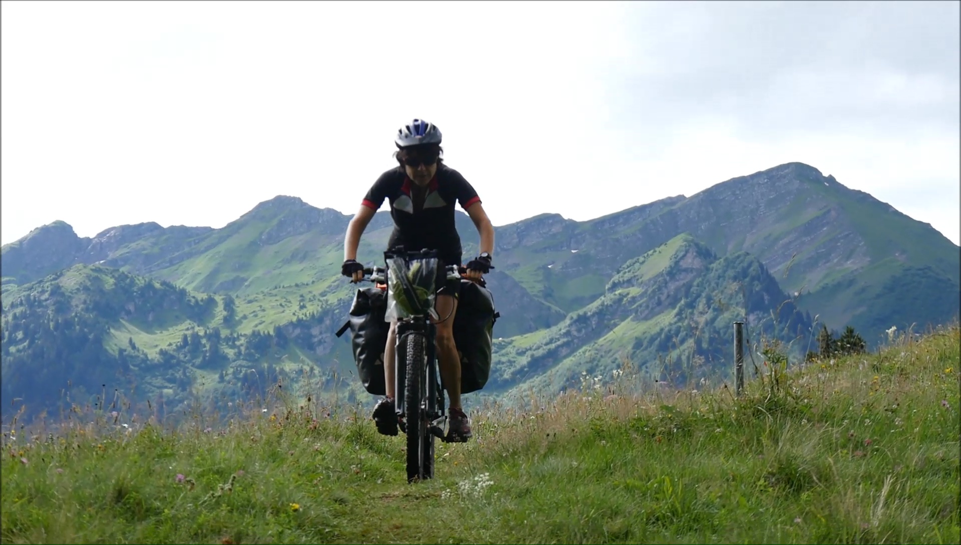
The road never takes too long to meander on the
heights, and the freshness of the morning is quickly compensated
by intense efforts. To go to Moléson, we go on a steep
path then a pretty road leading to the ridges (to go down) while
the main road is ... direct. Our way forward may seem strange
but it brings great joy. The difficult moments make it possible
to pass a pass and to discover new horizons. After Moléson,
I'm having fun riding mountain bikes, the guys push hard, I'm
screwed on my saddle. Cool !
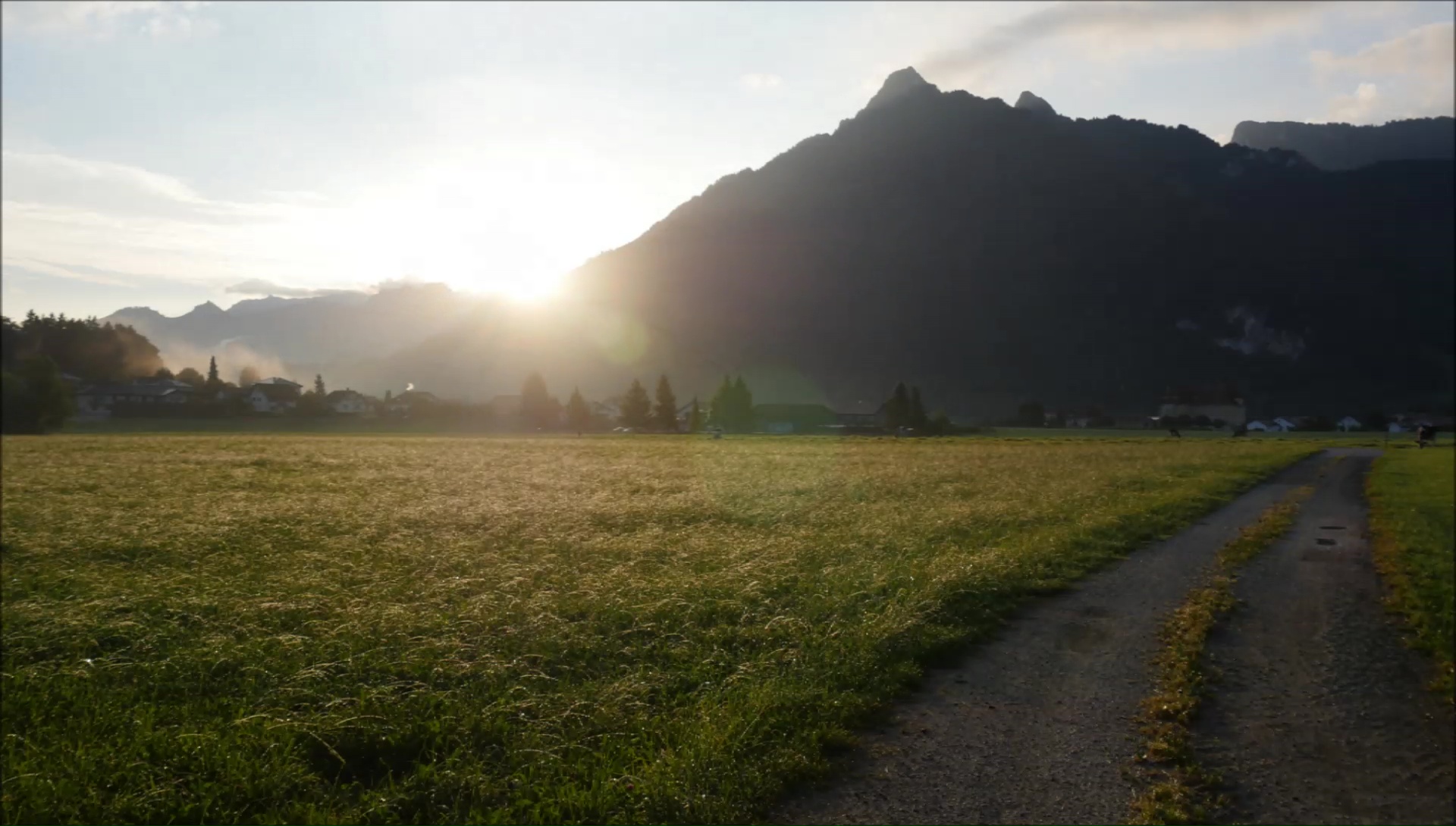
The terrain becomes more rolling and pleasant towards
Gros Plané. Everything is together for this last stage
to be memorable: the sun is out and the panorama is divine. At
random from a sheepfold, we leave with more than a kilo of cheese,
hard not to resist! A true delight. The last difficulty is before
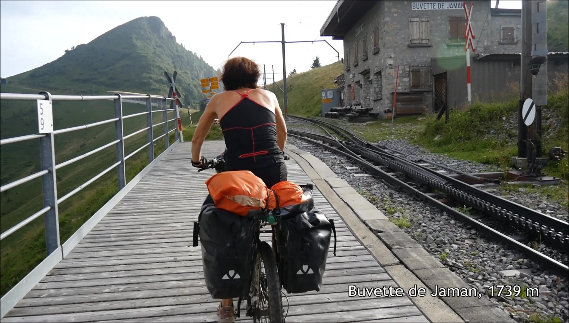
our eyes with the Col du Soladier 1576 m. The last meters are
stifling, we grow in pain. More than 250 md + after the neck of
Jaman, the tent is placed above the train station, breathtaking
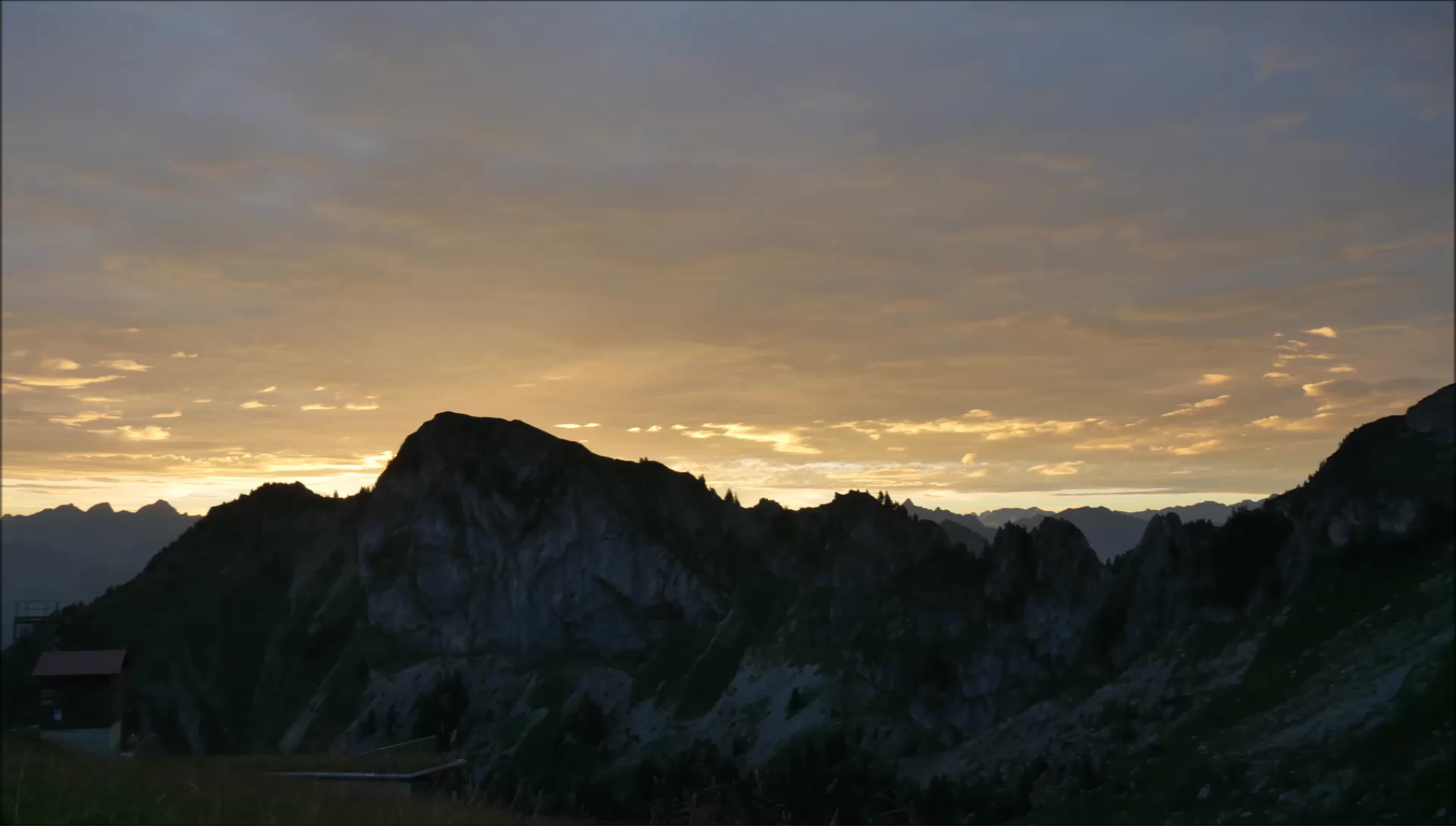
views of the rocks of Naye and Lake Geneva. Top !
|
|
|
|
|
|
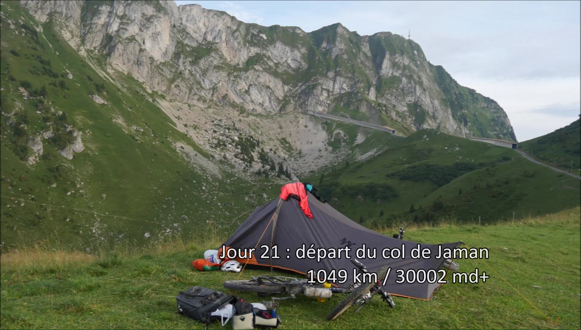
6:15. It was not long to admire the
only ray of sunshine of the day. Gray clouds gather to form an
impenetrable ceiling. Black, it's black, there's no hope, we'll
take the head, especially since we see the rain fall in Lausanne.
The pancho is at hand. We return to Jamin pass by a path and we
start a crazy descent of 1400 md- in 1:15 to Montreux. I recognize
in the distance the curves of the lake, the Dents du Midi, the
Rhone valley, the mountain of Aï that we have bypassed at
the beginning of this 21-day adventure. What efforts to be here!
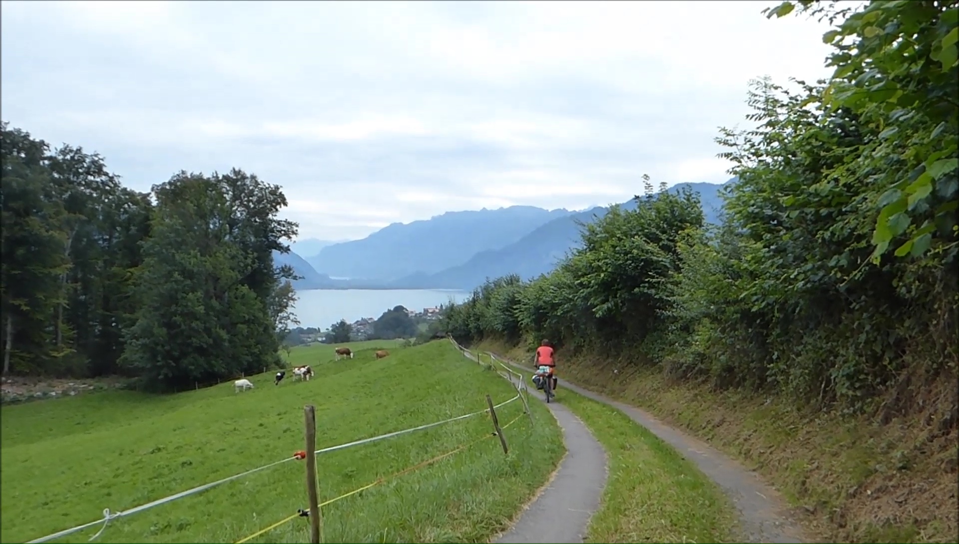
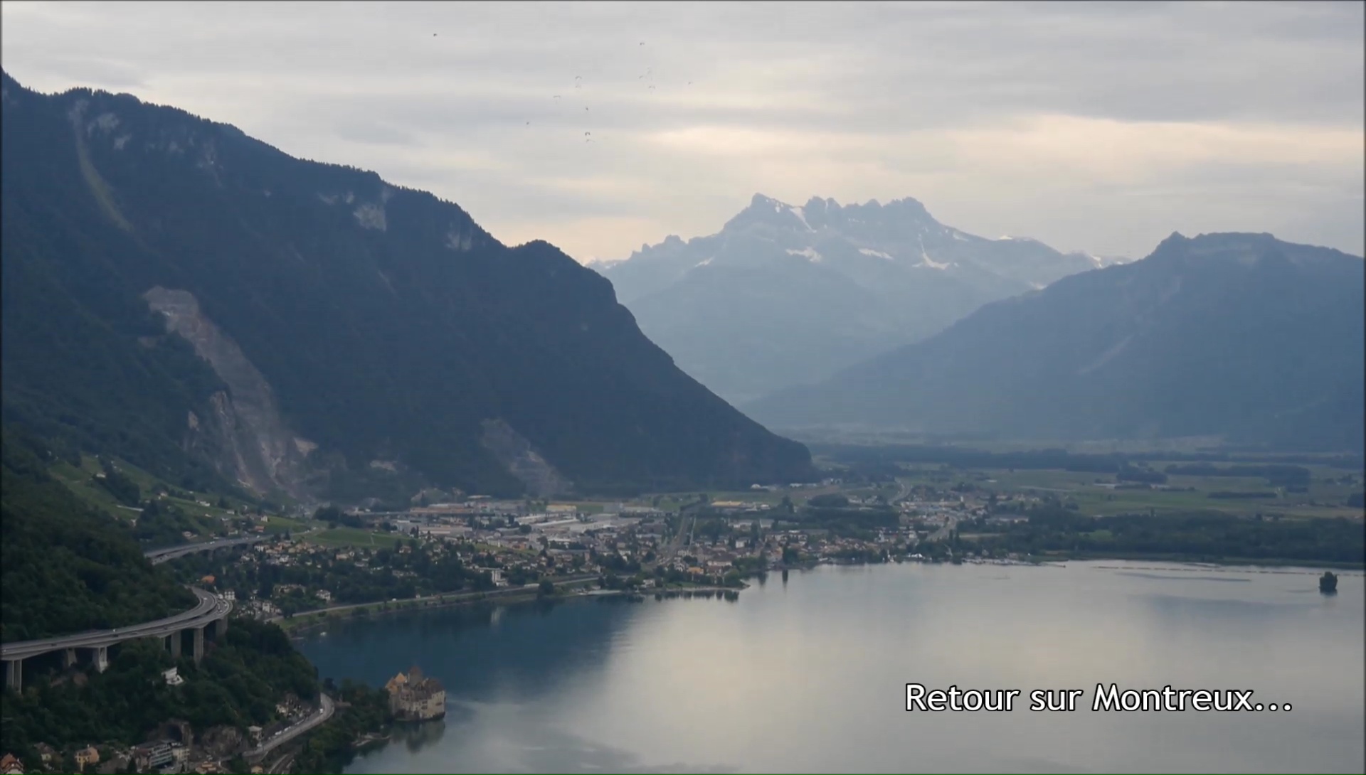
In Montreux, we take the bike path
by the lake ... in memory of our first crossing of the Alps! Nothing
to change, everything is so calm and beautiful. We spend our last
Francs at Coop de Villeneuve in beer and cheese ... to keep a
holiday taste at home! In the swamps Grangettes, the rain is loose:
the panchos are put and I try the plastic bags on the shoes ...
The illusion lasts a few minutes, we take buckets of water to
Evian along the RN . We are rinsed and the bikes are clean. What
a memorable return ...
|
|
|
|
|
|

|
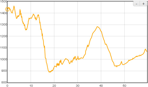
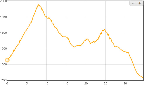
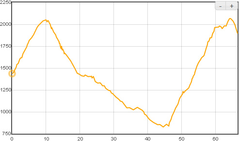
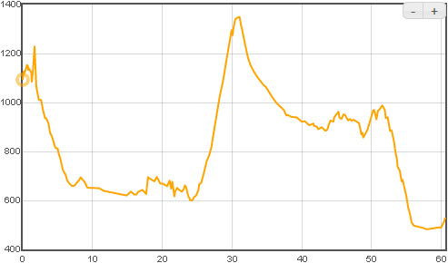
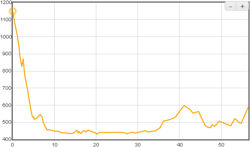
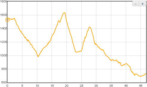
Dénivelé étape par étape
|
Start
00 - Lyon / Evian (1/2 j)
01 - Yvorne / Aigle (1/2 j)
02 - Col des Mosses (1/2 j)
03 - Lenk im Simmental
04 - Frutigen
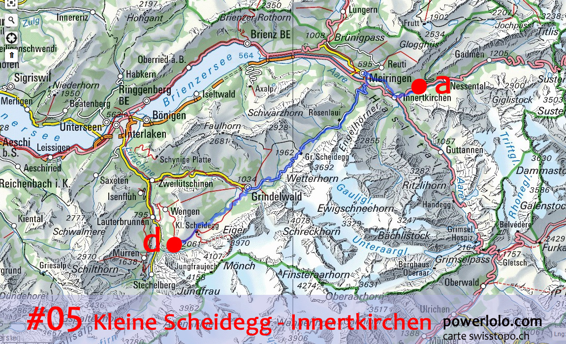
05 - Kleine Scheidegg
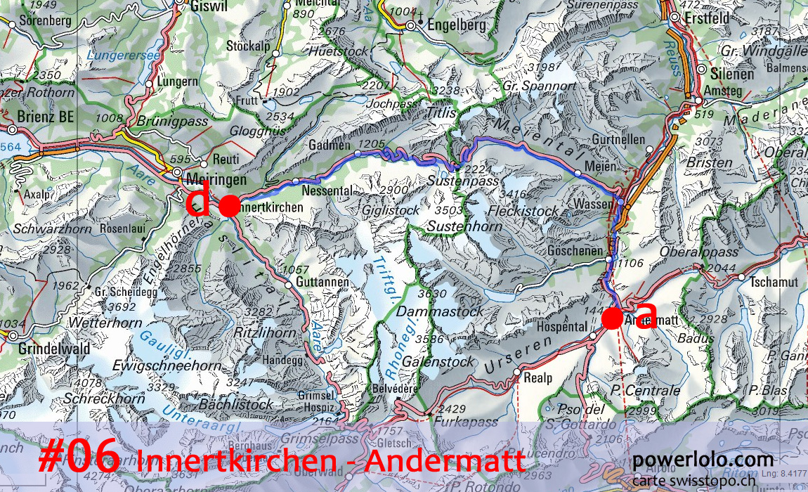
06 - Innertkirchen
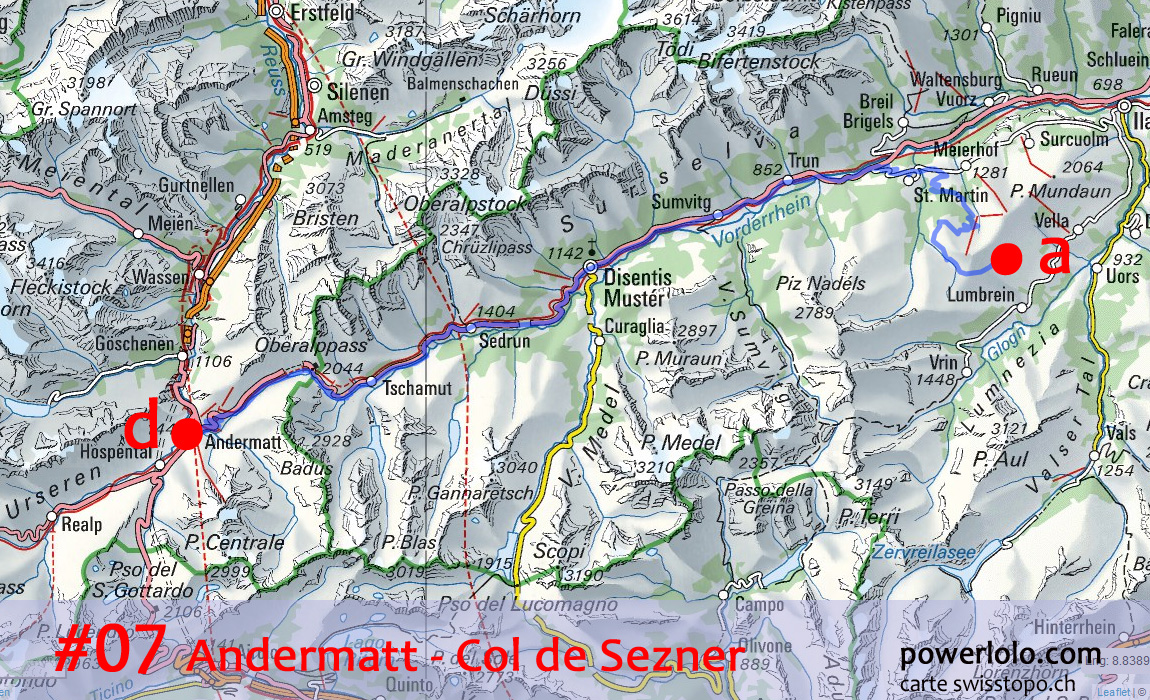
07 - Andermatt
08 - Col de Sezner
09 - Col de Tomül
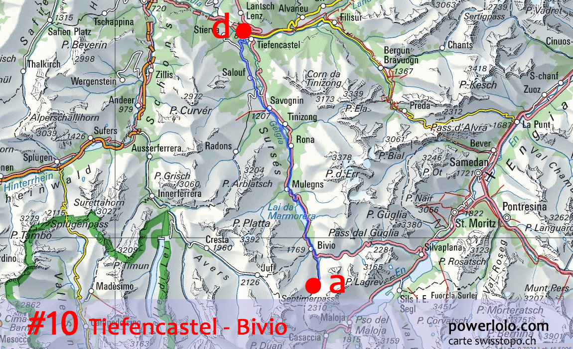
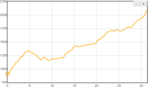
10 - Tiefencastel
11 - Bivio
12 - Bever
13 - Muldain
14 - Mels
15 - Ref. Mettmen
16 - Schwitz
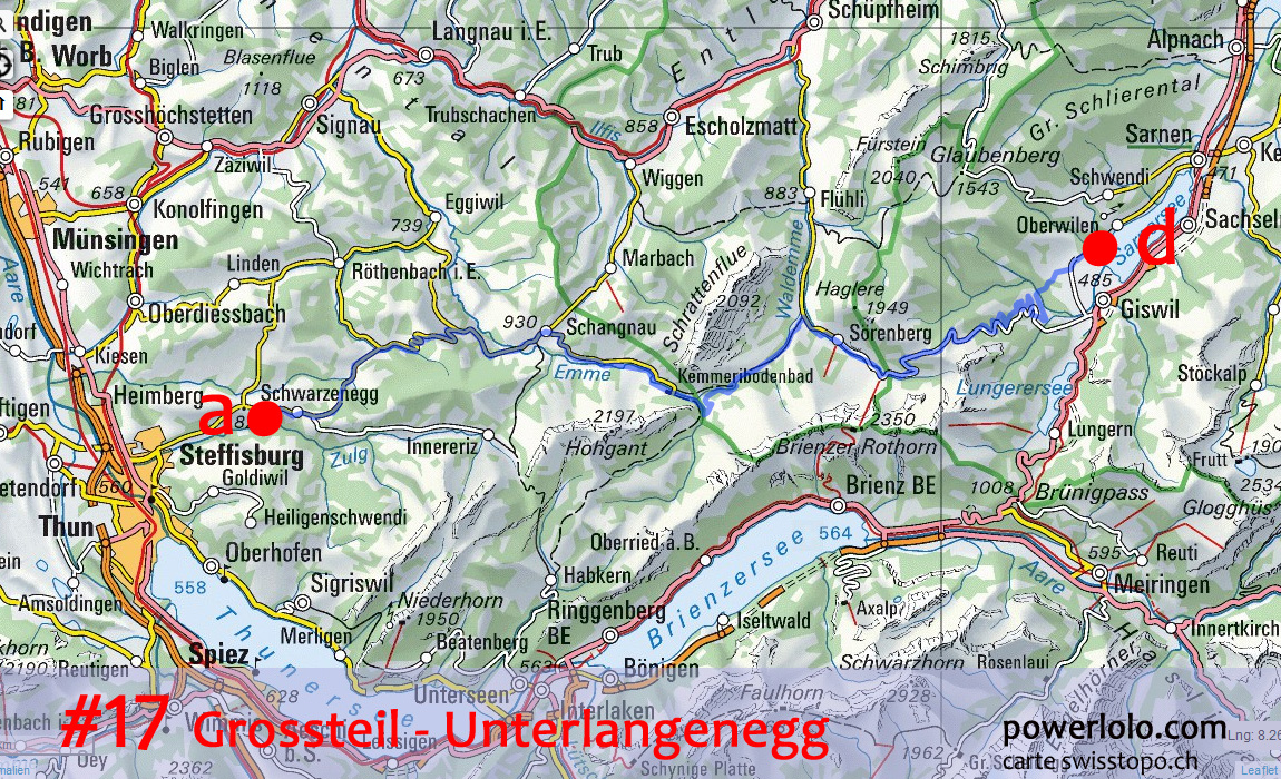
17 - Grossteil
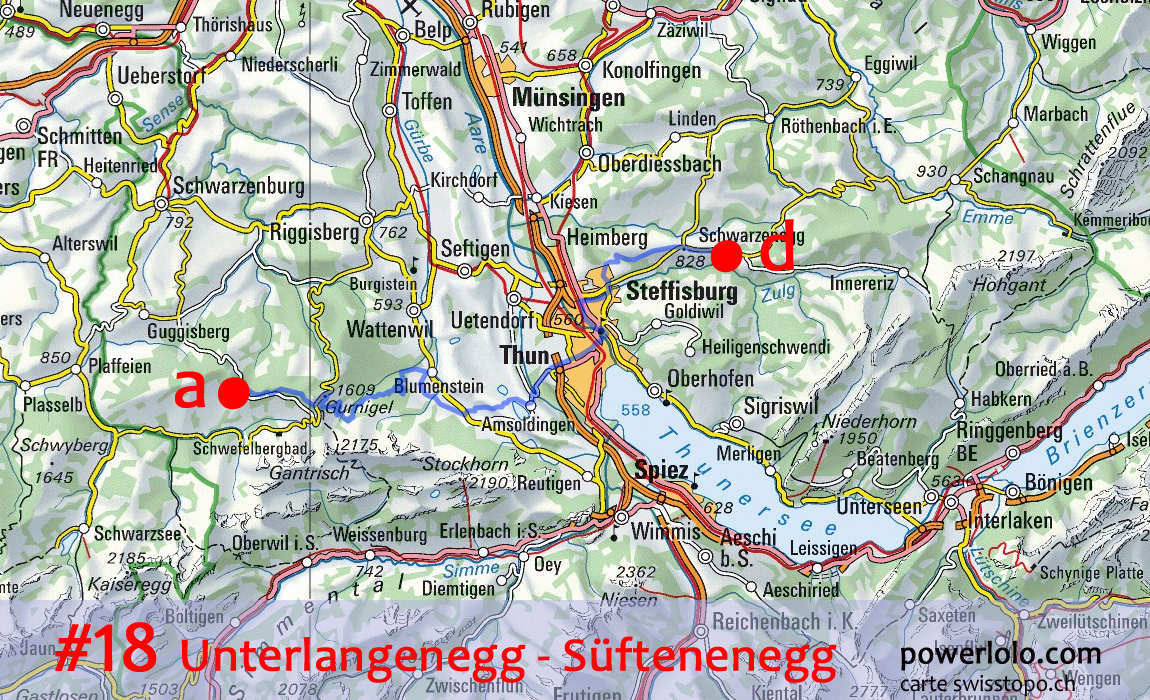
18 - Unterlangenegg
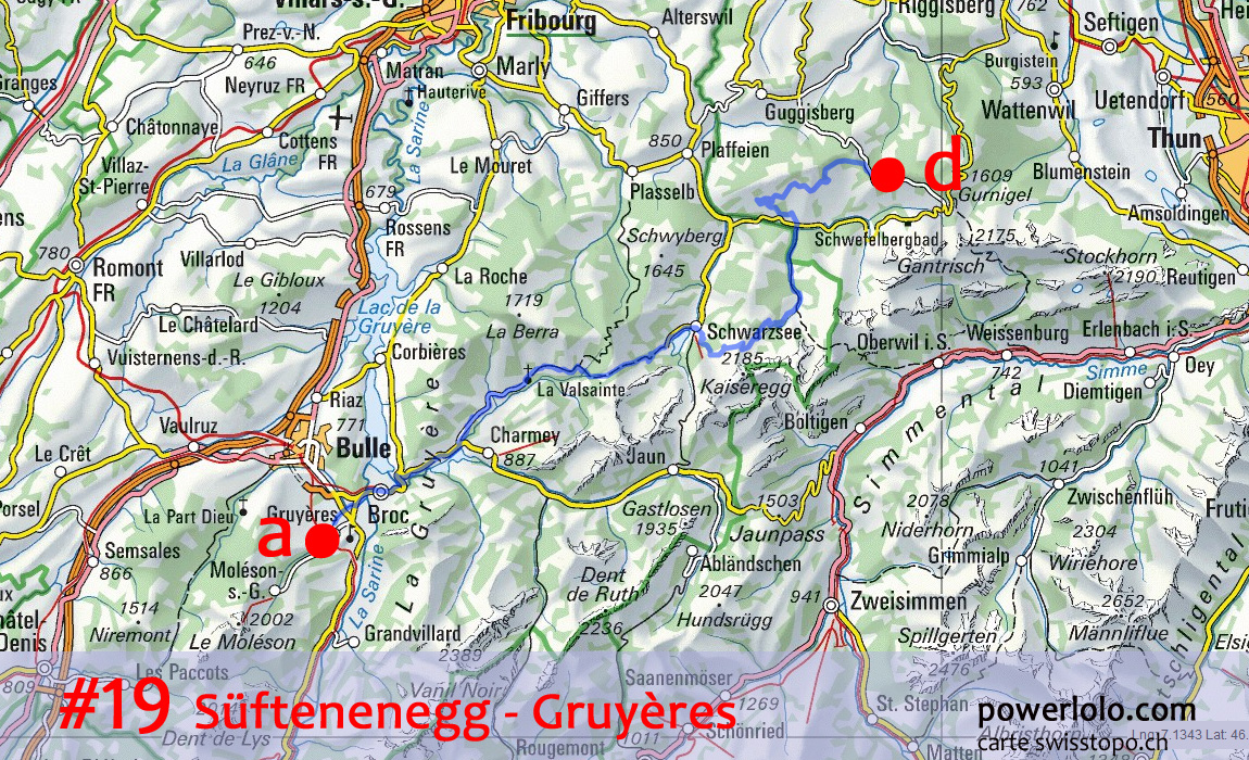
19 - Süftenenegg
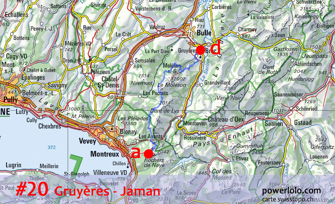
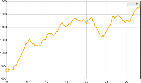
20 - Gruyères
21 - Buvette Jaman (1/2 j)
-
|
Arrival
Yvorne / Aigle
Col des Mosses
Lenk im Simmental
Frutigen
Kleine Scheidegg
Innertkirchen
Andermatt
Col de Sezner
Col de Tomül
Tiefencastel
Bivio
Bever
Muldain
Mels
Ref. Mettmen
Schwitz
Grossteil
Unterlangenegg
Süftenenegg
Gruyères
Buvette Jaman
Montreux / Evian
-
|
km
37
33
63
37
56
54
55
70
42
62
34
44
54
64
50
45
60
62
44
49
36
58
1107
|
md+
212
1723
1164
1289
1779
1717
2227
1952
1835
1651
1449
938
1062
1505
1724
1369
484
1730
1232
1162
1798
249
30251
|
md-
217
735
1510
1558
749
2734
1622
1517
1367
3053
320
1308
1637
2040
1077
1421
1014
1398
599
1927
866
1505
30174
|
Alt. max
400
1703
1461
1950
1871
2061
2224
2072
2419
2384
2099
2310
2314
1349
1208
1424
1149
1620
1627
1635
1722
1744
-
|
Alt.
min
374
400
889
786
562
598
848
827
932
644
911
1520
861
482
421
634
431
495
560
693
733
373
-
|
Alt. moy.
385
1200
1132
1444
952
1318
1378
1531
1446
1397
1420
1824
1500
853
678
1040
545
1028
960
1180
1335
743
1141
|
Main stops: Evian, Aigle, Gstaad, Lenk, Adelboden, Interlaken,
Lauterbrunnen, Grindelwald, Meringen, Wassen, Andermatt, Dissentis,
Vals, Safen, Thusis, Albula, Savognin, Bivio, Sils, Saint-Moritz, Tamins,
Weesen, Einsiedeln, Ibach, Sarnen, Thoune, Bulle, Montreux, Evian
|
|
GPX / KML : GPS garmin tracks
|
00 - Lyon / Evian
01 - Yvorne / Aigle
02 - Col des Mosses
03 - Lenk im Simmental
04 - Frutigen
05 - Kleine Scheidegg
06 - Innertkirchen
07 - Andermatt
08 - Col de Sezner
09 - Col de Tomül
10 - Tiefencastel
11 - Bivio
12 - Bever
13 - Muldain
14 - Mels
15 - Ref. Mettmen
16 - Schwitz
17 - Grossteil
18 - Unterlangenegg
19 - Süftenenegg
20 - Gruyères
21 - Buvette Jaman
|
Yvorne / Aigle
Col des Mosses
Lenk im Simmental
Frutigen
Kleine Scheidegg
Innertkirchen
Andermatt
Col de Sezner
Col de Tomül
Tiefencastel
Bivio
Bever
Muldain
Mels
Ref. Mettmen
Schwitz
Grossteil
Unterlangenegg
Süftenenegg
Gruyères
Buvette Jaman
Montreux / Evian
|
Suisse 01 Yvorne - Les Mosses.gpx
Suisse 02 Les Mosses - Lenk.gpx
Suisse 03 Lenk - Frutigen.gpx
Suisse 04 Frutigen - Kleine Scheidegg.gpx
Suisse 05 Kleine Scheidegg - Innertkirschen.gpx
Suisse 06 Innertkirchen - Andermatt.gpx
Suisse 07 Andermatt - Alp Sezner.gpx
Suisse 08 Alp Sezner -Tomül.gpx
Suisse 09 Tomül - Tiefencastel.gpx
Suisse 10 Tiefencastel - Bivio.gpx
Suisse 11 Bivio - Bever.gpx
Suisse 12 Bever - Muldain.gpx
Suisse 13 Muldain - Mels.gpx
Suisse 14 Mels - Ref. Mettmen.gpx
Suisse 15 Ref. Mettmen - Schwyz.gpx
Suisse 16 Schwyz - Grossteil.gpx
Suisse 17 Grossteil - Unterlangenegg.gpx
Suisse 18 Unterlangenegg - Süftenenegg.gpx
Suisse 19 Süftenenegg - Gruyères.gpx
Suisse 20 Gruyères - Jaman.gpx
Suisse 21 Jaman - Evian.gpx
|
|
|
|
|
Pictures of Alps crossing
by MTB
Transalps & Integralps
Maps & daily
routes
|
|
# part 1:
transalps
geneva - nice
# part
2 : swiss paradise
geneva - davos
# part 3: let's
go to the dolomites
davos - cortina d'ampezzo
# part 4: julian
alps & balkans
venice - cortina - ljubljana - istanbul
|
|