Snowshoeing and pulka sledding on the Vercors High Plateaus (nature reserve)
January 29: A white paradise
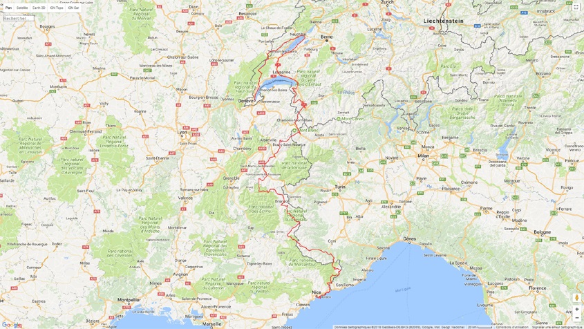
The desire to roam in the mountains was born in the Carpathians, in Romania: it was a real revelation after having traveled the Danube to its delta. The contrast between these two types of travel was striking: enough of the long monotonous straight lines, the flat and infinite horizons... Make way for the reliefs, the bends, the raw adventure. What love at first sight: climbing passes, moving on roads that cannot be found on maps, experiencing inexplicable situations and meeting incredible people in the middle of nowhere! This stay in the Carpathians changed my way of experiencing roaming even more. "Transalpes" is the first episode of a saga that will lead us (with Valérie) to cross the entire Alpine arc by mountain bike: Nice, Genève, Saint-Moritz, Davos, Cortina d'Ampezzo, Ljubljana... Corfu... Istanbul). Leaving the asphalt for the path: it's truly a different world! The adventure of this quadrilogy (even stronger than Star Wars) begins between Geneva and Nice. In 2015, the film Rolling in the Alps was released, a 26-minute documentary recounting this journey: a huge success since the film was shown in more than 30 festivals and won two awards (incredible for a film put together with 2 pieces of string)! Here is the travel diary.
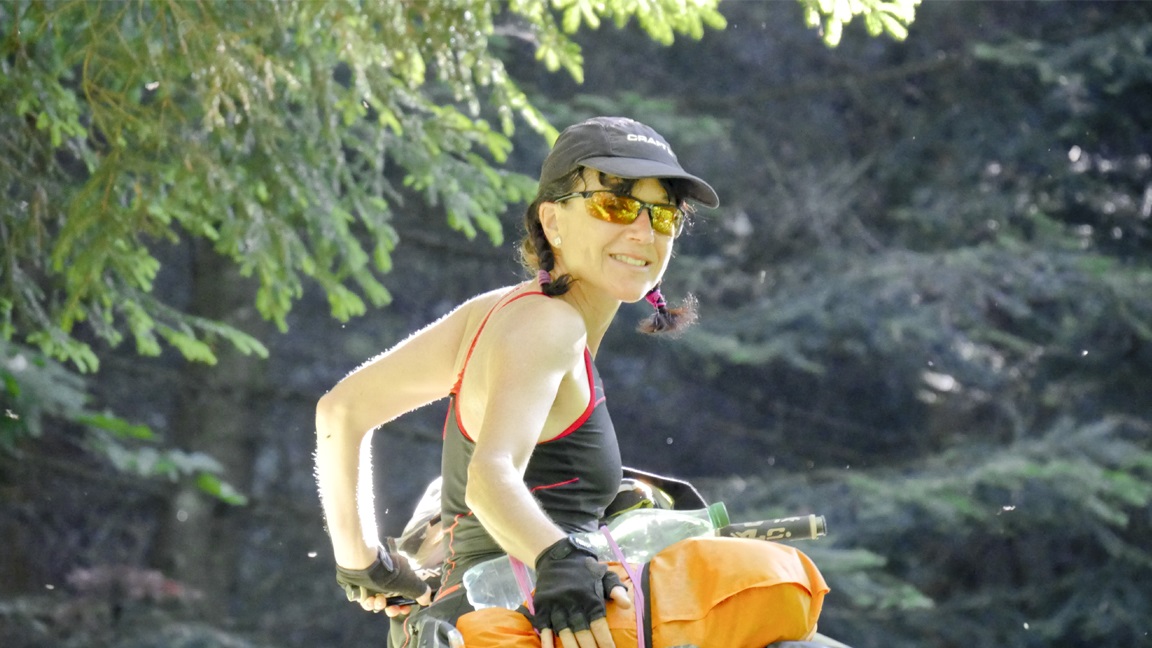
On this day of July, everything is ok. We are ready with a big smile! we are clean, well shaved, dry despite of the morning rain, we feel good, we had a good night in a very comfortable bed, the bags are filled with good things to eat... but for how long? Meeting is scheduled at the train station of Lyon Part-Dieu at 10am. All stories have a beginning, excitement is palpable, envy of the project has grown for months, legs are sharpened, the route is in the head ... That the show must go on !!
After a rainy morning and a train journey, it's an grey arrival in Geneva, the first laps are held back by a downpour, forcing us to take refuge in public toilets on the banks of Lake Geneva. Cool. The road becomes more enjoyable, especially after Nyon ... when it goes up. Less people, beautiful scenery, greener, with beautiful views of the lake and the forests of the Jura. It arises in an area of bungalows, nobody ... tonight is the final of the World Cup: we will know the result three weeks later! Gut!


The morning is wet, but we are dry. We start with a 8 km straight-line
acrossing the plateau of Amburnex and green landscapes (with all that
rain, there is no surprises). The road is wet, then we are wet in Vallorbe,
we take a real shower! After a bit in France, we cross the border on a
small path (not even marked on the map) to get to St. Croix. The evening
climbs up a little, then a lot ... and passionately on the grass. I'm
on top of the Creux du Van, I'm the king of the world! Deep breaths.
The place was forbidden cycling and camping? Oops, sorry. Now You See
Him, Now You Do not.
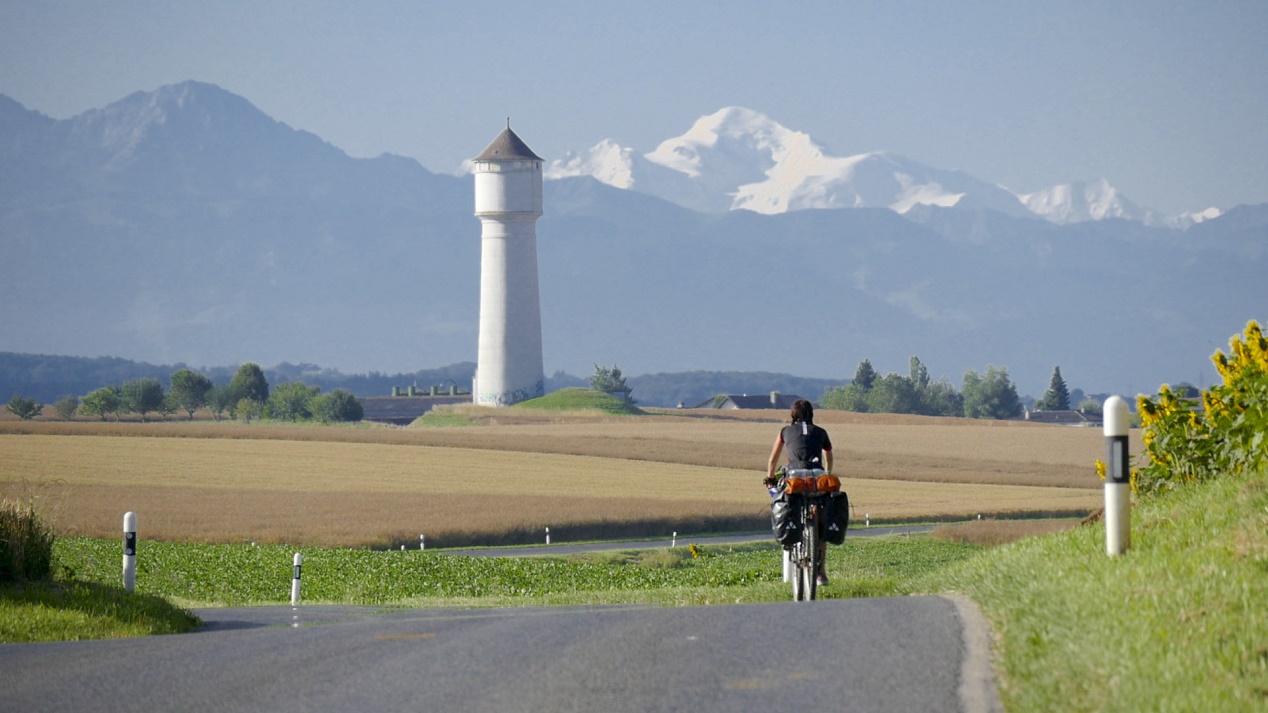
For the first time, we go down (and under the sun!). Lake Neuchâtel is as blue as the Mediterranean sea and Val who dreamed of spending her vacation at the seaside... The next part is a dense jungle to cross in Cudrefin: trunks, vines, prickly shrubs, mud up to the ankles. We put the tent on the heights of Suchy, facing the Mt Blanc. Peaceful evening in the countryside. With the sunset, it's another day in paradis.


6am and what a sight... I don't even have time to put on shorts before I'm outside to photograph the sunrise: the colours are amazing. Four ibex stand a few metres in front of the tent: one of them jumps to claim a piece of land. I happily watch him frantically chewing this lush grass. It's the first sunny day, it's good to ride in a t-shirt from the morning, especially since 1000 metres of negative altitude difference await us to reach Lake Neuchâtel and its turquoise blue waters. Val who dreamed of spending her holidays by the sea... here she is! The morning becomes very urban... The banks of the lake are dense, under construction. Too much concrete, too much noise, too many cars! The rest of the programme is one of those unforgettable moments: we cross a real jungle towards Cudrefin. We are on the other side of the lake, due south, and the path is strewn with pitfalls: tree trunks, vines, prickly shrubs, mud up to our ankles. Turning back is probably preferable, but we continue to wade through 20 cm of mud for several hundred meters to reach a small road. We push the bike with our arms. A memorable epic!
We pitch the tent on the heights of Suchy, facing Mont Blanc. A luxury that is priceless! The evening is peaceful in the sun, in the countryside. As the song says, it's another day in paradise. All these efforts find meaning during these magical and contemplative evenings. You just have to open your eyes to admire this beauty, you just have to listen to hear this nature, you just have to feel the wind. More than ever, tonight, I am alive!


During the trip there are beautiful landscapes, but some are breathtaking. Having Mont Blanc face to face is a luxury, worse... it's priceless. All these efforts find meaning in a second, just by opening my eyes! Just listening the nature, feeling the wind, touching the flowing grass while driving. It is these moments that I enjoy the most... Love it! No particular difficulty for today. A small (big) thought of my last trip to Lausanne, I still love Switzerland, me!
Hard start in Lausanne: I break the fixation brackets of my bags bike (bam, everything is dropped in a second). Miraculously, at 300 meters is an automotive workshop where I spend half a day to refix everything. A big thank you, guys. Then it is a succession of beautiful cities which are crossed by bicycle path, among vineyards and Leman lake. It's crazyness in Montreux, thousand of people. There is a bit of quiet in Villeneuve, facing the Dents du Midi to settle the tent.


The day looks beautiful because everything starts today. Hardly time
to fill the cans, the climb is churning legs. The path turns easily into
the forest with beautiful views over Lake Geneva. Then comes the drama
when we get on a trail: GPS announces less than a kilometer bird's-eye
that will be done in almost 2 hours ... the bike with bags is really heavy,
the path is impractical, too stony, too steep. In brief, we have to push...
forced to catch its breath a few seconds every 5 feets ... we are not
arrived!
After a well-deserved lunch break at Lake Taney, we continue the road
400 meters -evation loss swallowed in 2 km ... it is like 20%, no? Better
to do it on the way down, to join Miex.
The next part is still a beautiful climb on a forest path, then on a more perilous single track. The camp will be settled at the Blancsex pass (no sexual meaning, please!) at 1567 meters. We spend a nice evening, rocked to the sound of cows, and mosquitoes attacking at 9 pm. Anyway, the are tired, we go to the "bed"...


We wanted to leave early... we took off around 10 am from the Blancsex
refuge after a long breakfast: 2 coffees and the last part of our carrot
cake (sooo good!). Stops "strawberries" punctuate the morning
to the pass of Bellevue... aptly named. In Morgins, the Mecca of downhill
mountain biking, there is a little off with our bike bags, it's like being
from the same "2 wheels" family, but we can not understand!
The wind cools the machine because it is (very) hot. Even the brakes are
smoking!
We continue in the Morgins valley with the peaks of Avoriaz in the crosshairs,
and then straigh South... in front of us stand the Dents du Midi, a sublime
paradise for hiking. The afternoon is very nice, relatively less stock,
2 or 3 hard climbs (short but mighty), and finally 30 minutes of non-stop
descent to Champéry, pure happiness. Arriving time: 7.15 pm.
Tonight we sleep under a bridge ... what a contrast with this chic village, where we find that wooden chalets and 4x4 Mercedes. Viva cycle touring.


Today is an early morning departure: we must move quickly forward, because we were told that storms arriving on us within 2 days. Time to liquidate our Swiss currency to buy a piece of bread and cheese (God, that life is so expensive for French guys), here we are trudging to climb around the Dents du Midi. Nobody on the road, big elevation gain difference (again!), pretty lights in the morning, beautiful view of the Rhone Valley, it heats in the sun.
It takes beautiful lanes to Martigny, back to 400 meters above the sea.
To exit the Rhone valley, several routes are available to us: the road
seems the most "simple" to go up the 1000 meters gain elevation
to Tretien. A big thank to the Swiss apples that bring us some strength
for the afternoon, and I do not forget the wild strawberries and raspberries
flashing red on the edge of the road. Dug into the rock, the forest path
to Finhaut is wonderful, quiet and wild. It goes down to Châtelard
to cross the border to sleep in a shed ... reserved to donkeys! It is
9pm.


At 8am, weather is ok. Just the time to pack our stuff in the bags, it's raining. We hesitate before leaving, the sky shows signs of hope, so let's go. The panchos are out a few minutes after departure. We look smart in bright red and canary yellow panchos... well it's mostly my flip flops that gzt me really cool: I have the greatest look at the col des Montets Pass.
We can not say that the landscapes are fantastic, Mont Blanc and red
Needles (aiguilles rouges ) are in the fog, roads are soggy in Vallorcine
and Argentière.
Chamonix is well-known for the beauty of its natural surroundings, the
Mt Blanc. But if the weather is grey and you can not see the Mt Blanc,
your mind is black! Fortunately trailers in shorts with their frog legs
give color to the city! We take the tunnel (by bus if need to be specified)
to reach Italy and Courmayeur, there is no more beautiful weather on the
other side! Oh my God, are we really in August? We ride around in the
city center, not much to do excepted to have a hot coffee.


At dawn, we sneak out of our makeshift shelter, not really wanting to be evicted by a moody local! The night was still pretty good, even if it was hard to close our eyes at the same time. The weather is still uncertain, the grey sky gives us the start in the Val Veni, the threatening clouds are never far away and the wind fuels the uncertainties of this first day. The north wind is cold this morning, and when the rain starts to fall, it hits our calves like lead balls! We find refuge in a chapel at the side of the road, not enough money to light a candle, but I say a little prayer just in case to ask for a moment of respite. As the day goes on, the clouds rise in altitude and remain stuck on the mountain peaks; in the afternoon the sun makes clear appearances. We still can't see Mont Blanc but the blue hues of the glaciers in decline (bye-bye Lex blanche, Miage, Brenva and all the others) give contrast to this alpine landscape. The road goes deeper and deeper into this splendid valley and turns into a path. In these conditions, the climb is pleasant.
The arrival at the Elisabetta Soldini refuge (managed by the CAI) is steeper but nothing stops us. The desire to pitch the tent is strong but the icy wind and the ambient humidity push us to go through the door to sleep in the warmth... and have a nice cold beer. First night in a bed after 9 days of travel and 480 kilos, first hot shower too. The manager is always amused to see mountain bikers passing by this path, it's sure that with our panniers, we are... "different"! In the evening, we write our memories on paper (the purists!) while all the hikers tap frantically on their tablets connected to the refuge's wifi. The situation is mind-blowing... especially since they are almost fighting to recharge their devices on the 2 electrical outlets in the main room. Aghhh technology, when you hold us... We pitch the tent on the heights of Suchy, facing Mont Blanc. A luxury that is priceless! The evening is peaceful in the sun, in the countryside. As the song would say, it's another day in paradise. All these efforts find meaning during these magical and contemplative evenings. You just have to open your eyes to admire this beauty, you just have to listen to hear this nature, you just have to feel the wind. More than ever, tonight, I am alive!


We are the last (or almost) to get up. The large room is deserted, the
hikers have braved the bad conditions early. An Englishman we met the
day before returns to the refuge completely exhausted after a night in
his tent, the poor guy looks completely defeated. We decide to leave in
intermittent rain, the clouds gather at the bottom of the valley... precisely,
it is our destination: the Col de la Seigne at 2,516 meters. The first
part is quite rolling, but the ground is super greasy, the effort is violent
because the wheel slips. It is difficult to move forward, but about twenty
overexcited Chinese encourage us, let out loud cries of hysteria when
they see us in the saddle: photos are flying. The scene is funny: it is
5 degrees, they are wrapped up in big mountain jackets while we climb
at full speed in t-shirts! We cross the pass in thick fog, the weather
is not better in France: we take out our ponchos again.
The descent towards the Mottets refuge and the town of Glaciers is obviously
muddy and slippery... Controlling the mountain bike with the panniers
on the front is random, difficult to avoid slipping (fall without seriousness).
Mud bath and wet buttocks... better than a spa treatment! The panorama
is limited to a few hundred meters of visibility, needless to say that
we can't see anything. It is difficult to find a place to take shelter,
the extra fresh goat cheese from the Chapieux sheepfold comforts us during
a short lunch break.
The ascent to the Cormet de Roselend (1,968 meters) is done in terrible conditions: less than 25 meters of visibility, we are frozen at the summit. The route changes itself depending on the hazards: we do not hesitate for a second to reach a refuge less than 2 kilometers away. The descent is by road, buttocks clenched for fear of being hit by a car, hands locked on the brakes and the headlamp behind on the head! A faint red halo stands out in this black and white landscape, but seems quite ridiculous to be spotted from afar. The welcome at the refuge is not worth the one received the day before in Italy, I sometimes have the impression of disturbing! Fortunately we find a little warmth by having a large glass of tea and we spend the afternoon playing games and reading with other unfortunate teammates.


The second consecutive night in a bed is regenerating, be careful not to get a taste for it! But the cost of the paid shower for a refuge located on the edge of a departmental road definitely finishes me off... I stay in my own juice, so as not to get used to too much luxury! On the other hand, the very good news of the day is that the weather is magnificent, not a cloud! We buy a piece of bread in a restaurant near Lake Roselend before reaching the Col des Prés at 1,700 meters, our legs are struggling a little this morning. Mont Blanc stands before us, majestic, just like the Pierra Menta, due South. The waters of the lake are turquoise, we contemplate for a few moments all these beauties that we could not distinguish the day before. We continue the adventure by the botanical path which takes us to Lake Saint-Guérin, then to the Cormet d'Arêches. The rest is more technical with the passage of 3 passes at more than 2300 meters of altitude (Col de la grande Combe, Col des Génisses and Col des Tufs blancs). You have to resolve to push the bike on certain sections because the terrain is not suitable for mountain biking with a pannier... or mountain biking without a pannier for that matter! Tough, tough, but many passages are easy, we go from ridge to ridge almost flying over these green spaces, almost infinite. The path winds far into the mountain pastures and shows us the right direction. The ground has absorbed the heavy rains: the terrain is surprisingly dry and rolling until the Nant du Beurre refuge.
We find the Tarentaise valley after an exceptional descent: almost 2000 meters of d- without pedaling (or almost), the absolute dream! It goes down quickly, too quickly. In a few minutes, we lose the calm of the mountains to find the hustle and bustle of the city: a concert of horns, noisy traffic jams, jostling to do our shopping in Aigueblanche! Urban savagery in its purest form. We go up the Morel canal to pitch the tent in a picnic area, the rain is back to play tricks but no one will come to smoke us out with their barbecue. We count the drops to fall asleep!


When I wake up, the tent is bathed in a pool of brown water and the mattresses are almost floating! It's hard to motivate myself to leave, especially since a thick drizzle makes the atmosphere gloomy: for more cheerfulness and fantasy, I take out the yellow poncho and flip-flops! The sun comes out on the first climb (that is to say... right away), just to dry the things hanging from the bike. The path initially planned is closed following an avalanche (we don't fight against the elements), but I can't tell if the passage is really blocked... or simply "forbidden"! In doubt, I cobble together an alternative route by looking at the map, we join the Doucy and Celliers paths to change valleys. Here we are on the road to the Col de la Madeleine (1,993 meters), like cyclists in the Tour de France... with added panniers! Lacking grease, my pedal squeaks at every turn, which doesn't stop me from competing with the racing bikes. I hold the wheel for some, quite annoyed by the way. With its 10% slopes and in full sun, we almost regret the freshness of the day before.
At the summit, I take the tent out into the wind, it dries in a few minutes, the time for Val to arrive with a smile. The clouds catch up with us at a crazy speed, they are huge, black, threatening... if we don't hurry, we're going to have problems! Barely time to pose at the summit that we are again speeding towards the Maurienne valley: 20 kilos non-stop with the wind in our hair. Oh yeah! The sensations are great, we are exhilarated by the speed, our batteries recharge, we relax our legs. We turn around: the clouds remain on the Madeleine, it must be the deluge up there. We are faster than lightning, so we take the time to pick some wild plums and venture to the banks of the Arc. Places to set up camp are rare, so we continue to Saint-Jean de Maurienne to park the bikes under the stands of the municipal stadium. The place is not great but partially protects us from the rain. In any case, the night will be short, because we wake up early...


Lying on the stands, the wake-up call is made with a fanfare at 6 o'clock sharp. A municipal employee is winding his lawn on his lawnmower! We wave to him friendly before leaving the premises in a few minutes (the bikes were ready to go). A quick stop at the bakery to stock up on sweets. After 3 km of very smooth single track on the banks of the Arvan, we attack hard on a forest path between 6 and 10% above the Combe des Moulin. Obviously, the track is not very busy, weeds a meter high invade our playground, worthy of a real jungle. In the final straight, a raspberry stop is essential for the explorers that we are. A lady who asks us where we come from, offers us an orange game... Nice. A bench facing the Aiguilles d'Arves forces us to take a lunch break (even if it is 11 o'clock). The bench is a luxury for the traveler... I always remember those cyclists who carried a mini folding chair to rest their backs. I thought the idea was crazy... at the time! Under a blazing sun, the 300 meters of altitude difference to the Col du Mollard are trying but the body gets used to the effort and the legs turn by themselves. We join the road towards Saint-Sorlin d'Arves (on the banks of the Arvan... another nice detour!) with a fixed idea: to find this cooperative that has been praising its cheeses for several kilometers. The enticing advertisements have an effect: we can't resist the winks of these goats or these beautiful dairy cow buttocks! The fate of the fresh cheeses and faisselles is sealed in a few minutes, the time it takes for a heavy downpour to cool the ambient air.
The Transmaurienne begins at Charmieux (1600 m) and traces an almost straight line for 30 km due south: we are stuck between Oisans and Vanoise, paradise! The start of the trail is almost too easy, too beautiful, too perfect! After crossing 2 bridges, the path becomes a huge battlefield: the climbs are very steep, but above all the mud does not allow you to stay more than 15 meters on the bike. Very often, we push. It is impossible to cross a stream without having mud up to our ankles, the rain has dug ruts several centimeters deep where the water stagnates. Impassable! Pleasure is hard to find, despite the beauty of the mountains that surround us. We still find a magical cabin (Malpasset on the IGN maps) to spend the night. Half destroyed, we have to climb a section of wall and step over a forest of nettles, but the interior is cozy: tonight we sleep on straw! A bull joins us for the evening and starts licking the water bottles left on the bikes... it's like a pitbull relieving itself on your shoes, you let it finish!


If you are paying attention, you will have noted the 3.6 kilometers covered during this 14th stage, yes... yes... over a whole day! You are not dreaming. If I tell you that it was the hardest physically and mentally of our trip, huh?! Our average kilometers take a serious hit, especially since it takes us 4 or 5 hours for a cumulative distance on the bike that does not exceed 100 meters! For the remaining 3.5 kilometers, we ride a rickshaw with our feet in the mud, on the climb of course, on the flat of course... and even on the descent. Each meter is a victory at the cost of intense efforts, the 30 kilos of the bike are weighed down by mud that clumps at the wheel arches, forcing us to scrape off large packets of molasses every 10 meters. The bike takes unexpected directions, the shoes slip constantly. One step forward, one step back. For the first time, we are really fed up, wondering what we are doing here, in the middle of nowhere. Cycling? Certainly not! Holidays? No, not anymore. However, when we think about it, we have decided to be here, we have shaped our trip, each pedal stroke is an unparalleled joy. The problem is that in our situation, we do not pedal...
This crazy day continues after the Borsa chalet by a hiking trail that climbs in very tight bends, needless to say that it climbs steeply, almost vertically for 350 md+. Good deed of the day: we guide a Dutch couple (with 2 children and 1 donkey) completely lost... I reassure myself about my map reading skills! The next kilometer is almost flat, but we push without pleasure on a paddling pool! We enjoy our afternoon in the sun, personal grooming and cleaning clothes in the stream. We settle into the chalet des Prés nouveaux, between two beams placed on the ground and a collapsed wall, the building is a ruin... and delivers the final blow to our day!


After a full turn of the clock, we get up at 7:45! The wind that has come from all sides into the "chalet" has dried all the clothes. Needless to say, this morning, we are pumped up and the last 175 meters of altitude difference to reach the Col des Prés nouveaux are swallowed up in a few minutes. The panorama at the summit is exceptional: a valley of several kilometers stretches before our eyes, with green pastures on one side, on the other an immense slab of schist illuminated by the sun (Praouat spine). This same gray rock that seemed so dull yesterday, takes on a luminous and chrome appearance. Amazing. We are in the heart of Oisans and the Grandes Rousse, the Ecrins loom due south! We go down to the Valette river, 400 meters lower for a 3-hour break! On the menu, contemplation of the mountains and swimming (completely naked... the marmots still remember it!). The bike also takes a dip, today the ground is dry! From a distance, the path that takes a southerly direction seems perfect, but once again the dream was too good to be true. After a few pedal strokes, it turns out to be broken up and difficult to ride: the cows and the rain have transformed the ground, millions of holes have frozen with the sun, this is what we call cow land. The bike jumps in all directions, the front wheel often freezes and it is impossible to move forward in a straight line.
We leave this minefield without too much trouble to do our shopping in Besse-en-Oisans (only local products, the bread and cold meats are a real delight). We start the Emparis plateau with a certain impatience by setting up camp at the Nazié pass, where 1500 sheep and their shepherd await us. Beautiful encounter at 1902 meters. The evening is peaceful, the colors of the sunset are sublime once again.


Another beautiful night in the tent, without a drop of rain. In a few pedal strokes, we quickly pass above the sea of ??clouds to arrive on the Emparis plateau at an altitude of over 2000 meters. Before our eyes stretch vast flowery meadows, reminiscent of the green steppes of Asia. The landscape is shaped by millennia of pastoralism: here, the herds are kings, the shepherds and the patous keep watch. The detour to the Noir and Lérié lakes multiplies the magic of the panorama: the Meije and its glaciers are reflected in these pure and crystalline waters. We would like endless breaks at the edge of the GR 54... 7th heaven! Lunch takes place in front of the Ecrins bar, we could almost touch with our hands these peaks which reign above an abyssal void of 1200 meters.
The climb to the Souchet pass, 2,364 meters, is a bit steep, but we stay on the bike. At the top, we meet Benoît, a mountain guide, who educates hikers about their behavior towards patous (shepherd dogs). He will give us a great interview for the film, thank you. The trail is very smooth and ideal for mountain biking on the move, and offers an incredible feeling. The descent to the Chazelet by a single track is more technical than physical, the bike shakes a lot especially with the panniers on the front (a few ruts and big stones). The arrival is in the rain, we are forced to take shelter in a garbage room. In the end, we stay two days... (not in the room) "chez Baptiste", a very nice inn-guesthouse. But with all this rain, will we end up rusting?


After two days of forced rest, we set off at full speed. The air is fresh, the weather is still capricious: ponchos are on hand. To reach Lac du Pontet, we take the path to Valfroide, a hamlet lost at the bottom of a small valley above La Grave, then a really steep path to a pretty viewpoint. No time to be cold. The lake does not really shine in a green setting, the sun makes a quick appearance before being swallowed by gluttonous clouds. The rest is more of an adventure course than a cycle tour, I am quite proud to have opened a new mountain bike route between Lac du Pontet and the Col du Lautaret: very difficult, but very beautiful. The little extra is the crossing of a ravine of crumbly schist over 50 meters, the bikes are carried at arm's length suspended in the void. Memorable!
We get back to the Lautaret botanical trail where a platform on stilts is erected that cuts through the tall grass... we avoid sudden turns of the handlebars or we're sure to go off the road, 50 cm above the ground! At the pass, at 2057 m, it starts to rain, we wait under cover. A passer-by, seeing us huddled under our ponchos, tells us that we make her feel sorry for us. We definitely have a hard time hiding our joy because the trip is fantastic! Val is smiling in all circumstances, hats off! The rain stops for a moment, we get back on our bikes and put the turbo on to do the 8 km of the Galibier. A little disappointed, I was expecting a much more trying pass! On the other hand, at 2642 meters, the conditions are crazy, Val puts down his bike and is literally blown by the wind. We come across two or three slightly crazy cyclists on the border between France and Savoie, we don't really take the time to chat. Three quick photos and then they leave. We descend in the fog and the cold to Plan Lachat before going back up towards the Col des Rochilles. Visibility almost zero in the Cerces massif, too bad.


Every day has its share of surprises: we finished yesterday in a thick fog, we wake up with bright sunshine! During our breakfast, we watch the clouds dissipate in front of the Aiguilles d'Arves, this enormous cottony mass is literally sucked up and vanishes before our eyes. We finish the few remaining meters to pass the Col des Rochilles at 2496 m, everything becomes fabulous. The turquoise waters of the lakes shine with the sun, the path is fabulous. At 9 o'clock, we have another coffee, just to not start the day too quickly. We sunbathe, how classy! The descent to the Drayères refuge is a little more chaotic, the path is rough and strewn with stones. Val also gives us the only puncture of the trip... I suspect she needs an extra break, she is ready for anything!
The Clarée valley lives up to its reputation... sublime! It was one of the places I absolutely wanted to cross during this trip. And to think that the day before we were up there in the fog... Today, we take out the sun cream and the t-shirt. The breaks are endless with an impression of being in another world, everything is peaceful, harmonious, natural, immense. Difficult to describe such a wonder. No effort to make to go down the valley to Briançon. The small stretch of RN is uninteresting but inevitable. A few purchases to fill the panniers, then we set off again on the adventure to pitch the tent near the Cerveyrette torrent.


Warning, very big day (the biggest of the trip with 2125 md+), but we didn't know that the morning itself! To find a grocery store in Cervières, we'll have to go back... Here in front of us is the legendary pass of the Tour de France: the Izoard is in front of us, at the top... way up there! Today, it's crazy horns, everyone is encouraging us. Many cyclists overtake us, some take the time to chat, others bomb without saying a word. The electric bikes climb effortlessly, I get into a dancer's position to relax my legs. At the summit at 2340 m, a mother congratulates me "Well done, you climb well"! For fear of blushing, I put on a little sunscreen. Val is doing quite well, 15 minutes behind the yellow jersey (the canary poncho is at the bottom of the bag). The descent via the Casse du Désert is lunar, lunch is taken on a bench facing this exceptional panorama. The rest is more peaceful by the Roue lake, then gourmet with the faisselles of Château-Queyras.
The day could have ended at this point, around 5 p.m. but fate decided
otherwise with 11 km of climbing and 800 md+ additional on a forest track
to the Bucher. We even find time to interview Oscar, a retired lumberjack
who tells us about his larches. Quite a story.
We arrive at the Clos Henri refuge, where five young hikers welcome us.
Barely the mountain bike is put down, that we have our feet under the
table. We devour with pleasure and camaraderie sausages, chops and green
salad. We are truly hungry, we are more carnivores than ever. The leftovers
do not... stay! Great evening and night inside this small wooden refuge!


Breakfast is plentiful, orange juice, milk, Nutella brioche, compote. How long has it been since we had a feast like this? In any case, it's a change from the honey bread and 3-minute pasta that we've been enjoying for three weeks. This completely improvised moment of sharing is memorable! The morning is zen: once our playmates have left, we start a complete scrub down with cold water from the fountain (it wakes you up) and a cleaning of our clothes (it doesn't hurt)! The refuge is so cute and perfect that we could almost see ourselves staying several days in our new pied-à-terre. Too bad the provisions are limited in our saddlebags... We have trouble getting back on the saddle, especially since intrigued onlookers come to visit us. Welcome, you're at our place, would you like a glass of fresh water?
The descent into the Aigue valley is GE-NI-A-L on a very rolling single track. With astonishment, we easily pass with the panniers in all the tight bends, maybe habit?! At the edge of the path, the flowers shine with a thousand colors. In Molines, we buy 1.5 kg of bread, cheese and charcuterie for the days to come (we will need strength, oops), then we continue through the picturesque village of Saint-Véran, one of the highlands of Europe at more than 2000 m. We end the day a little further in the valley under a shelter. May the Sainte-Elisabeth chapel bless us. The successive showers cut our momentum and give colors to the evening. Great day, even if it was not very violent!


Foggy and chilly awakening with a light drizzle towards the Blanche refuge at 2499 m: €4.50 for 2 cold sock juices, I almost took out my credit card! The manager doesn't know the area, I ask her if it is better to go over the Col du Blanchet/Rocca Blanca (at 2900 m) or the Col de la Noire at (3000 m). She looks at me in amazement: more chance of opting for the best solution by tossing a coin! I stay on my initial route... very hard for 2h30! At the summit at 2897 m, it's freezing, it's blowing and the mist is coming! We stay for two minutes, watch in hand, time to take a photo and repair my luggage rack attachments! We have lunch in Italy on a rock before returning to France, the sun is almost with us when it's not behind the clouds. There are still a few snowfields, forced to push the bike.
One more pass, the Longet at 2650 m and here we are at the source of the Ubaye, a magical place, very flat, very rolling, very beautiful. What serenity! The descent goes well until the drama, a noise resonates in the frame of the mountain bike... ouch... the derailleur dangles in the spokes of the rear wheel. I feel the spokes one by one, luckily none are broken. I repair as best I can by removing chain links, but I don't have a derailleur hanger (apart from the 3 minutes...). And then the screw is so tight that it is impossible to remove it with my tools. Pfff! A scree spice up the end of the day because there is no more path, completely buried: it will take us 1 hour to advance 300 meters, misery! We come across an alpine chalet with a breathtaking view of the valley. To bed with the little mice!


Downhill day to Jausiers, we only do 65 meters of d+. As luck would have it... Without a rear derailleur, it's hard to pedal! I try a DIY job with a worker's electric drill in Maurin, in vain. I have one gear left: "you are the weak link, goodbye"! The path becomes a departmental road, then a national road, with its streams of cars and motorbikes. I struggle to find the right rhythm, too easy I grind like crazy, too hard I push the bike. In Jausiers, I go straight to the only sports shop: 2 days to order the part... 2 days to treat ourselves, in the afternoon it's ice cream, in the evening it's pizza and beer! After 3 weeks on the bike, it's hard to get your feet back on the ground, we're like lost, orphans! We find things to do, we laze around in the sun, we eat, we take hot showers at the campsite, we visit the city centre and the churches... a 2nd "luxury" trip begins?
So, to rest, we decide to do a little hike to the Tête de Cuguret, a summit at over 2900 m which dominates the Jausiers valley which is done as a round trip in a day. A fairly simple hike where you have to put your hands on the summit part... 4a, right? Easy after Mont Aiguille! The change of pace is good for the body and the head, and the legs relax, we really unwind. Once the derailleur hanger is back, we have a hell of a ride, ready to continue our honeymoon at full speed!


The forced stop at Jausiers changes the planned route somewhat: going through the Col de la Stroppia would force us to take too big a detour to the North. I decide to climb the Col de l'Arche, at 1996 m to reach Italy. Viva Italia! The new route is neither flat nor direct, as if we were doing it on purpose. So we go back up the Ubayette via the Roche Lacroix fort, a little culture doesn't hurt. Here, history is shaped by the geography where the French and the Italians defended their border at the top of the mountains. The path narrows over the kilometers before no longer existing, forced to cross the river on foot, 50 cm of cold water up to the knee. It is at these times that you must not let go of the bike, or the panniers... even if the water is frozen!
We continue through the Lauzanier valley, far from the main road. The landscape is incredible, we are at the gates of Mercantour (a first for me). At the Col de l'Arche, a stop is mandatory at Mateo's, an Italian cheese seller. The little mouse Val nibbles as soon as my back is turned... we enjoy ourselves. We yo-yo: beautiful descent to Bersezio on a national road then beautiful climb at the end of the day to Ferrero, a village lost in altitude. Some locals are very happy to see us arrive: we are entitled to a glass of wine and an aperitif. Very friendly welcome. We camp away from the village with the pass that we will climb the next day, hot! Beautiful dreams in perspective.


The sky is clear and the Becco Rosso is in sight. At the start, the path climbs well, but we stay on the saddle, the summit seems within reach. That's without counting on a beautiful descent into a valley that we couldn't see... All the altitude difference lost in a few minutes will have to be made up with a difficulty factor of 10: 450 md+ of super steep and rough slope, 15 endless bends with grassy areas that finish us off! Hard, very hard! Even the blueberries have a bitter taste... For the first time, fatigue is felt, we are completely cooked at the summit, even if the place is truly magical and the sun is out!
Hungry and exhausted at the summit, we eat like 4 (whereas usually we eat like 3!) This moment of calm gives us back a little mental strength to set off again. After a short nap, the lights turn green, bingo, we're off again! The afternoon is more enjoyable with magnificent alpine views over the Stura Valley. The trail is pleasant to descend, 800 md- swallowed in a few minutes of pure happiness, hair in the wind, oooh yeahhh! For once, it is the arms and fingers that are tired... from braking so much! The rest of the route is on small roads in the valley. Time to do some shopping, we stop at Fiandin in an abandoned farm. This evening, straw replaces the air mattress for our best comfort!


We leave our comfortable accommodation to start the day with a climb to the Madona pass, easy and very pleasant. The Italian tifosi wave out of their car windows to the two aliens on mountain bikes... Nice and good atmosphere! The descent to Valdieri is just as pleasant with a succession of bends, before taking a path along the edge of the forest and river to a picnic area. There, the grills are out but not for us, alas, because the rest is steep up to the Goderia pass. I imagine that a sausage would have given us wings... The sun is not out, but the weather is heavy: big sweats!
We descend into the Limone Piemonte valley by very rolling singles. The two passes of the morning have whetted our appetite: tasting on a bench a yellow melon and yogurts (it's better by 4) especially since the road is not yet finished for today. Direction: Col de Tende. Quite a few cars up to the Tende tunnel, quite a few crazy drivers! There is still an hour of climbing to the pass, or 500 md+, the last few meters are hard, fatigue helping and headwind not helping. We pitch the tent in France. The spectacle is sublime: the wind blows and makes the clouds swirl.


The wind has calmed down, Italy is under the clouds while France is radiant, we have lunch in the sun with a view of the southern Alps. The start is laborious... even when the military path descends. We go along ridges and clearly see the old road to the Col de Tende and its 48 bends: the arrival at the summit is dizzying. The forts of Marguerie and Val Castérino stand proudly at the top of the mountains. We alternate between forests and aerial passages; in the distance the mountains are always more beautiful: the Mercantour is within pedaling distance, but forbidden to bikes, too bad. The Vallée des Merveilles is a paradise, but it will wait for our return. We descend the 1250 meters in a (too) short moment to get to Tende, just to fill the panniers. We walk along the cobbled streets still on our bikes, difficult to put our feet on the ground. A short break, and we're off again!
We continue through the Roya Valley to head due East towards La Brigue, a small picturesque village wedged between two mountains. The cobblestones make the bikes jump in all directions, almost as technical as a single track! And us? We are still in the saddle, like in a rodeo... At 5 p.m., Notre Dame des Fontaines closes its doors, I just have time to take a look at the immense paintings before the doors close, incredible scenery! The visit is worth the detour. I am struggling at the end of the day: no more juice to climb and less than 4 km in an hour, I would have done better on foot! Val sets the pace to find the bivouac spot. Sleep by the side of the road.


A quick breakfast, we continue the climb with disconcerting ease: our legs are back. We even hold the wheel of mountain bikers... who don't have panniers! This is Olympic form for riding on the Franco-Italian ridges, from the Baisse de Sanson, at 1700 meters. We meet Francis, a 67-year-old shepherd, one of the most important figures of our trip. The man has character, passion, and ardor, he loves his briguasque goats more than anything. We talk to him about the wolf, we hold a grudge against him, but in the gardens of the Elysée! We'll have a cheese from him, a delight!
After lunch at the top of Mount Peïrevieille, we are kings of the world: we have a view of the sea. This day is the most exciting of our crossing: the path dug into the rock is 50 cm wide, on one side the mountain, on the other the void. The passage is risky, aerial, really gripping and extraordinary with two via ferratas cables. The path is more technical than difficult, much smoother than it seems. Fatigue takes over while the descent is simple, and causes a succession of technical errors. We stop for the night at the side of the path. The bivouac is set up in the tall grass, the evening is bright facing the Mediterranean Sea. No one for miles.


This morning, there is not much left to eat, no more coffee, just 1 liter of water. The sky is getting visibly covered, the beautiful sunlight is absorbed in the gray clouds, we set off again on our path along the cliffside with a few drops. We barely have time to reach the Muratone refuge when it starts to rain cats and dogs. We stay 3 hours under a rickety 4m² sheet of metal, very useful, especially for filling our water bottles! Not much to do except joke and drink infusions to warm up, the water is flowing freely. It is not warm even though the Muratone refuge is a few meters away from us, closed.
Once the deluge has passed, we remain in the fog, the path is full of water, the ruts are filled to the brim, our feet are wading in pools of mud! Nice single track very slippery to go down into the Saorge valley, but impassable with our mountain bikes that are too heavy! I try somersaults and artistic figures worthy of a clown show. Good laugh with a humidity level of 200%. Finally the path calms down, we sit in the sun on the Castou bridge, to dry our things. Then direction Breil-sur-Roya and Olivetta and sleep in the olive trees.


We leave the Roya road to return to France with a nice gourmet break: the blackberries call us at the side of the road. Direction: Sospel which will have no interest, except that of filling our water bottles. A guy explains to us where to go by saying that he often does the pass by mountain bike... given the size, I have no doubt of our success! It is cool for these 2 hours of climbing to the Scuvion pass, 1154 m. Up there, it is a disappointment because we had reserved the sea view, but the mist has invited itself. We have lunch with our down jackets!
After the Razet pass, the small single track in the undergrowth is very nice especially since the sun comes back. Everything is rolling on the GR 52, even if a big descent on stones tetanizes the arms and breaks the back. We pitch the tent near the source of the Merle, on a terraced field, next to a sheepfold. We pick 2 kilos of plums, good for the transit! For the first time, we take a one-hour nap in the sun. We are exhausted but we are happy. All good things must come to an end: in front of us, there is no more road, it is the sea...


Last awakening in paradise. This breakfast on the heights of the Mediterranean is magnificent, everything is so beautiful and peaceful. The sea sparkles and blends into the horizon. The legs are a little heavy, but we could have continued this journey through the mountains for weeks more. The back is pulling, the arms are heavy, but the legs are at the top! At the seaside, there are no more real difficulties, apart from slaloming between cars and avoiding tourists in shorts. On the coast, the weather is nice, it is hot, it smells good of... sweat! We have lunch on a bench in Monaco, the 4th country crossed: what a useless luxury! The shade of our palm tree is no more valuable than that of a larch tree in Queyras or elsewhere. The sea is beautiful, calm, and breaks on the coast. We continue to pedal.
This seaside stroll is pleasant, Menton, Cap Martin, Monaco, Beaulieu, St-Jean Cap Ferrat... names that make you dream. The air is full of iodine, you can dip your feet in the water, but the bike is never far away. In Nice, the Promenade des Anglais and the city center are very dirty and sad. We are nothing more than two grains of sand lost on the beach, wandering the streets for a few hours. We return to Lyon by train after a month of emotions. Long live bike touring!


| 01 - Genève / Chanelax | 47 km / 775 md+ |
| 02 - Chanelax / Creux du van | 95 km / 1900 md+ |
| 03 - Creux du van / Sushy | 94 km / 650 md+ |
| 04 - Sushy / Villeneuve | 64 km / 675 md+ |
| 05 - Villeneuve / Blancsex | 25 km / 1650 md+ |
| Suite | + |
geneva - nice![]()
geneva - davos - geneva
davos - cortina d'ampezzo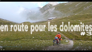
ljubljana - corfu - istanbul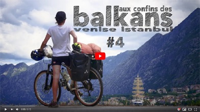
MOUNTAIN GUIDE
Trekking leader / Travel agency
EXPEDITREK
38880 Autrans, Vercors - France
Mobile cell phone +33 (O)6 88 76 54 7O
See you soon with Whatsapp